


- Browse Categories
- YQFH Drone
- DJI Drone
- Other Drone
- Drone Payloads
- Robot
- Pipeline Detection Instrument
- 3D Laser Scanner
- Industrial Measurement Devices
- Weather Station Series
- Optical Survey Instruments
- GNSS RTK & CORS System
- BDS System Products
- Visual Displacement Monitoring System
- UWB Indoor Positioning System
- Hydrology Products
- Others
- Spectrometer
- Wet Blast Machine
- SDI Soil Tester
- Pengjin Smart Flying Drone Patrol and Inspection System
- Supercomputing
- Module
- Viscometer
- Electric Hygro-thermograph
- Echo Sounder
- Processing Software
- Keson Measuring Tools

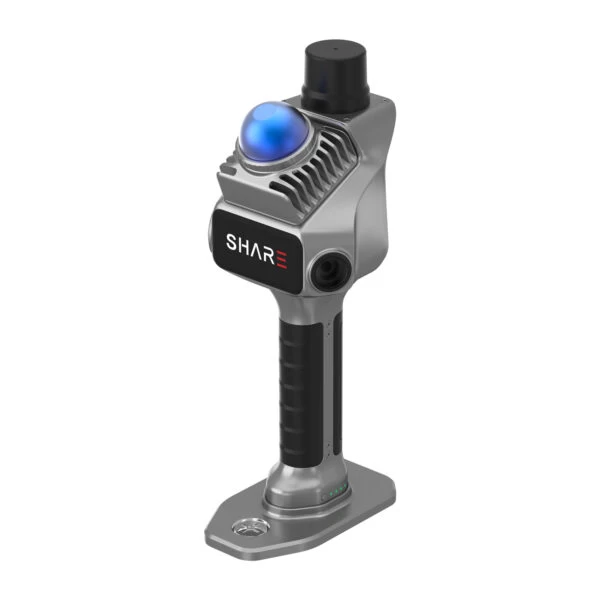
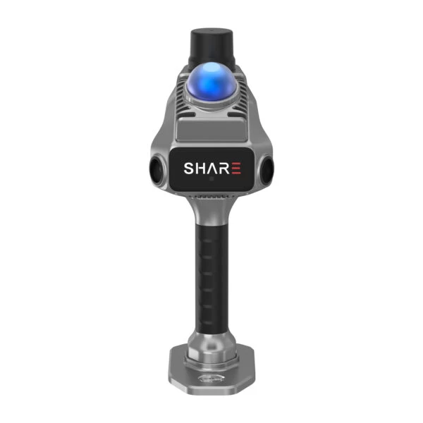
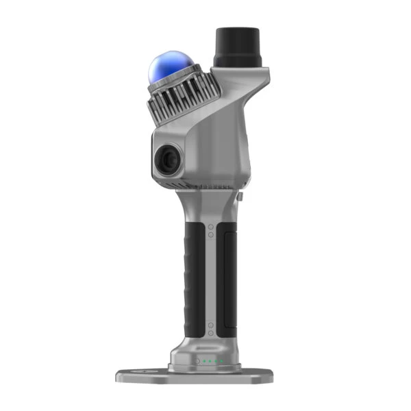
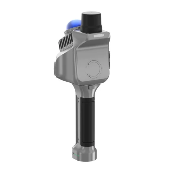
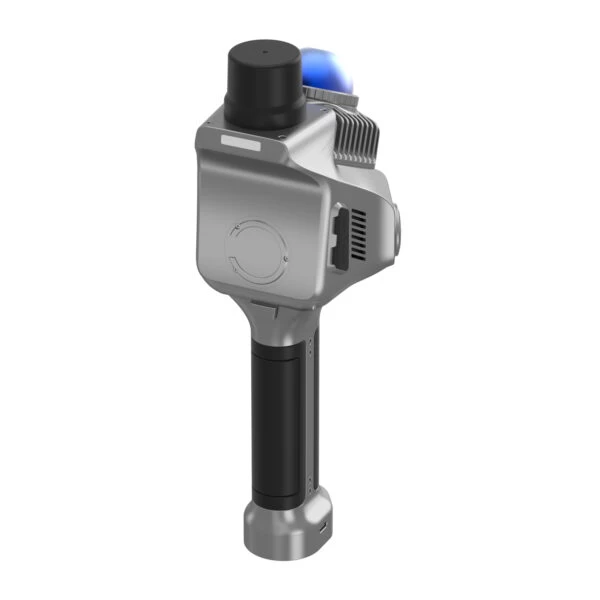
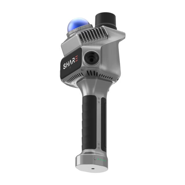
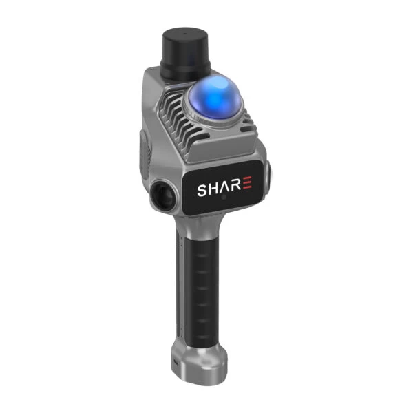
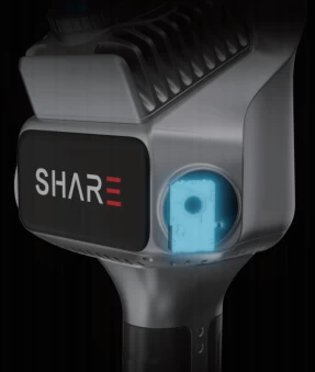
3D Lidar scanner Share slam S20
- Dimensions : 110.5*140*333.3mm
- Weight : 1079g
- Battery Capacity : 45.36wh(3150mAh)
- Working time: 150 min
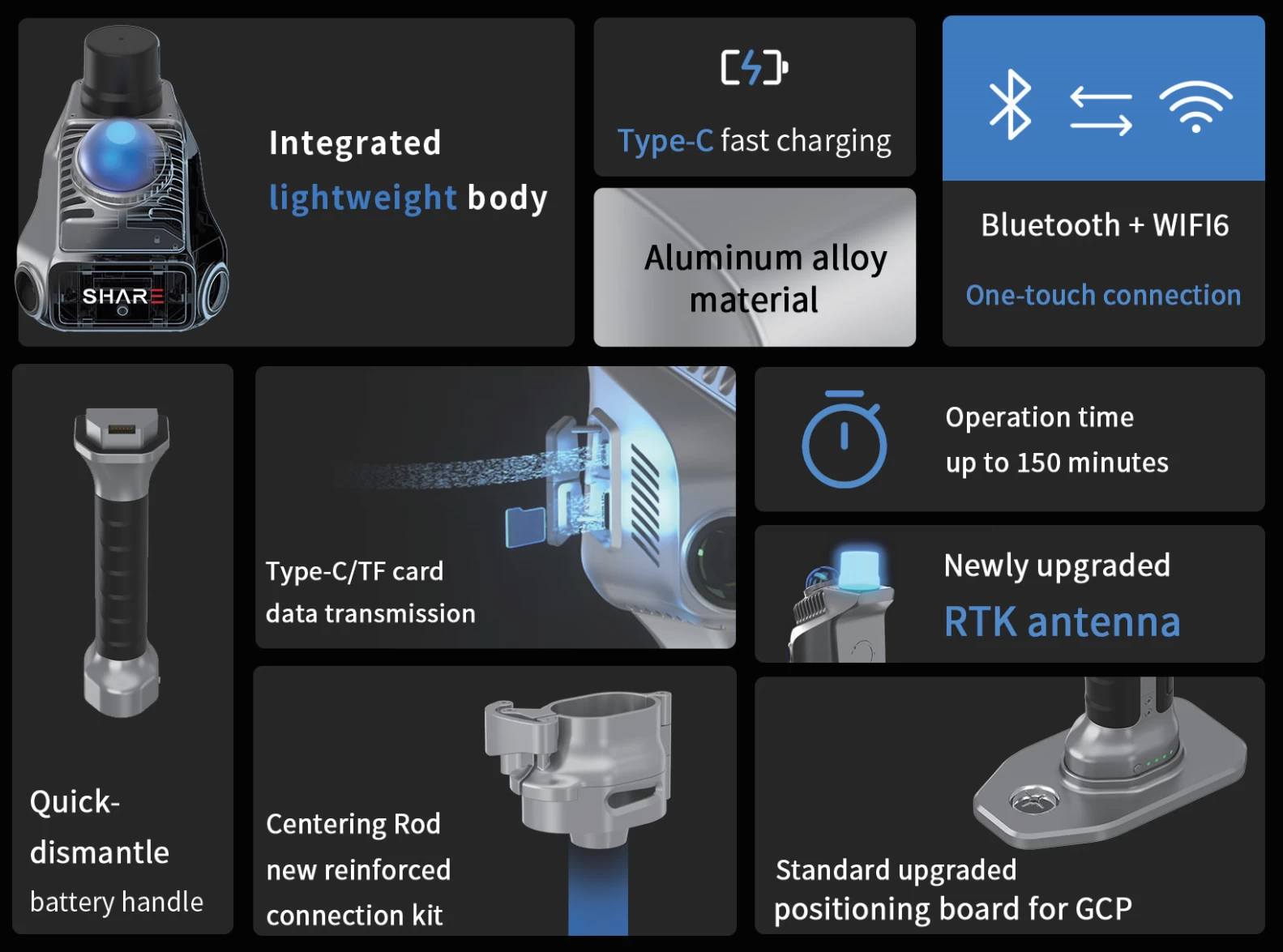
- Charging Port : TYPE-C ; PD30 W fast charging
- Working Temperature : -20℃~50℃
- Storage Temperature : -20℃~60℃
- Storage Capacity : 256G
3D Lidar Scanner S20
Detailed Overview
Feature
 |
|
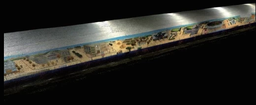
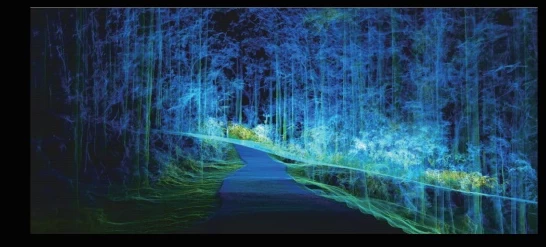
Precise Colorzed Point Cloud Featuring microsecond-level system-wide hardware time synchronization, this results in highly accurate point cloud data. It ensures seamless integration of color and intensity point clouds. |
 |
|
|
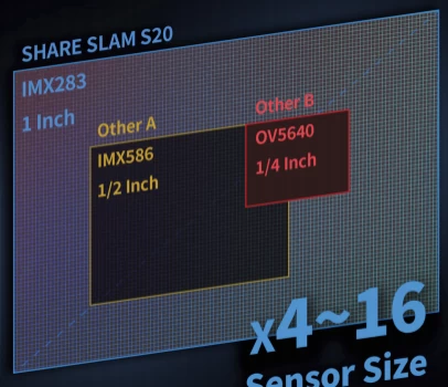
One-Inch Large-Format Image Sensor Equipped with dual one-inch large-format CMOS sensors, featuring 2.4μm pixel size and 16 effective megapixels per lens. This configuration delivers enhanced photo clarity and more accurate and clear point cloud colorization. |
 |
Professional-Grade Mechanical Shutter
The mechanical shutter enables global exposure without jelly effect. This ensures more accurate colorful point cloud colorization and makes the photos highly suitable for nap-of-the-object photogrammetry modeling.
  |
|
Powered by Proprietary Algorithms SLAM RTK lidar scanner factory direct from China,The system delivers robust performance with SHARE's proprietary LiDAR SLAM and Visual SLAM algorithms . This enhances real-time point cloud density and colorization effects, making it adaptable to diverse complex scenarios. |
 |
 |
|
|
Open Hardware Interfaces Open hardware interfaces enable cross-platform collaboration. Open SDK supports device communication, data transfer and operational control, ideal for new surveying equipment (e.g.,embodied intelligence systems). |
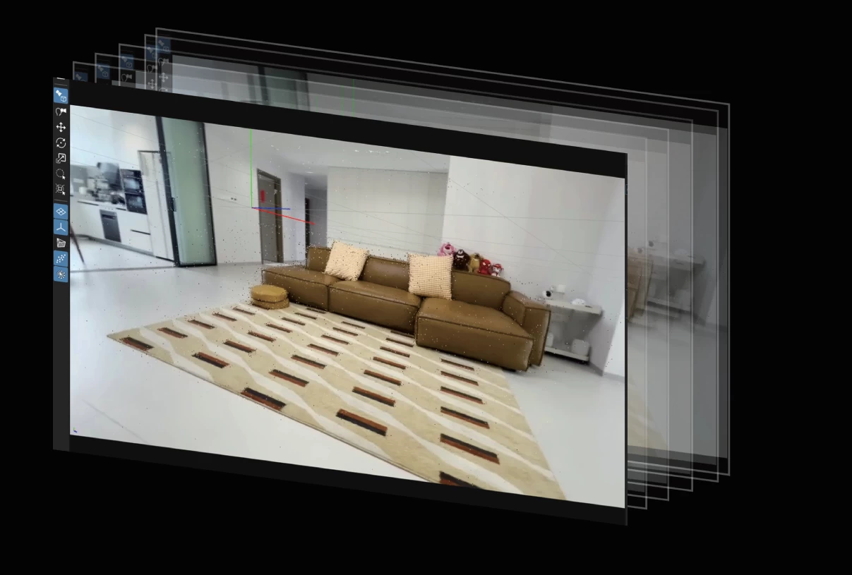
Photos Support 3DGS Modeling Benefiting from the one-inch large-format camera and combined with image pose metadata technology, the photos are clear with uniform color. This makes them better suited for 3D Gaussian Splatting model generation. |
|
 |
 |
|
|
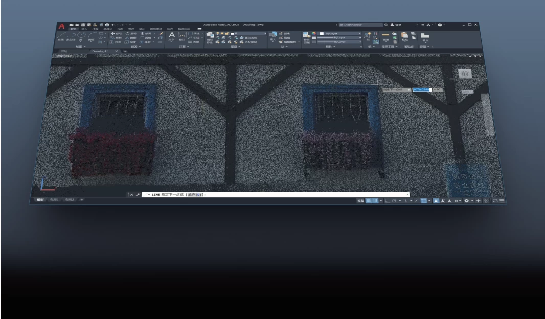
Optimized for Post-Processing Workflows Point cloud data integrates seamlessly into BIM/CAD workflows. Leveraging high-accuracy point cloud data enables efficient mapping and modeling. |
Supports Mesh Model Generation Raw data is fully accessible to software developers, allowing them to process the data using their own SLAM algorithms. The photos can be used for Mesh models, meeting the data processing needs across various industries. |
Specifications
| Physical Parameter | |
| Weight | 1,07 kg (con batería) |
| Battery | 14,8V 3150 mAh |
| Duration | 150 minutos |
| Charge | USB-C 30W (Fast Charging) |
| Storage | 256 Gb (SD card) |
| Level of protection | IP54 |
| Working temperature | -20 ℃-55 ℃ |
| Transport platform | Manual |
| Working modes | Pure SLAM, Checkpoints and RTK |
| Laser Unit | |
| Detection range | 40m@10%, Maximum range 70m |
| Relative accuracy | 1 cm |
| Absolute precision | 5 cm |
| LiDAR FOV | H: 360º - V: 52º H: 360º - V: 52º H: 360º - V: 52º |
| LiDAR class | Class 1 |
| Point rates | 200,000 points/sec |
| GNSS Unit (POS) | |
| RTK | Integrated |
| RTK accuracy | H: 0,8cm + 1ppm - V: 1,5cm + 1ppm |
| Camera | |
| Number of camera | 2 |
| Resolving power | Total 24 million pixels |
| Single camera resolution rate | 12 million images |
| Photo field of view angle | 360°*270° |
| Photo format | .png |
| Data and software | |
| Point thickness | Within 1cm |
| Processing method | Real time solution/ post solution |
| Absolute accuracy | Better than 5cm |
| Relative accuracy | Better than 1cm |
| Point cloud format | Common formats such as .las, pcd,ply, etc |
| Point cloud | Support previewing colored point clouds |
| Mobile software | Supports IOS and Android |
| Desktop software | Supports one click output of color point clouds |
| Built point cloud browsing | Support point cloud and image space association vie |

- Other Products


