


- Browse Categories
- YQFH Drone
- DJI Drone
- Other Drone
- Drone Payloads
- Robot
- Pipeline Detection Instrument
- 3D Laser Scanner
- Industrial Measurement Devices
- Weather Station Series
- Optical Survey Instruments
- GNSS RTK & CORS System
- BDS System Products
- Visual Displacement Monitoring System
- UWB Indoor Positioning System
- Hydrology Products
- Others
- Spectrometer
- Wet Blast Machine
- SDI Soil Tester
- Pengjin Smart Flying Drone Patrol and Inspection System
- Supercomputing
- Module
- Viscometer
- Electric Hygro-thermograph
- Echo Sounder
- Processing Software
- Keson Measuring Tools
Software
Processing Software
-

-
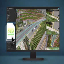
Advanced agriculture mapping software for aerial crop analysis and digital farming Pix4dfield
Advanced agriculture mapping software for aerial crop analysis and digital farming Pix4dfield
More
-
-
Fully automated processing software PIX4Dmatic
PIX4Dmatic:Next generation photogrammetry software for professional drone and terrestrial mapping
More
