


- Browse Categories
- Self-Developed Drone
- UAV from Represented Brands
- Robot
- Spectrometer
- Mechanical measurement device
- PJK Brand Monitoring System
- Optical Survey Instruments
- RTK GNSS Systems
- Pipeline Detector/ Locator & GPR
- Unmanned Aerial Vehicle Payload
- Thermal Camera
- 3D Laser Scanner
- Wet Blast Machine
- Measuring instrument Plainmeter
- Weather Station Series
- SDI Soil Tester
- Pengjin Smart Flying Drone Patrol and Inspection System
- Supercomputing
- USV
- Module
- Viscometer
- Electric Hygro-thermograph
- Echo Sounder
- Processing Software
- Keson Measuring Tools
Unmanned Aerial Vehicle LIDAR
Unmanned Aerial Vehicle LIDAR
-
-
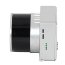
UAV LiDAR Scanning System LD-260X
MoreLD-260X is a kind of Mid-range, compact LiDAR point cloud data acquisition system, integrated HESAI Pandar XT laser scanner, GNSS and IMU positioning and attitude determination system, and storage control unit, is able to real-time, dynamically, massively collect high-precision point cloud data and rich image information. It is widely used in the acquisition of 3D spatial information in surveying, electricity, forestry, agriculture, land planning.
-
-
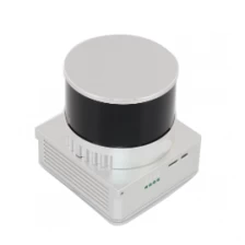
UAV LiDAR Scanning System LD-130X
gAirHawk UAV LiDAR Scanner is a kind of short-range, compact LiDAR point cloud data acquisition system, integrated HESAI XT laser scanner, GNSS and IMU positioning and attitude determination system, and storage control unit, is able to real-time, dynamically, massively collect high-precision point cloud data and rich image information. It is widely used in the acquisition of 3D spatial information in surveying, electricity, forestry, agriculture, land planning.
More
-
-
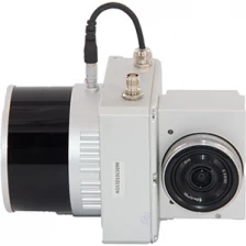
32 Channel UAV LiDAR Scanner HESAI XT Laser Sensor 3D Scanning
gAirHawk UAV LiDAR Scanner is a kind of short-range, compact LiDAR point cloud data acquisition system, integrated HESAI XT laser scanner, GNSS and IMU positioning and attitude determination system, and storage control unit, is able to real-time, dynamically, massively collect high-precision point cloud data and rich image information. It is widely used in the acquisition of 3D spatial information in surveying, electricity, forestry, agriculture, land planning.
More
-
-
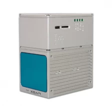
750g LD 100M+ Livox Avia Laser Vehicle Mounted UAV LiDAR System
LD-100M+ is a kind of light compact LiDAR point cloud data acquisition system, integrated Livox new generation laser scanner, GNSS and IMU positioning and attitude determination system, and storage control unit, is able to real-time, dynamically, massively collect high-precision point cloud data and rich image information. It is widely used in the acquisition of 3D spatial information in surveying, electricity, forestry, agriculture, land planning.
More
-
-
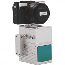
UAV LiDAR Scanning System LD-100M+
LD-100M+ liDAR scanning system is a UAV measurement system independently developed by Geosun company. It highly integrates laser scanner, GNSS satellite positioning system, INS inertial navigation system and camera(optional), and can quickly obtain high-precision laser point cloud number. It can be widely used in Digital city construction, Industry, Land survey, Forestry and AgricultureMore
-
-
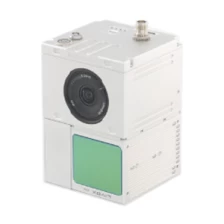
UAV LiDAR Scanning System LD-100C+
LD-100C+ liDAR scanning system is a UAV measurement system independently developed by Geosun company. It highly integrates laser scanner, GNSS satellite positioning system, IN S inertial navigation system and camera, and can quickly obtain high-precision laser point cloud number. It can be widely used in Digital city construction, Industry, Land survey, Forestry and AgricultureMore
