


- Browse Categories
- YQFH Drone
- DJI Drone
- Other Drone
- Drone Payloads
- Robot
- Pipeline Detection Instrument
- 3D Laser Scanner
- Industrial Measurement Devices
- Weather Station Series
- Optical Survey Instruments
- GNSS RTK & CORS System
- BDS System Products
- Visual Displacement Monitoring System
- UWB Indoor Positioning System
- Hydrology Products
- Others
- Spectrometer
- Wet Blast Machine
- SDI Soil Tester
- Pengjin Smart Flying Drone Patrol and Inspection System
- Supercomputing
- Module
- Viscometer
- Electric Hygro-thermograph
- Echo Sounder
- Processing Software
- Keson Measuring Tools
Category
-
-
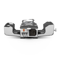
DJI Dock 3
All-weather capability is a major highlight of the DJI Dock 3. The Dock 3 boasts an IP56 protection rating, while both the Matrice 4D and Matrice 4TD drones achieve an IP55 rating. Even in temperatures reaching as high as 50°C, the system operates and charges smoothly, ensuring efficient, continuous operations. The Dock 3 performs equally well in low-temperature environments; it functions normally in harsh conditions down to -30°C and features a drone pre-heating function, enabling the aircraft to operate effectively even at -30°C. Furthermore, the DJI Matrice 4D/4TD drones come standard with low-noise, anti-icing propellers, ensuring stable flight even during freezing rain and preventing power saturation caused by ice accumulation. With robust flight performance and significantly extended endurance, the Matrice 4D/4TD can take off, land, and hover stably in strong winds of up to 12 m/s for up to 32 minutes; when fully charged, it can fly for 47 minutes at a speed of 15 m/s, representing a 37% increase in effective operational time compared to the DJI Dock 2.
More
-
-
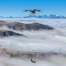
FlyCart 200
As a new generation of heavy-duty flagship, the FC200 has achieved a leapfrog breakthrough in carrying capacity. The maximum load of a single unit is 200kg, two units working together can reach 360kg, and four units working together intelligently can lift up to 600kg, meeting the needs of transporting large and bulky goods.
With robust high-altitude performance, it can maintain a full load without reduction at an altitude of 3,000 meters and still carry 140 kg at a plateau of 6,000 meters.
In terms of battery life, the dual-battery mode provides 16-18 minutes of full-load battery life, while the quad-battery mode extends this to 32 minutes. It is equipped with a 46Ah smart battery that can be quickly recharged in 7-8 minutes and supports hot-swapping, significantly improving work efficiency.
More
-
-
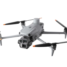
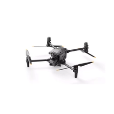
DJI Matrice 4
DJI has officially unveiled the all-new Matrice 4 Series—a compact, intelligent, multi-payload flagship platform. Comprising two models, the Matrice 4T and Matrice 4E, the series features built-in AI detection models for people, vehicles, and vessels, while also opening up the aircraft's AI computing power for developers. With comprehensive hardware and software upgrades—spanning cameras, image transmission systems, and environmental sensing capabilities—the series supports a host of intelligent functions, including smart detection and laser-assisted measurement. The Matrice 4T is designed to cover a wide range of application scenarios, such as power line inspection, emergency response, public safety, and water conservancy and forestry monitoring; the Matrice 4E, conversely, targets scenarios requiring high-precision professional surveying and detailed surface inspection. The launch of the Matrice 4 Series marks the official dawn of the AI-driven era for industrial drones.
More
-
-
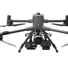
DJI Matrice 400
DJI has officially unveiled its flagship industrial flight platform, the DJI Matrice 400. As the pinnacle achievement of five years of flagship industrial platform development, the Matrice 400 boasts robust capabilities—ranging from flight endurance, obstacle avoidance, and payload capacity to intelligent operations—and represents DJI's latest breakthrough in flagship industrial flight platform technology. Furthermore, through its powerful platform capabilities, it ushers in a new era of collaborative, win-win ecosystems. With this launch, both the technological advancement of drones and the collaborative growth of the industry ecosystem have reached a pivotal turning point.
More
-
-
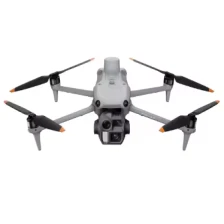
Matrice M30 series
The Matrice M30 series boasts a maximum flight time of 41 minutes, a maximum altitude of 7000 meters, and wind resistance up to 15 meters per second, easily handling various flight requirements. The Matrice M30 series features IP55 protection, allowing operation in ambient temperatures ranging from -20°C to 50°C. It also incorporates 6-way binocular vision and dual near-infrared sensors for all-around obstacle avoidance, ensuring comprehensive flight safety.
More
-
-
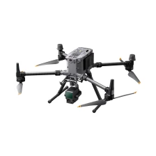
Matrice M350 RTK Drone Mapping Industrial Drones Long Distance for Search Rescue and Surveying Drone
-
-
DJI Zenmuse L3 LiDAR
The DJI Zenmuse L3 is not just a simple performance upgrade. It improves range and accuracy, uses a dual 100-megapixel camera system to simultaneously acquire visible light data, and combines an intelligent gimbal, high-precision positioning, and end-to-end processing software to provide a complete solution from data acquisition and processing to application. It is an industry-application-level product that truly integrates hardware performance, software ecosystem, and user experience in the professional surveying and mapping field.
More
-
-
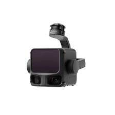
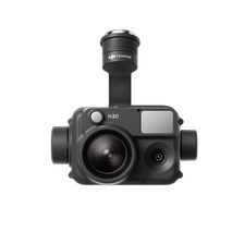
DJI Zenmuse H30
On May 16, 2024, DJI released the Zenmuse H30 series, a flagship all-weather multi-light payload. It includes two models: the H30 and H30T. The H30 integrates four modules: a wide-angle camera, a zoom camera, a laser rangefinder, and a near-infrared illuminator. The H30T adds an infrared thermal imaging module, comprehensively enhancing perception and imaging capabilities and overcoming the limitations of day and night vision. The H30 series, mounted on a flight platform, can be easily applied to various industries such as public safety, emergency rescue, and energy and power, making it DJI's most integrated and highest-performing multi-light flagship payload to date.
The all-new Zenmuse H30 series, a flagship multi-beam payload, is a highly integrated product that integrates sensors required by security, fire protection, and inspection users, offering a comprehensive upgrade in performance and user experience. It also boasts numerous independently developed technologies across modules such as optics, hardware structure, algorithms, and manufacturing processes, ensuring maximum performance within its compact and precise design. DJI will continue to address the pain points of industry users, drive product efficiency innovation, and provide industry customers with convenient, efficient, safe, reliable, and cost-effective technologies and services, enabling drone technology to play a greater role in various fields.
More
-
-
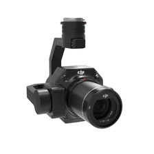
DJI Zenmuse P1
Zenmuse P1
A New Benchmark for Full-Frame Aerial Surveying.
The DJI P1 integrates a full-frame image sensor with a 3-axis gimbal and supports multiple prime lenses, creating a high-performance, versatile aerial surveying payload. When paired with the Matrice 300 RTK and DJI Terra software, it delivers a high-precision, high-efficiency, and integrated aerial surveying solution, setting a new benchmark in the field.
More
-
-
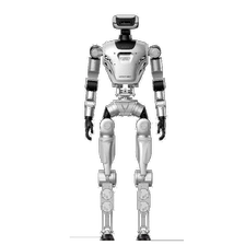
YQ-OIi Full-Size General-Purpose Humanoid Robot
Equipped with Self -Developed IMU and depth cameras, plus extensive electrical interfaces for seamlessintegration of external sensors like LiDAR and additional cameras, enabling comprehensive perceptioncapabilities for complex environment motion control and diverse application scenarios.
More
-
-
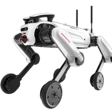
ASTRALL·AO1 All-terrain heavy-duty wheeled foot control platform
Daring to venture on rugged roads, the journey is boundless Specifically designed for industry applications
More
