


- Browse Categories
- YQFH Drone
- DJI Drone
- Other Drone
- Drone Payloads
- Robot
- Pipeline Detection Instrument
- 3D Laser Scanner
- Industrial Measurement Devices
- Weather Station Series
- Optical Survey Instruments
- GNSS RTK & CORS System
- BDS System Products
- Visual Displacement Monitoring System
- UWB Indoor Positioning System
- Hydrology Products
- Others
- Spectrometer
- Wet Blast Machine
- SDI Soil Tester
- Pengjin Smart Flying Drone Patrol and Inspection System
- Supercomputing
- Module
- Viscometer
- Electric Hygro-thermograph
- Echo Sounder
- Processing Software
- Keson Measuring Tools
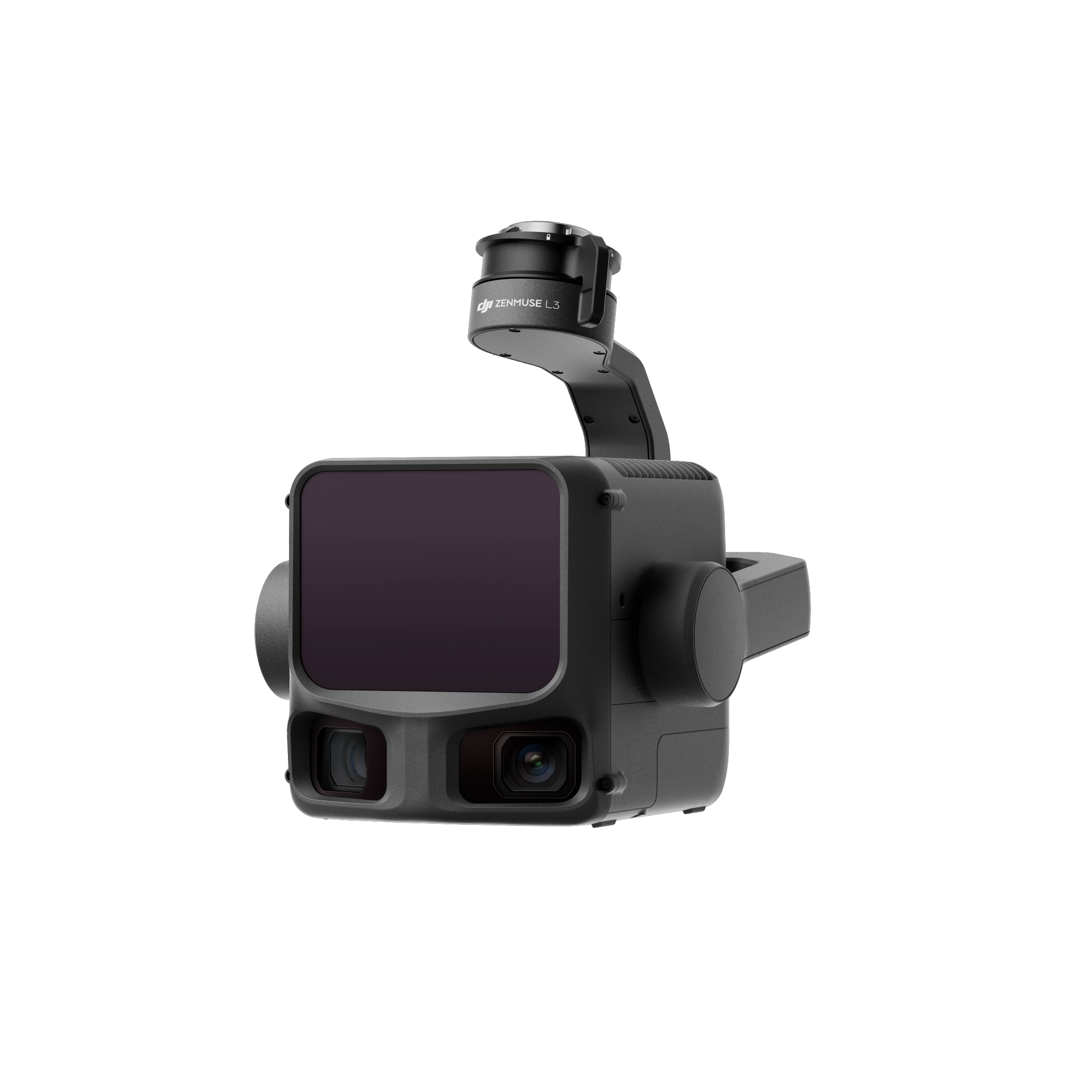


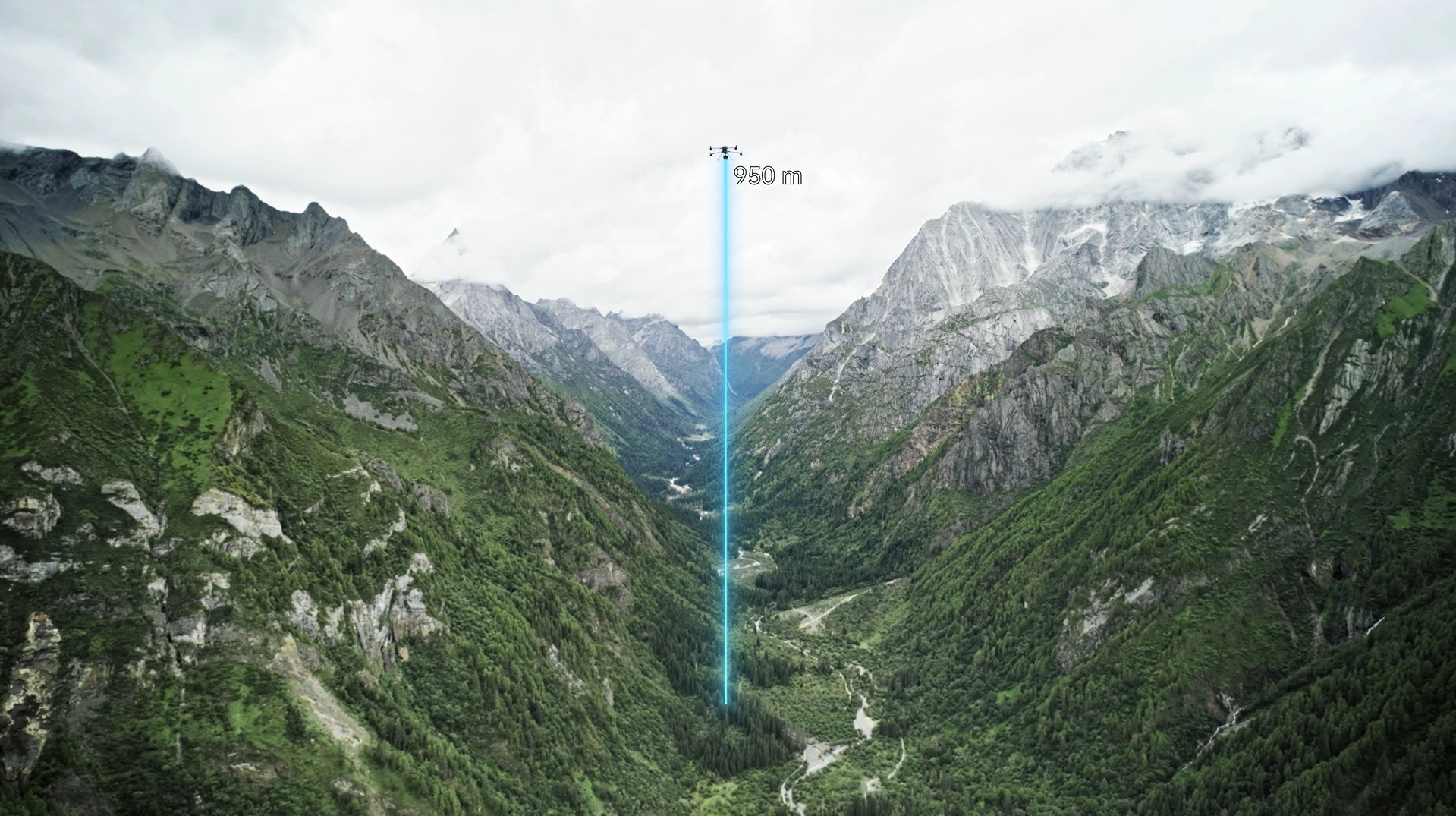
The most striking feature of the DJI Zenmuse L3 is its improved range. Equipped with a 1535nm wavelength long-range LiDAR, the 1535nm wavelength offers superior atmospheric penetration compared to the 905nm wavelength commonly used in its predecessor, making it safer for human eyes. This allows it to achieve a range of 950 meters on targets with 10% reflectivity, and up to 2000 meters on targets with 80% reflectivity. This means the drone can operate at typical altitudes of 300 to 500 meters, easily handling scenarios such as deep mines, terrain with significant elevation changes, and dense forests, without the need for frequent altitude adjustments or risky low-altitude flights. This improves operational safety and reduces operating costs.
In addition to the increased range, the DJI Zenmuse L3 also boasts significantly enhanced accuracy and detail reproduction capabilities. Building upon its support for linear and non-linear repeating scan modes, the new Zenmuse L3 introduces a "rice" pattern scanning mode. With a laser divergence angle of only 0.25 milliradians, the spot diameter at 120 meters is as small as 41 millimeters, less than one-fifth that of the Zenmuse L2. This smaller spot size translates to superior resolution of minute ground features such as power lines, tiles, and twigs. Combined with a high spot rate of 2 million points per second and a 16-echo reception capability, the DJI Zenmuse L3 can penetrate dense vegetation to acquire more and more continuous ground point cloud data, providing more reliable data for forestry surveys, topographic mapping, and other fields.
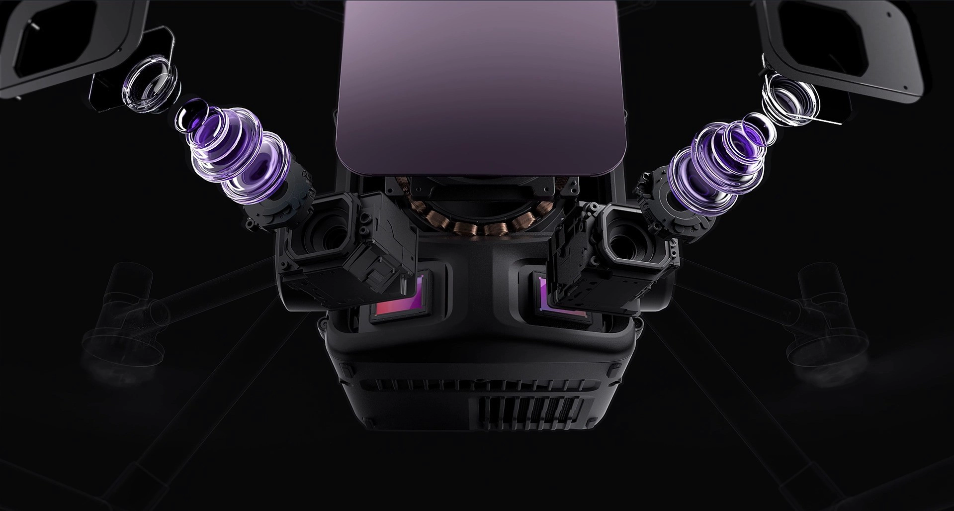
In terms of visible light data acquisition, the DJI Zenmuse L3 uses a fusion of two 100-megapixel cameras. The stitching of the two cameras widens the field of view to 107 degrees, solving the problem of low efficiency of traditional LiDAR when acquiring visible light images simultaneously. This significantly reduces the frequency of field operations and lowers equipment investment and time costs.
Furthermore, while enhancing performance, the DJI Zenmuse L3 has also undergone significant refinement in terms of reliability. The DJI Zenmuse L3 boasts an IP54 protection rating, an operating temperature range of -25°C to 55°C, and can operate stably in extreme environments such as heavy rain, dust storms, extreme cold, and extreme heat, supporting all-weather operation. In addition, the DJI Zenmuse L3 is equipped with a D-RTK 3 high-precision base station, which can solve the problem of accurate positioning in areas with weak signals, such as mountainous areas and canyons.
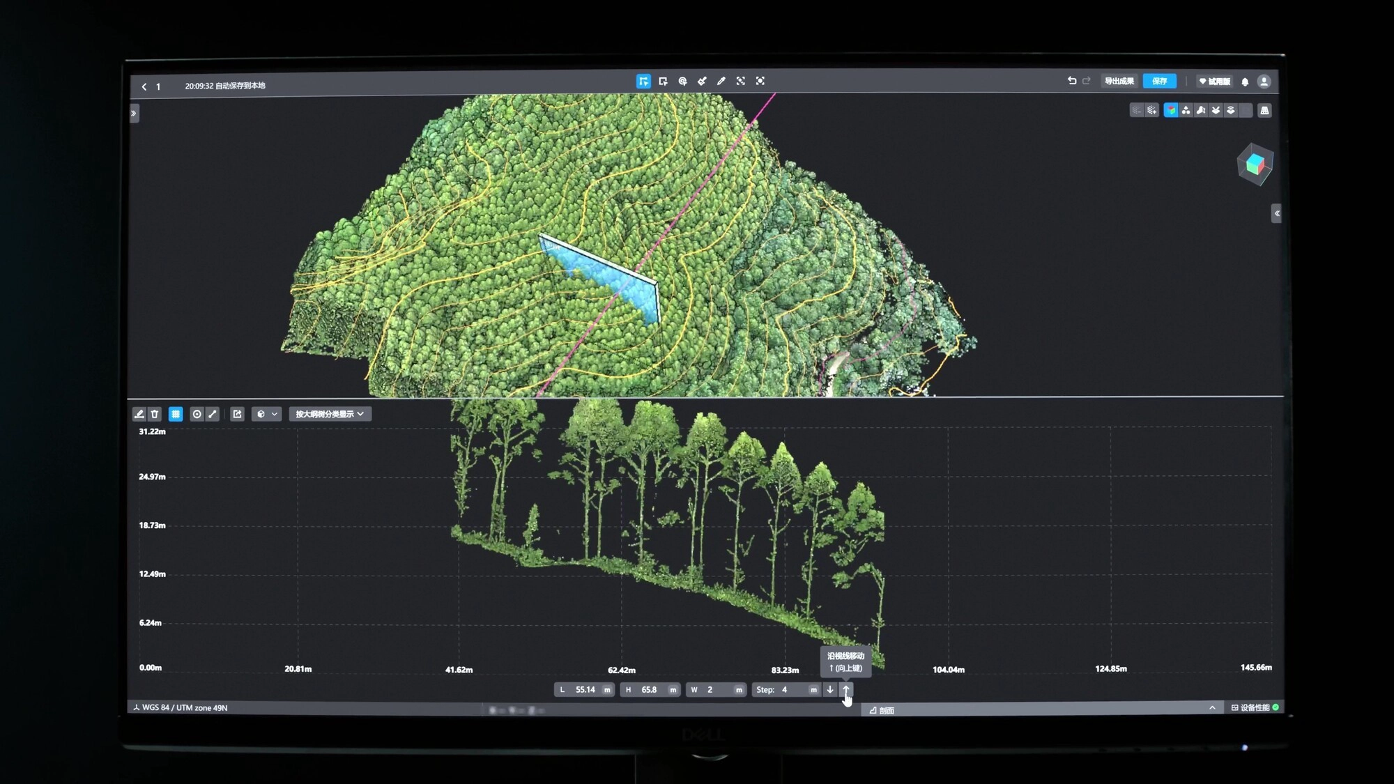
From flight path planning and data acquisition to processing, DJI provides a complete software system. DJI Terra offers free point cloud processing capabilities and supports multi-computer cluster computing. DJI Terra models can automatically classify data and output topographic maps. This complete hardware-to-software solution is easy for even non-professional surveyors to use quickly.

The high price of radar systems often deters many users across various industries. The DJI Zenmuse L3, however, offers high-quality performance at a low cost. Overseas, devices with similar functionality to the DJI Zenmuse L3 cost around one million yuan, while domestically, comparable models typically cost five to six hundred thousand yuan. The DJI Zenmuse L3, on the other hand, is priced at only around 100,000 yuan. Therefore, it is now used not only in surveying and mapping but also in emergency response and cultural relic surveys. With its increasing popularity and improved cost-effectiveness, it is gradually being adopted by various industries.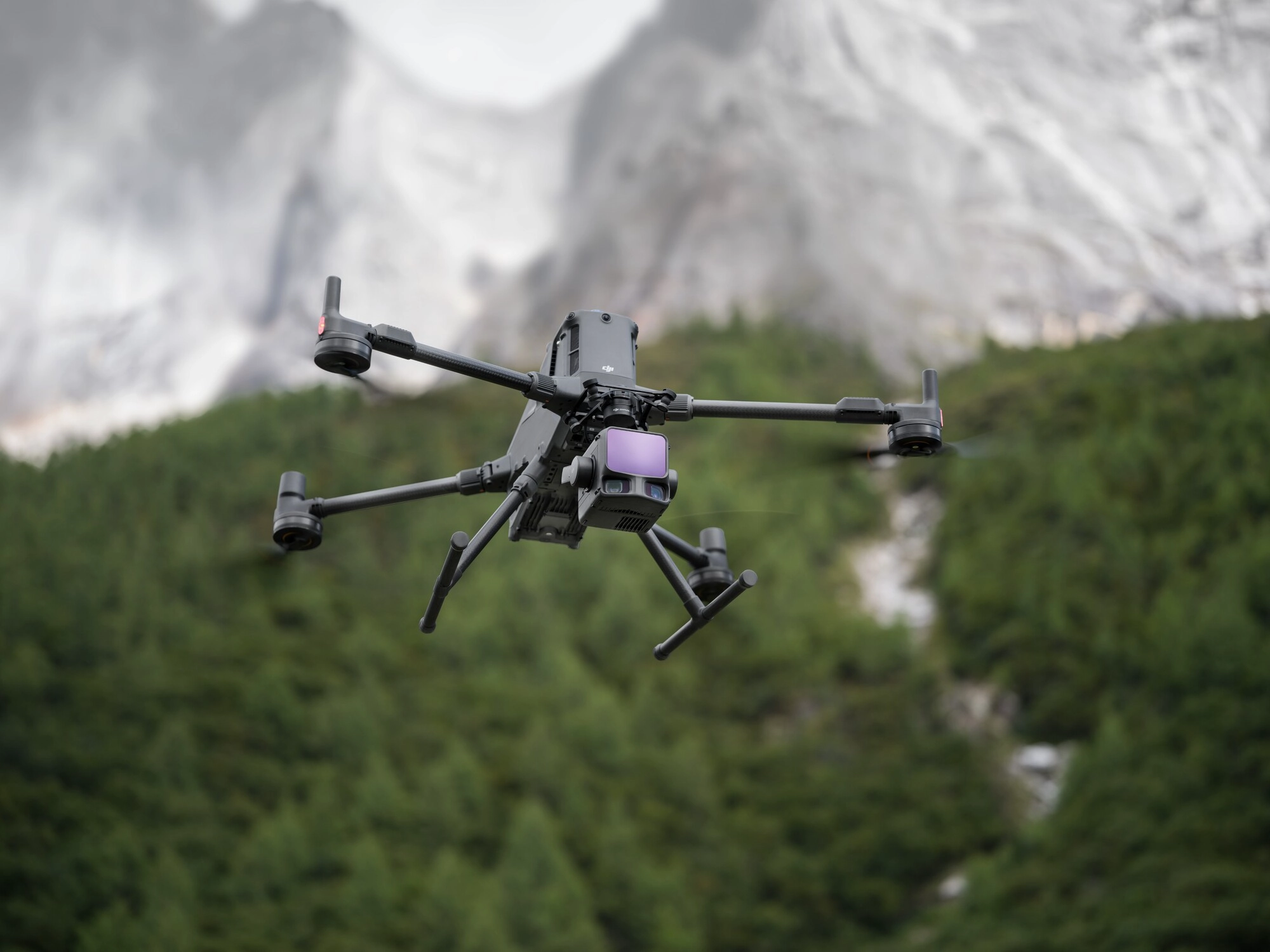

- Other Products


