







- Browse Categories
- DJI Drone
- YQFH Drone
- Other Drone
- Drone Payloads
- Robot
- Pipeline Detection Instrument
- 3D Laser Scanner
- Mechanical measurement device
- Weather Station Series
- Optical Survey Instruments
- GNSS RTK & CORS System
- BDS System Products
- Visual Displacement Monitoring System
- UWB Indoor Positioning System
- Others
- Spectrometer
- PJK Brand Monitoring System
- Unmanned Aerial Vehicle Payload
- Thermal Camera
- Wet Blast Machine
- Measuring instrument Plainmeter
- SDI Soil Tester
- Pengjin Smart Flying Drone Patrol and Inspection System
- Supercomputing
- USV
- Module
- Viscometer
- Electric Hygro-thermograph
- Echo Sounder
- Processing Software
- Keson Measuring Tools
UAV Payload multispetra camera
Unmanned Aerial Vehicle Payload
-
-
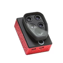
Parrot SEQUOIA+ Unmanned Aircraft Systems multispectral sensor for agricultural drone camera
The Parrot Sequoia+ multispectral sensor is revolutionising the sector, offering a comprehensive, adaptable solution that is compatible with all types of drones. With its two sensors, multispectral and sunshine, Parrot Sequoia+ analyses plants' vitality by capturing the amount of light they absorb and reflect. Collecting this data means that farmers can do what's best for their fields.
More
-
-
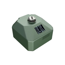
HIGH-PERFORMANCE FIVE-LENS TILT PHOTOGRAPHY CAMERA PY505
With a total resolution of 3.05 million pixels, the camera integrates five 61-megapixel full-frame ExmorRCMOS back-illuminated image sensors. Equipped with a high-performance AI motherboard, it excels in heat dissipation, data communication, system integration, and data transmission. It is compatible with mainstream Multirotor and Fixed-wing UAV on the market.
More
-
-
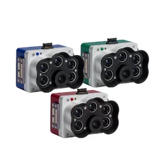
5-Band Multispectral High-Res RGB Drone Camera Rededge-P for Precision Agriculture
The Micasense Altum-PT is an advanced multispectral and thermal imaging sensor designed for precision agriculture and remote sensing applications. The combination of high-resolution multispectral and thermal images provides detailed insight into crop health, vegetation index, and biophysical parameters. Ideal for drone integration, Altum-PT enables efficient data collection and analysis for informed decision-making in agriculture and environmental surveillance. You can capture both thermal and multispectral data at the same time. This sensor is a powerful tool to improve agricultural productivity and sustainability.
More
-
-
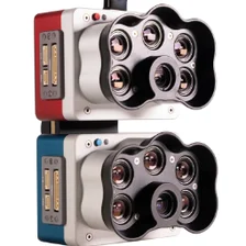
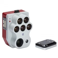
5-Band Multispectral + Thermal & High-Res RGB Drone Camera Altum-PT for Precision Agriculture
The Micasense Altum-PT is an advanced multispectral and thermal imaging sensor designed for precision agriculture and remote sensing applications. The combination of high-resolution multispectral and thermal images provides detailed insight into crop health, vegetation index, and biophysical parameters. Ideal for drone integration, Altum-PT enables efficient data collection and analysis for informed decision-making in agriculture and environmental surveillance. You can capture both thermal and multispectral data at the same time. This sensor is a powerful tool to improve agricultural productivity and sustainability.
More
-
-
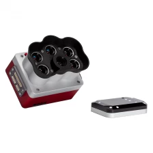
High Resolution Panchromatic Band Multispectral Mica Sense Camera Rededge-P
Single camera solution for tuned high resolution synchronous capture
Multispectral and RGB images with FOV and capture rates are optimized for efficient flights.
More
-
-
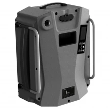
PJT-2 UAV Tie Mooring power system
PengJin PJT-2 UAV Tie Mooring power system, including airborne power supply (sky end) and integrated receiving and drop machine (ground end).The system can convert single-phase AC power into DC high voltage, which is transmitted to the airborne power supply through the high-performance nickel alloy power supply cable, and can continuously power the aircraft for a long time.
More
-
-
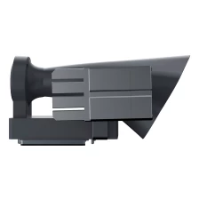
PJLB-12, A Probe Radio All-In-One Machine
PengJin PJLB-12 is a two-in-one load device specially designed for DJI M30 industry UAV.With the design concept of fluid aesthetics, it can challenge the limit of performance, take into account the artistic taste, effectively reduce wind resistance and improve the endurance of UAV flight operations.
More
-
-
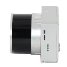
UAV LiDAR Scanning System LD-260X
MoreLD-260X is a kind of Mid-range, compact LiDAR point cloud data acquisition system, integrated HESAI Pandar XT laser scanner, GNSS and IMU positioning and attitude determination system, and storage control unit, is able to real-time, dynamically, massively collect high-precision point cloud data and rich image information. It is widely used in the acquisition of 3D spatial information in surveying, electricity, forestry, agriculture, land planning.
-
-
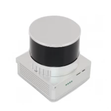
UAV LiDAR Scanning System LD-130X
gAirHawk UAV LiDAR Scanner is a kind of short-range, compact LiDAR point cloud data acquisition system, integrated HESAI XT laser scanner, GNSS and IMU positioning and attitude determination system, and storage control unit, is able to real-time, dynamically, massively collect high-precision point cloud data and rich image information. It is widely used in the acquisition of 3D spatial information in surveying, electricity, forestry, agriculture, land planning.
More
-
-
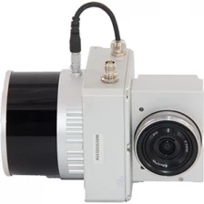
32 Channel UAV LiDAR Scanner HESAI XT Laser Sensor 3D Scanning
gAirHawk UAV LiDAR Scanner is a kind of short-range, compact LiDAR point cloud data acquisition system, integrated HESAI XT laser scanner, GNSS and IMU positioning and attitude determination system, and storage control unit, is able to real-time, dynamically, massively collect high-precision point cloud data and rich image information. It is widely used in the acquisition of 3D spatial information in surveying, electricity, forestry, agriculture, land planning.
More
-
-
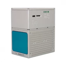
750g LD 100M+ Livox Avia Laser Vehicle Mounted UAV LiDAR System
LD-100M+ is a kind of light compact LiDAR point cloud data acquisition system, integrated Livox new generation laser scanner, GNSS and IMU positioning and attitude determination system, and storage control unit, is able to real-time, dynamically, massively collect high-precision point cloud data and rich image information. It is widely used in the acquisition of 3D spatial information in surveying, electricity, forestry, agriculture, land planning.
More