


- Browse Categories
- YQFH Drone
- DJI Drone
- Other Drone
- Drone Payloads
- Robot
- Pipeline Detection Instrument
- 3D Laser Scanner
- Industrial Measurement Devices
- Weather Station Series
- Optical Survey Instruments
- GNSS RTK & CORS System
- BDS System Products
- Visual Displacement Monitoring System
- UWB Indoor Positioning System
- Hydrology Products
- Others
- Spectrometer
- Wet Blast Machine
- SDI Soil Tester
- Pengjin Smart Flying Drone Patrol and Inspection System
- Supercomputing
- Module
- Viscometer
- Electric Hygro-thermograph
- Echo Sounder
- Processing Software
- Keson Measuring Tools


The optimized software for the next surveying and mapping challenges

Bigger datasets, accurate results
PIX4Dmatic processes thousands of images while maintaining survey-grade accuracy, halving the processing time, without the trouble of splitting and merging.

Fully automated processing
Developed in close-collaboration with surveyors and mapping professionals to streamline your workflow: import, process and assess the quality of a project in just a few clicks, and move seamlessly from PIX4Dmatic to PIX4Dsurvey.

Terrestrial workflow
Leverage the benefits of both photogrammetry and LiDAR technology. Process LiDAR and RGB image outputs from PIX4Dcatch for a full terrestrial workflow. Easy and desktop-based.
Accurate 3D maps and models from thousands of images
Fast processing
Handling and processing large amounts of data is easy with PIX4Dmatic. Get your results up to 50% faster, while keeping a survey-grade accuracy.

-

FAST PROCESSING
-

EASY ACCURACY CHECKS
-

VERTICAL COORDINATE SYSTEMS AND GEOID SUPPORT
-

IMPORT FROM PIX4DCATCH
-

FAST DEVELOPMENT CYCLES
Essential outputs, in a fraction of the time
without compromising accuracy
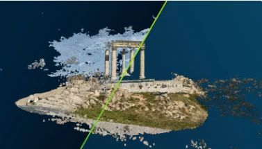
Point cloud
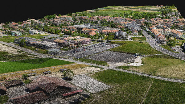
Generate a dense point cloud, create a depth point cloud or fuse them according to the needs of your project and create the best reconstruction possible.
Export formats: .laz .las
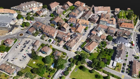
Orthomosaic
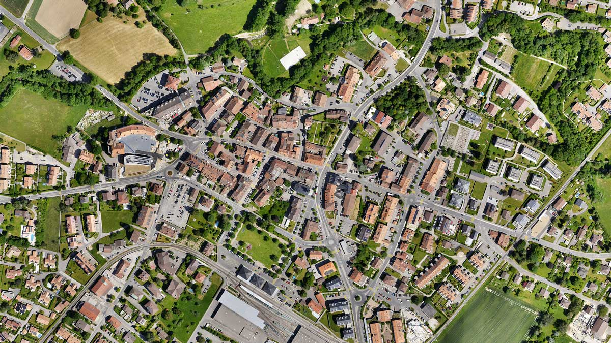
Create orthomosaics that are geometrically corrected such that the scale is uniform. They are color balanced in order to be visually pleasing.
Export formats: .tiff (GeoTIFF) .jpg (Georeferenced with .jgw)
Digital surface model (DSM)
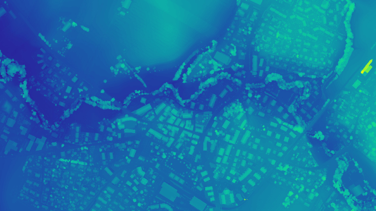
Generate a digital representation of all objects in the mapped area. It includes natural features as well as elevated objects, like buildings.
Export formats: .tiff (GeoTIFF)
Mesh
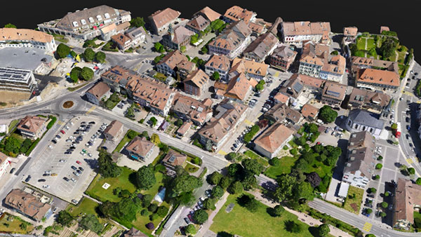
Generate a 3D textured mesh by defining the texture size and decimation criteria and view it either in textured or shaded mode.
Export format: .obj .slpk Cesium 3D Tiles .laz
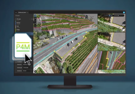
Compatible with PIX4Dsurvey
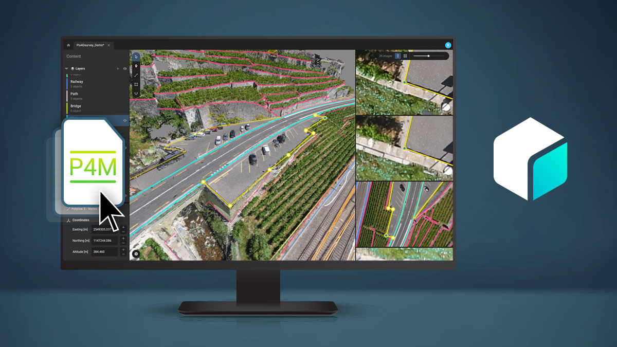
Seamless export of processed projects into PIX4Dsurvey to transform point clouds into actionable CAD-ready data. Pix4D's proprietary .bpc file format is optimized for loading and manipulation of big point clouds. You can now bundle PIX4Dmatic with PIX4Dsurvey and get more than 50% off!
Export format: .p4m
PIX4Dmatic is changing the face of surveying and mapping
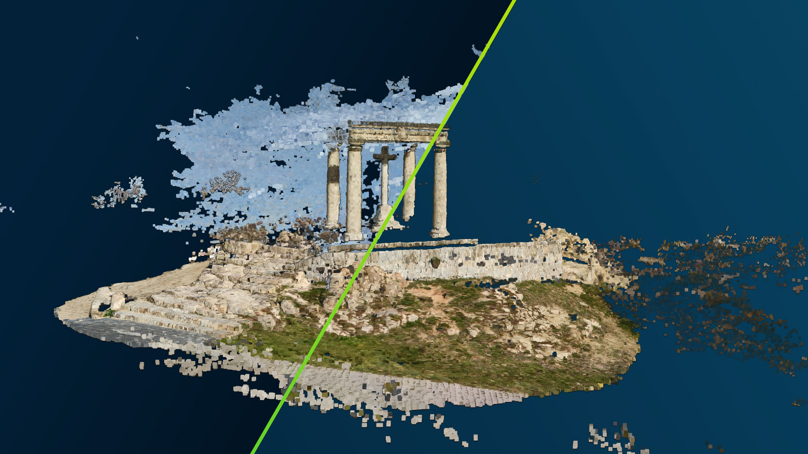
How to tidy point clouds with our sky filter
Check out how PIX4Dmatic uses machine learning algorithms to automatically identify and remove the sky in point clouds, and making outputs easier to analyze.
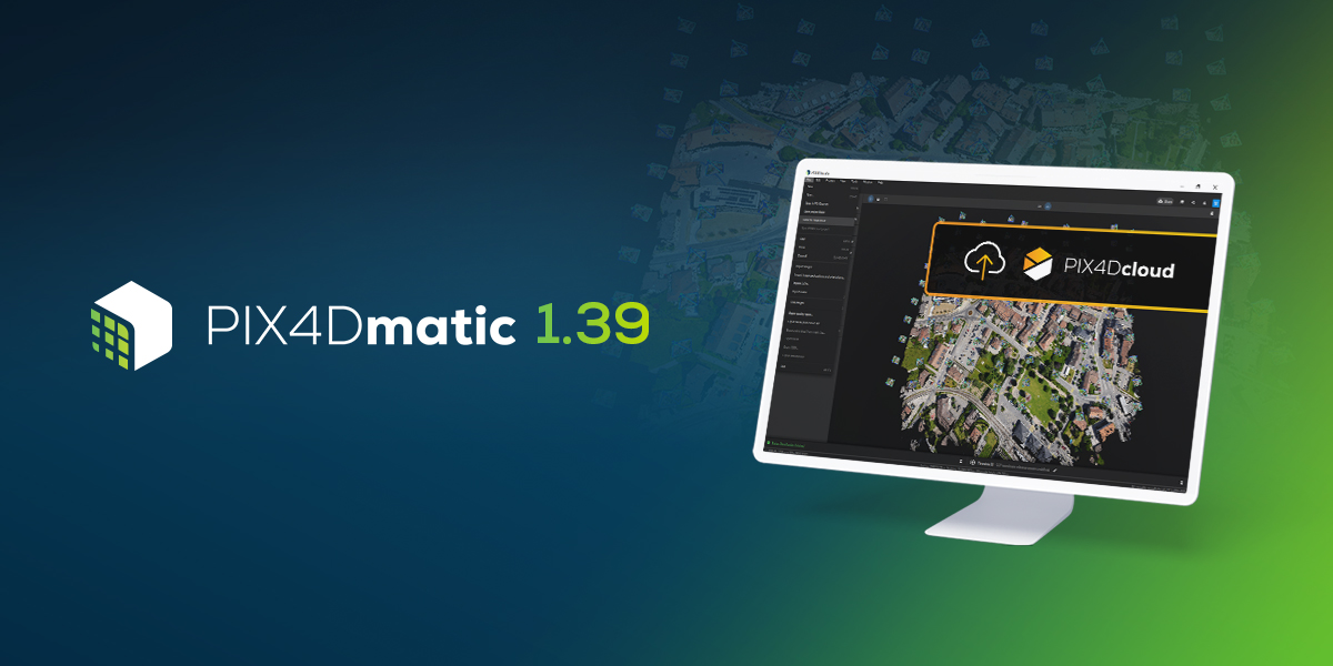
PIX4Dmatic 1.39: share to PIX4Dcloud and new mesh exports!
In PIX4Dmatic 1.39 you can now share to PIX4Dcloud, export your mesh in new file formats, and localize your site!
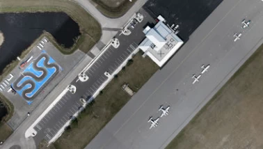
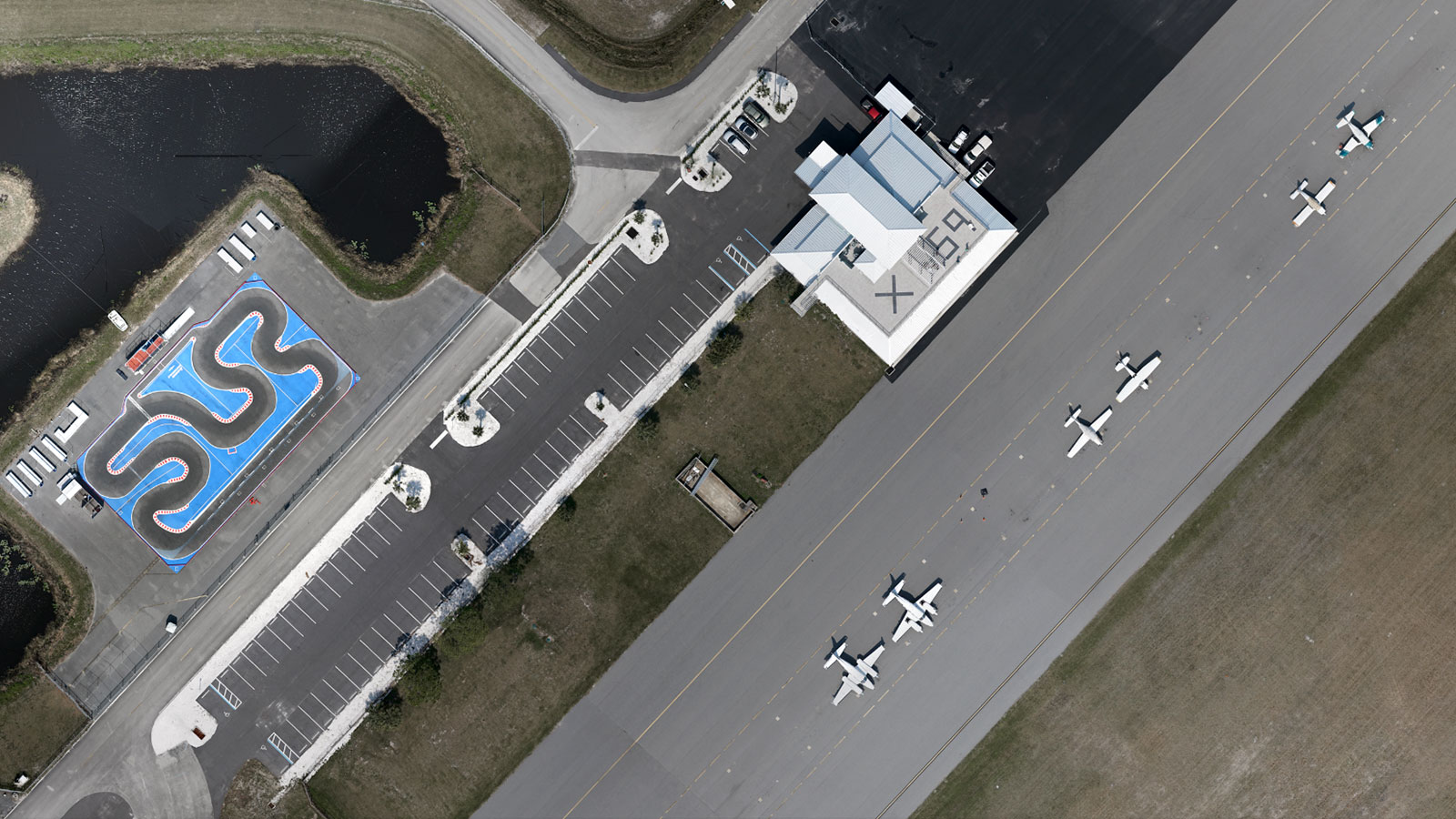
Drones and airplanes: surveying an active airport
Mapping an active airfield can be incredibly dangerous. Discover how Quantum-Systems mapped the Valkaria Airport without startling pilots.

- Other Products

