


- Browse Categories
- YQFH Drone
- DJI Drone
- Other Drone
- Drone Payloads
- Robot
- Pipeline Detection Instrument
- 3D Laser Scanner
- Industrial Measurement Devices
- Weather Station Series
- Optical Survey Instruments
- GNSS RTK & CORS System
- BDS System Products
- Visual Displacement Monitoring System
- UWB Indoor Positioning System
- Hydrology Products
- Others
- Spectrometer
- Wet Blast Machine
- SDI Soil Tester
- Pengjin Smart Flying Drone Patrol and Inspection System
- Supercomputing
- Module
- Viscometer
- Electric Hygro-thermograph
- Echo Sounder
- Processing Software
- Keson Measuring Tools
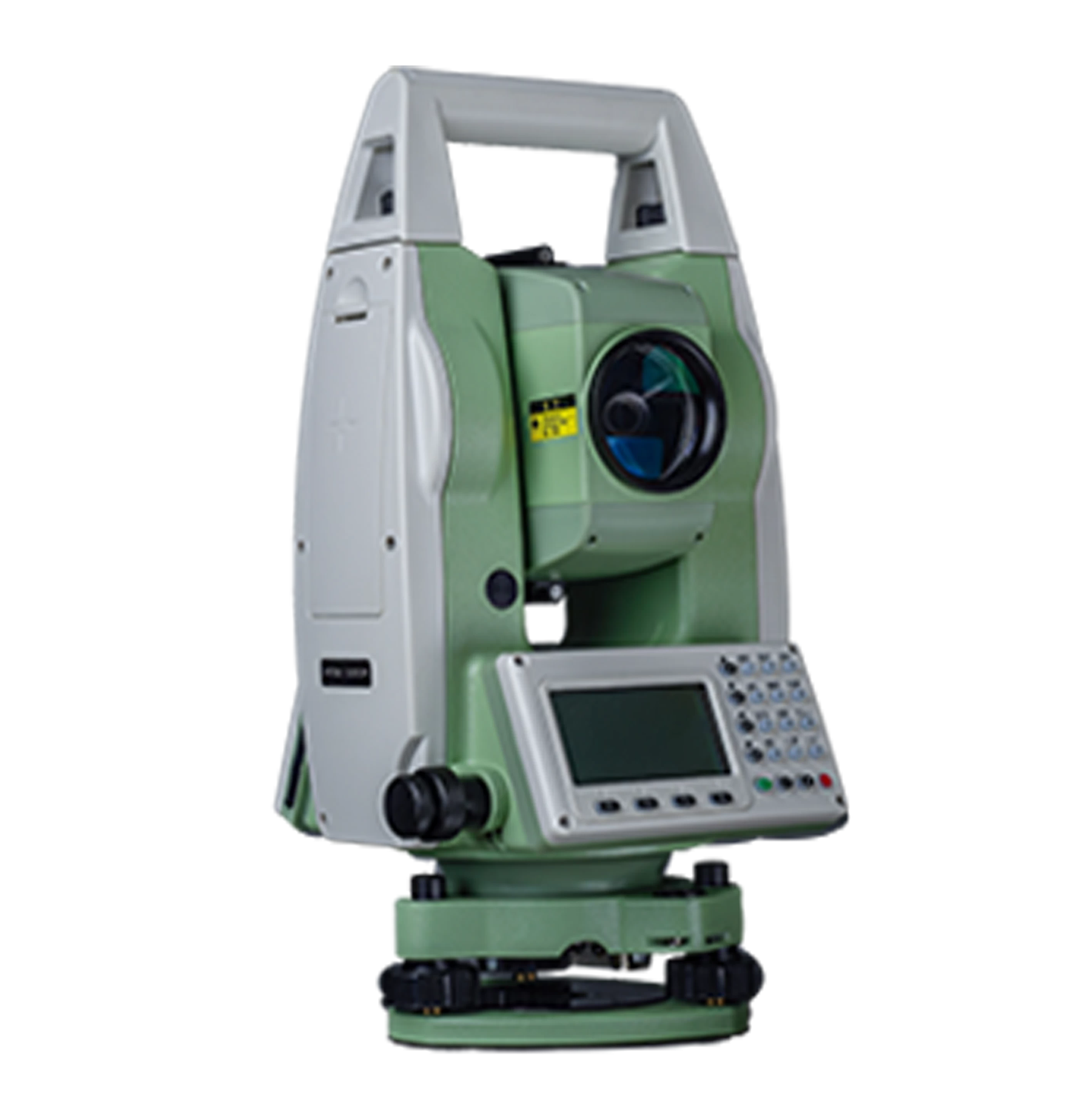
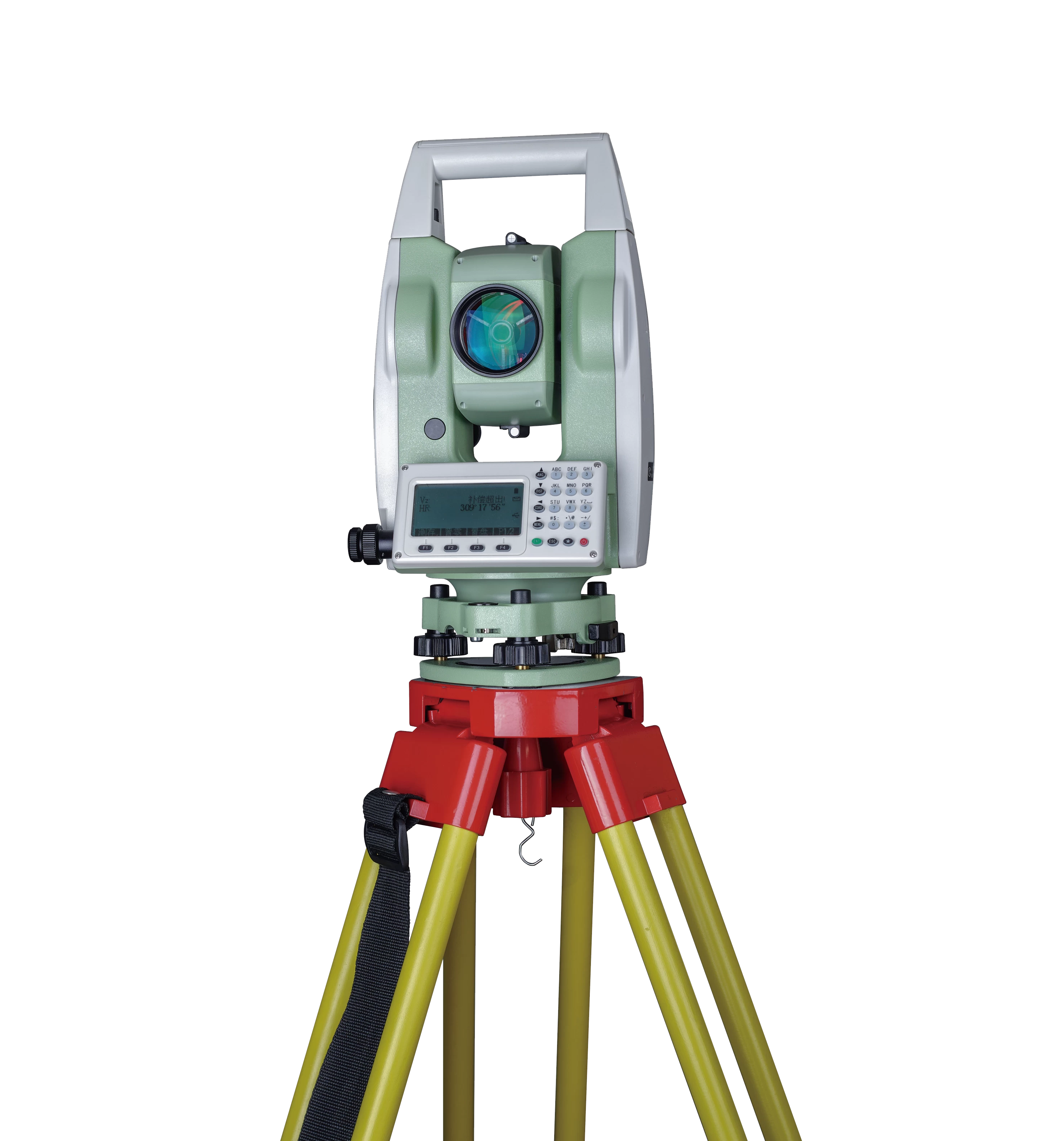
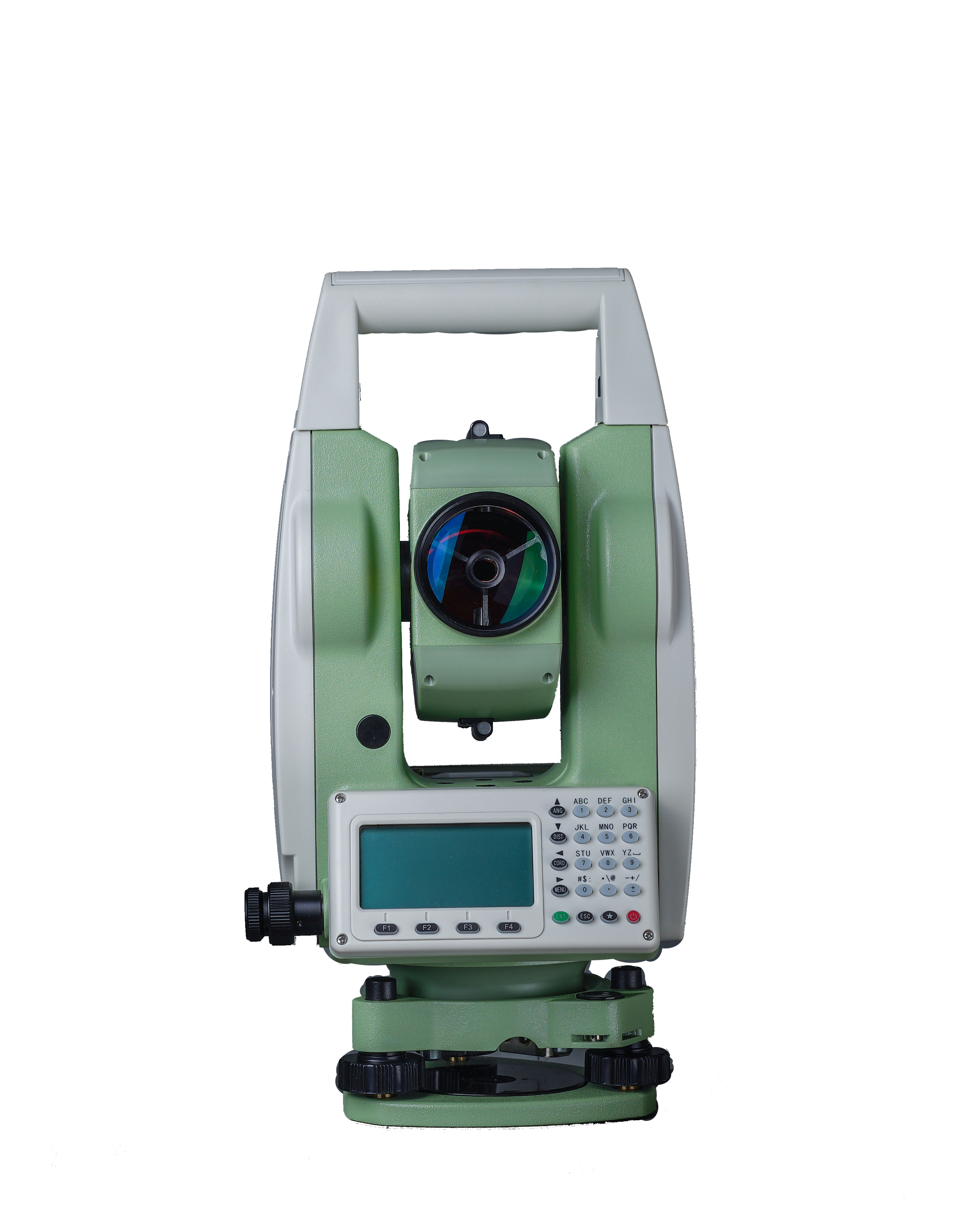
PTS-121R Total Station
- Brand name: PJK
- Model name: PTS-121R
- Origin: China
- Warranty period: 1 year
- Support Express: Shipping, Airmail
PTS-121R Total Station
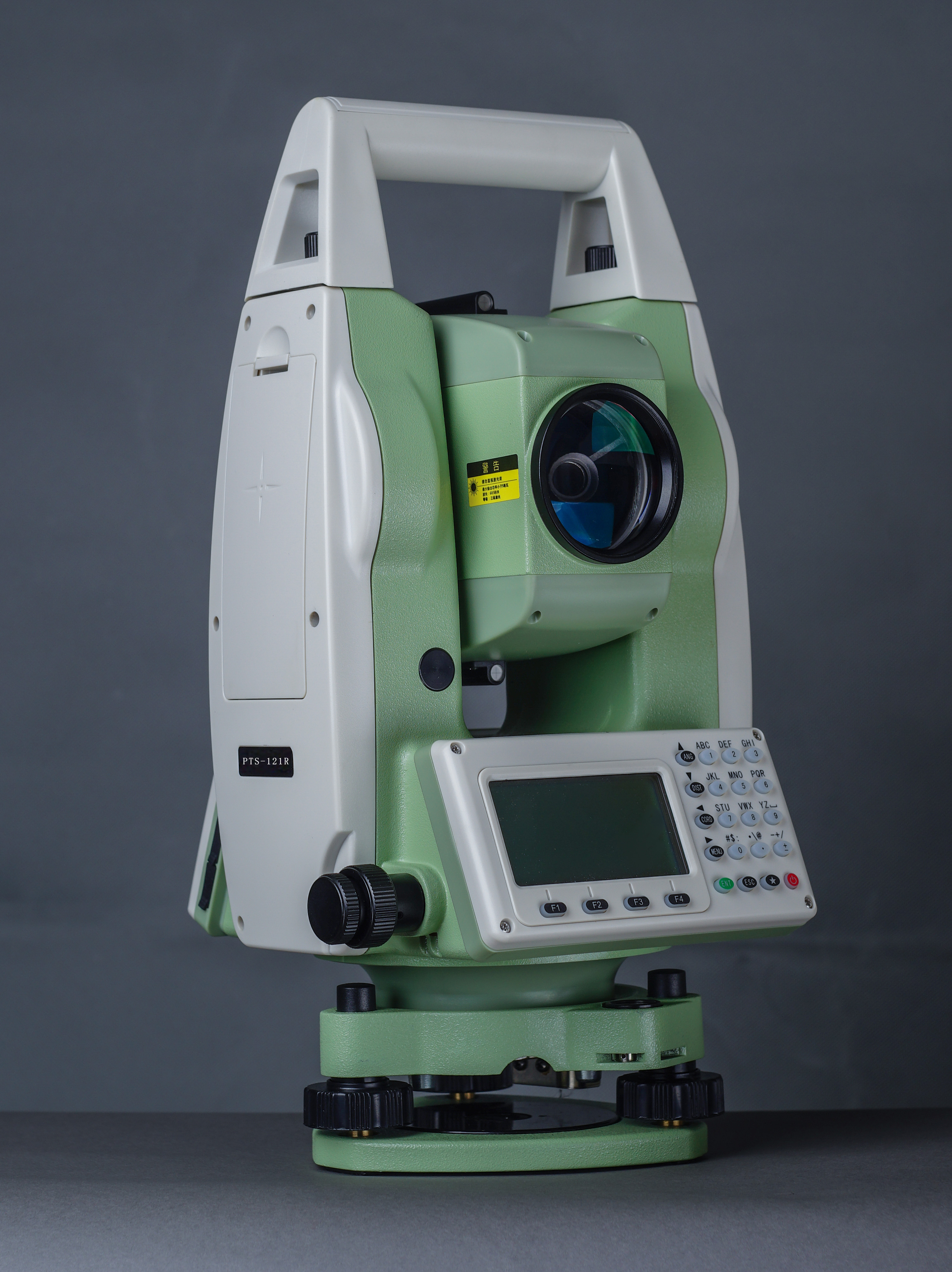
Main features
1) Two-axis compensator
2) Measurement range without reflectors of 600m
3) Big Data Storage and Bluetooth Connection
Detailed benefits features
Two-axis correction
of P TS-12 1 R consists of an advanced two-axis compensator for automatic error removal and automatic accuracy compensation.
Absolute encoding
Absolute encoding disks ensure high accuracy, efficiency and stable performance. There is no need to initialize and you can measure the angle immediately. P TS-12 1 R turns on. Previous data and settings will be saved automatically. parable P TS-12 1 R suddenly turned off.
High performance MCU
With the SMT32 MCU based on the ARM Cortex™-M processor, P TS-12 1 R Very high processing speed and low power consumption.
bluetooth
Bluetooth wireless technology, P TS-12 1 R can access any data collector for real-time communication. Third-party field software such as Carlson SurvCE is fully compatible with the PTS-121R.
Data Storage
A variety of data transfer options, such as SD cards and Micro-USB ports, work perfectly with free dual-port USB disks.
Backlight
The screen and keyboard backlight are adjustable, making it easy to work in the dark.
Diagonal eyepieces
It supports diagonal eyepieces for observation with sudden gazes.
Calibration software
Running real-time diagnostics using SUNWAY Calibration software allows you to quickly identify problems and ensure trouble-free operation.
New Data Transfer Software
The new, easy-to-use data transfer software supports a variety of output data formats that can be used with AutoCAD and other branded post-processing software.
Reticle: Illumination
Technical parameters
Angle measurement
Measurement method: Absolute encoding
Minimum readout: 1″/5″/10″ (0.3mgon/1.5mgon/3mgon) option
Accuracy 1:2”
Distance measurement (with reflector)
Single Prism: 5000m (9,842 ft)3 under good conditions
Three prisms: 6000m (19,685 ft) under good conditions 3
Reflective sheet: 800m (2,624 feet)
Accuracy: 2 mm 2ppm
Measurement time (fine/quick/tracking): 1.5 seconds/1 second/0.5 seconds
Distance measurement (no reflector)
No reflector 2 Range: 350m, 600m
Single Prism: >7500m (24606ft.)
Accuracy: 3mm2ppm
Measurement time: 1.5 seconds
telescope
Magnification: 30X
Field of view: 1°30 min (2.7m at 100m)
Minimum shooting distance: 1.2m
Reticle: Illumination
Compensator
System: 2-axis (optional)
Operating range: ±3'
Setting accuracy: 1 inch
communication
bluetooth
Interface: Standard RS232, SD card 4, USB pen drive, Mini USB
Internal data memory: Approx. 20,000 points
Data format: ASCII
Surgery
Operating System: Real-time Operating System
Display: High-resolution backlight black and white display with contrast adjustment function/Graphics: 280 x 160 pixels/Characters: 6 lines x 25 characters
Keyboard: 2-sided alphanumeric backlit crystal keyboard
Laser Plumet
Type: Laser Point, 4 levels of brightness adjustment/centripetal force (optional)
Centering Accuracy: 1mm at equipment height of 1.5m
power supply
Battery Type: Rechargeable Li-ion Battery
Voltage/Capacity: ZBA-400: 7.4V(DC)/3000mAh
Operating time when using ZBA-400: Optimal 16 hours 5 (continuous angle measurements every 30 seconds) / 10 hours (standard)
Measurement time: Approximately 1 hour 12,000 times
environment
Operating temperature: -20℃ to ﹢50℃ (-4℉ to 122℉)
Storage temperature: -40℃ to ﹢70℃(-40℉~158℉)
Dust and waterproof (IEC60529 standard)/Moisture resistance: IP54, 95%, no condensation
application
1. Mineral investigation, exploration and excavation.
2. Construction of railways, highways and bridges.
3. Irrigation and water conservation, urban planning and construction.
4. Building battlefield preparation, ports, fortress, airports, and military engineering.
5. Accurate positioning and installation in the shipbuilding and aerospace industries.
6. Three-dimensional coordinates of the structure, measurement position, pipeline orientation, and cross-section measurement.
7. Triangulation, topographical survey, cadastral survey, property survey.
If you are interested in this product, please feel free to contact us.

- Other Products


