


- Browse Categories
- YQFH Drone
- DJI Drone
- Other Drone
- Drone Payloads
- Robot
- Pipeline Detection Instrument
- 3D Laser Scanner
- Industrial Measurement Devices
- Weather Station Series
- Optical Survey Instruments
- GNSS RTK & CORS System
- BDS System Products
- Visual Displacement Monitoring System
- UWB Indoor Positioning System
- Hydrology Products
- Others
- Spectrometer
- Wet Blast Machine
- SDI Soil Tester
- Pengjin Smart Flying Drone Patrol and Inspection System
- Supercomputing
- Module
- Viscometer
- Electric Hygro-thermograph
- Echo Sounder
- Processing Software
- Keson Measuring Tools
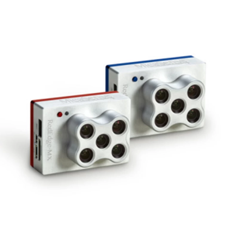
MicaSense RedEdge-MX & RedEdge BLUE
- Brand Name:MICASENSE
- Model Name:MX & RedEdge BLUE
- Place of Origin:USA
- Warranty:1 year
- Support Express:Sea freight, air freight
- NR SERIES Steel Blade Measuring Tape
MicaSense RedEdge-MX & RedEdge BLUE

Dual cameras.Ten bands.Infinite index.
Product presentation:
New blue REDEDGE-MX
 |
The performance of RedEdge-MX mainly depends on a new coastal blue band, a new green band, and three new bands in the red to red edge region of the spectrum. Combined with the bands in the RedEdge-MX, the 10 bands in the two-load camera system allow for a direct comparison of the satellite and drone data. Already have a RedEdge-M or RedEdge-MX?Buying the new RedEdge-MX Blu-ray suite gives you twice the spectral clarity. |
 |
Data comparison of satellite and drone images

Product characteristics:
- Pixel-aligned images were synchronously captured across all 10 frequency bands
- Standard 12-bit TIFF file output with embedded metadata, and the raw data is fully accessible
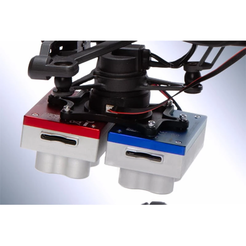
- Simplified integrated downlink light sensor and GPS combination for accurate ambient light calibration.Only one DLS is required
- Radiation-calibrated spectroscopic imager, used to perform accurate, reproducible measurements.
- All 10 lenses are equipped with a global shutter for distortion-free effects on each platform.
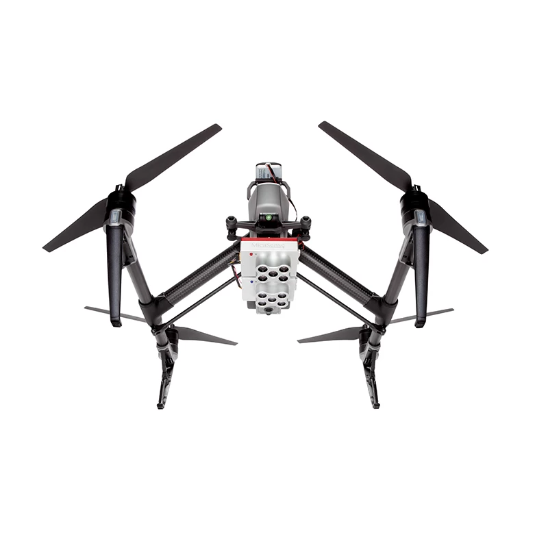
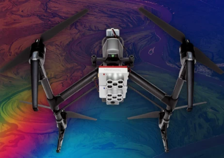
- The standard device includes a fixed bracket and a quick mount connector that can easily integrate with the DJI drone.
Product superiority:
- Images were directly compared with landsat and sentinel satellite data.
- Data can be easily processed using Pix4D, Agisoft, and other MicaSense data partners.
- The band was doubled and the analysis power was doubled.
- Shallow water environment can be monitored using new coastal blue / aerosol spectral bands.

Application:
The Micasense Ten-spectral Camera for Crop Analysis RedEdge-MX & RedEdge-MX BLUE, Developed and designed a RedEdge-MX Blue multi-spectral camera based on RedEdge-MX, The RedEdge-MX-Dual dual-camera imaging system consists of two multispectral cameras, the RedEdge-MX and the RedEdge-MX Blue, Total of 10 channels, Corresponding to the multiple bands of the imaging sensors carried by the Landsat8 and Sentinel2A satellites, One flight for more spectral information, Can be used in agriculture, forestry, urban planning, water quality monitoring and other fields.In particular, RedEdge-MX Blue increases the Coastal blue band, which can be applied to coastal zone monitoring.The two cameras share a solar luminometer (DLS2) to obtain light changes in real time.The overall weight of the system is 508.8g, and it can be equipped with DJI M100 / M200 / Wu 2 / M / 600 / M600 Pro.The obtained data can still be processed P software Pix4D, Agisoft, etc.

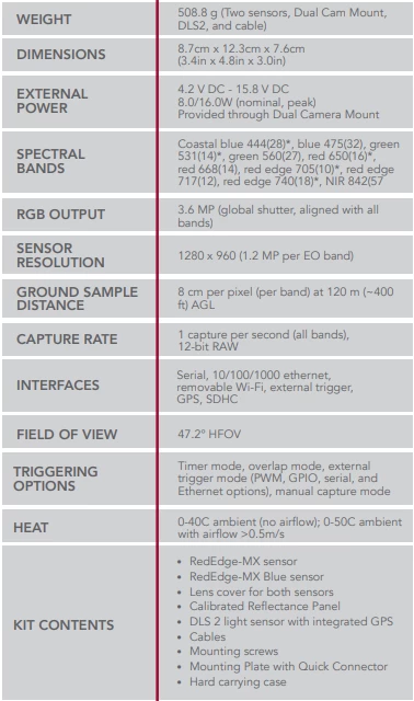
Technical parameters:

- Other Products


