


- Browse Categories
- Self-Developed Drone
- UAV from Represented Brands
- Robot
- Spectrometer
- Mechanical measurement device
- PJK Brand Monitoring System
- Optical Survey Instruments
- RTK GNSS Systems
- Pipeline Detector/ Locator & GPR
- Unmanned Aerial Vehicle Payload
- Thermal Camera
- 3D Laser Scanner
- Wet Blast Machine
- Measuring instrument Plainmeter
- Weather Station Series
- SDI Soil Tester
- Pengjin Smart Flying Drone Patrol and Inspection System
- Supercomputing
- USV
- Module
- Viscometer
- Electric Hygro-thermograph
- Echo Sounder
- Processing Software
- Keson Measuring Tools
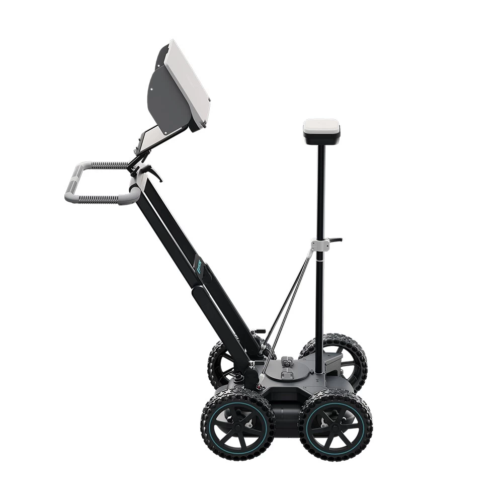
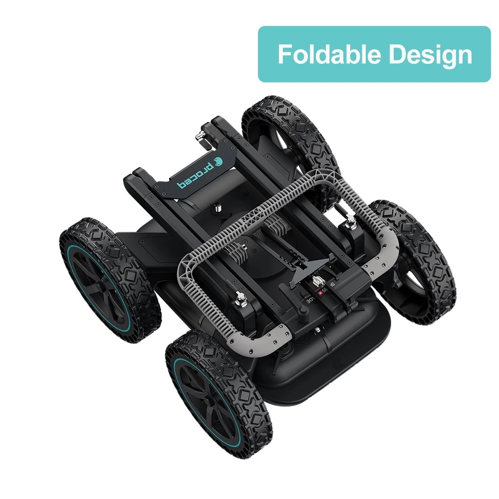
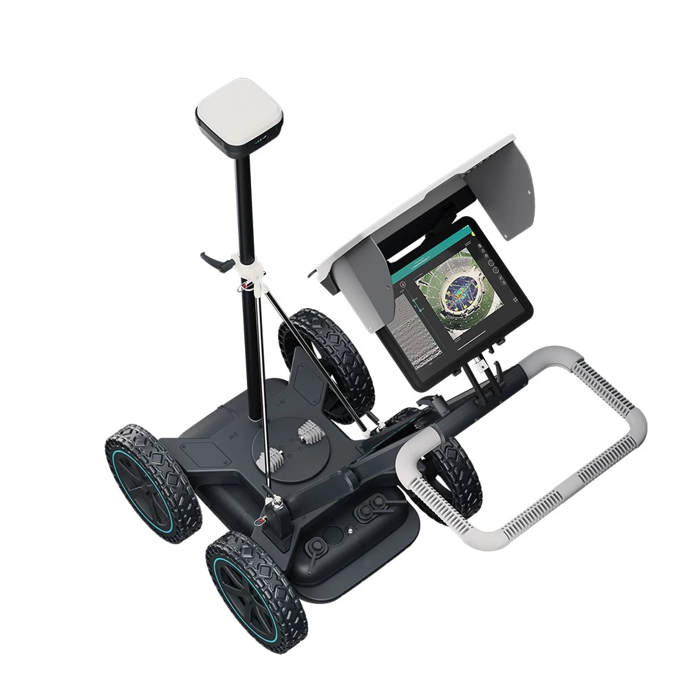
Underground mapping GPR Underground radar GS8000
- Radar Technology: Step Frequency Continuous Wave GPR
- Modulation frequency range: 40-3440 MHz
- Effective Bandwidth: 3200 MHz
- Minute. Detectable target size: 1 cm | 0.4 inch
- maximum. Depth Intrusion: 10 m | 33 feet
- Scan speed: 500 Hz
- Space spacing: Maximum 100 scans/min
- Acquisition speed: Maximum 80 km/h | 50 mph
- GNSS receiver: Multi-band GPS Glonass Galileo Beidou; SSR enhancement/RTK compatible. Dimensions: 145 x 145 x 70 mm. Weight: 0.7 kg, 4 AA batteries included
- GNSS Real-Time 3D Accuracy: Standard 1-5cm | 0.5-2 inches⁸
- Please contact us for more details.
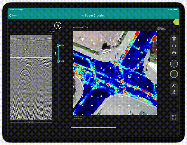
Underground mapping GPR Underground radar GS8000
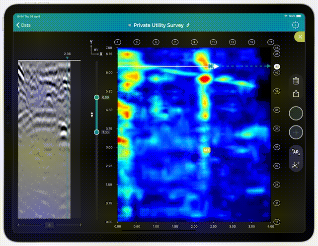
Best in class technology. Powerful 3D software. 100% real time. Perfect for professionals. It's intuitive for everyone.
1. Features
-
Versatility
Without methodological constraints, scanned underground real-time 2D and 3D data visualizations allow optimal interpretation in the field regardless of application.
-
Accuracy and resolution
Unique Swiss-made ultra-wideband radar technology and highly accurate geolocation information in local coordinates provide a clear view of data at various depths.
-
User Experience
End-to-end workflows ranging from the most intuitive data acquisition to instantly shareable deliverables. You can access your data anytime, anywhere.
2. Proceq GPR Underground App
-
App version 1
Key new features introduced with the free upgrade:
- Best image resolution with SFCW GPR data
- Adjust gain to better identify hyperbola in radargrams
- Migrated views to display embedded objects, layers, or defects
- A-Scan and Easy Tagging with User-Defined Targets
- Multilayer dielectric constant for accurate depth
- Grid scan for viewing tomography on the fly
- Time slice view with adjustable depth range
- Augmented reality overlaying time slices
- Real-time GNSS location log for Cm level during scanning
- All data is stored securely and distributed across the cloud, etc.
-
App version 2
Key new features introduced with the free upgrade:
- Full flexibility to scan areas without the constraints of following a grid
- Check for 3D tomography that is plotted in real time and updated during scanning.
- Display real-time position on top of satellite image
- Tags and markers are mapped and synchronized with top and cross sections
- Select the local coordinate system of the map from the EPSG database
- Store and categorize geographically located points of interest on a map
- Directly digitize utility diagrams in thyme slice view.
- Export results to general CAD and GIS formats in one click
- Mark up images and share sketches as part of field report
- Connect to a ground positioning system for indoor mapping, etc.
Tel:+8615899753550
Wechat:pjk2018666
Contact Person:Linda Lin

- Other Products


