


- Browse Categories
- YQFH Drone
- DJI Drone
- Other Drone
- Drone Payloads
- Robot
- Pipeline Detection Instrument
- 3D Laser Scanner
- Industrial Measurement Devices
- Weather Station Series
- Optical Survey Instruments
- GNSS RTK & CORS System
- BDS System Products
- Visual Displacement Monitoring System
- UWB Indoor Positioning System
- Hydrology Products
- Others
- Spectrometer
- Wet Blast Machine
- SDI Soil Tester
- Pengjin Smart Flying Drone Patrol and Inspection System
- Supercomputing
- Module
- Viscometer
- Electric Hygro-thermograph
- Echo Sounder
- Processing Software
- Keson Measuring Tools
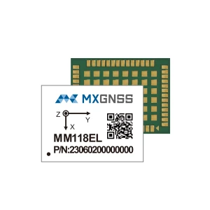
High precision dual-frequency RTK GNSS/INS integrated navigation module MM118EL
- Concurrent reception of BDS/GPS/Galileo/QZSS signals
- Fully support Beidou-3 satellites
- L1+L5 dual frequency RTK technology, centimeter-level accuracy
- Built-in GNSS/INS integrated navigation algorithm for continuous high-precision positioning
- Smart-surpress anti-jamming technology
- Support adaptive mounting
- •Mainstream package size 17x12mm
|
MM118EL High precision dual-frequency RTK GNSS/INS integrated navigation module |
 |
The MM118EL is a dual-frequency (L1+L5) RTK integrated navigation module developed by MXGNSS for the intelligent driving market. Built on proprietary high-precision chip design, it supports multi-constellation (BDS, GPS, Galileo, QZSS) combined with dual-frequency RTK technology and advanced integration algorithms. With full use of GNSS, IMU, wheel speed, and dynamic model, the product can provide continuous centimeter-level accuracy, ensuring reliability in occlusion environments such as overpasses, tunnels, and underground garages. The product stands out for its robust anti-jamming capabilities, low power consumption with good cost performance, widely used in global positioning application markets such as lawnmowers and vehicles.

Technical Features
•Concurrent reception of BDS/GPS/Galileo/QZSS signals
•Fully support Beidou-3 satellites
•L1+L5 dual frequency RTK technology, centimeter-level accuracy
•Built-in GNSS/INS integrated navigation algorithm for continuous high-precision positioning
•Smart-surpress anti-jamming technology
•Support adaptive mounting
•Mainstream package size 17x12mm
Specifications
| Power Supply | |
| Voltage | 3.0V~ 3.6V |
| RF input | |
| Signal Tracking |
BDS B1I, B1C,B2a |
| GPS /QZSS L1C/A、L5 | |
| Galileo E1, E5a | |
| Physical | |
| Package | 54-PIN Lga |
| 22x17x2.8mm | |
| I/O Data Interface | |
| UART | Default 115200bps |
| GNSS Performance | |
| TTFF | Cold Starts: ≤30s |
| Hot Starts: ≤1s | |
| Initialization Time | RTK :<10s |
| Position Accuracy | PVT:1.5m |
| RTK:1.5cm+1ppm | |
| Positioning Error of INS only | <1.5% of distance traveled without GNSS |
| Velocity Accuracy | 0.05m/s |
| Sensitivity | Tracking: -159dBm |
| Acquisition: -146dBm | |
| 1PPS Accuracy | 50ns |
| Nav. Update Rate | 1/2/5/10/25*HZ |
| Nav. Data Format | NMEA 0183 V4.1 |
| RTCM3.X | |
Application Fields
 |
 |
 |
||
| Lawnmowers | V2X | Intelligent Robot |

- Other Products


