


- Browse Categories
- YQFH Drone
- DJI Drone
- Other Drone
- Drone Payloads
- Robot
- Pipeline Detection Instrument
- 3D Laser Scanner
- Industrial Measurement Devices
- Weather Station Series
- Optical Survey Instruments
- GNSS RTK & CORS System
- BDS System Products
- Visual Displacement Monitoring System
- UWB Indoor Positioning System
- Hydrology Products
- Others
- Spectrometer
- Wet Blast Machine
- SDI Soil Tester
- Pengjin Smart Flying Drone Patrol and Inspection System
- Supercomputing
- Module
- Viscometer
- Electric Hygro-thermograph
- Echo Sounder
- Processing Software
- Keson Measuring Tools
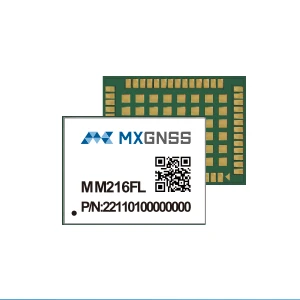
All-system all-frequency high precision positioning module MM216FL
- Simutaneous reception of All-constellation and All-frequency
- Significantly reduced TTFF for rapid positioning
- Support A-GNSS
- Smart-surpress anti-jamming technology
- Low power consumption design, strong multi-path resistance, high accuracy, and reliability Smart Suppress
- Mainstream package size 17x12mm
|
MM216FL All-system all-frequency high precision positioning module |
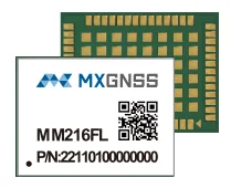 |
MM216FL is a high-precision positioning module supporting all currently system and all frequency of BDS, GPS, GALILEO, GLONASS,QZSS, NAVIC and SBAS. Built on MXGNSS's MXT2720 SOC chip, which has low power consumption and high performance, it achieves millimeter-level accuracy. This product is mainly used in safety monitoring, CORS receiver, surveying and mapping, agricultural vehicle autonomous driving, UAV and other high-precision navigation markets

Technical Features
•Simutaneous reception of All-constellation and All-frequency
•Significantly reduced TTFF for rapid positioning
•Support A-GNSS
•Smart-surpress anti-jamming technology
•Low power consumption design, strong multi-path resistance, high accuracy, and reliability Smart Suppress
•Mainstream package size 17x12mm
Specifications
| Power Supply | |
| Voltage | 3.0V~ 3.6V |
| RF input | |
| Signal Tracking |
GPS: L1C/A/L1C/L2C/L5 |
| BDS:B1I/B2I/B1C/B2b/B2a/B3I | |
| Galileo: E1/E5a/E5b/E6c | |
| GLONASS: G1/G2 | |
| QZSS:L1C/A/L1C/L2C/L5/L6 | |
| NAVIC:L5 | |
| L-BAND | |
| SABS | |
| Physical | |
| Package | 54-PIN LGA |
| 17x22x2.4mm | |
| I/O Data Interface | |
| UART | Default 115200bps |
| Communication Interface | 3xUART、1xPPS、1xSPI、1xEVENT、1xI2C |
| GNSS Performance | |
| TTFF | Cold Starts: ≤24s |
| Hot Starts: <2s | |
| A-GNSS: <1s | |
| RTK Initialization Time | <5s |
| Initialization Reliability | 99.9% |
| Position Accuracy | PVT≤1m |
| RTK≤0.8cm+1ppm | |
| Observation Accuracy(RMS) | Phase:≤1mm |
| Code:≤1mm | |
| Velocity Accuracy | 0.03m/s |
| 1PPS Accuracy | 20ns |
| Nav. Update Rate | 1HZ |
| Nav. Data Format | NMEA 0183 V4.1 |
| RTCM V3.X | |
Application Fields
 |
 |
 |
 |
 |
||||
| CORS receiver | Safety monitoring | Smart driving | UAV | Mapping |

- Other Products


