- Browse Categories
- YQFH Drone
- DJI Drone
- Other Drone
- Drone Payloads
- Robot
- Pipeline Detection Instrument
- 3D Laser Scanner
- Industrial Measurement Devices
- Weather Station Series
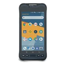
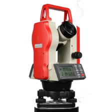
- Optical Survey Instruments
- GNSS RTK & CORS System
- BDS System Products
- Visual Displacement Monitoring System
- UWB Indoor Positioning System
- Hydrology Products
- Others
- Spectrometer
- Wet Blast Machine
- SDI Soil Tester
- Pengjin Smart Flying Drone Patrol and Inspection System
- Supercomputing
- Module
- Viscometer
- Electric Hygro-thermograph
- Echo Sounder
- Processing Software
- Keson Measuring Tools
Category
-
-
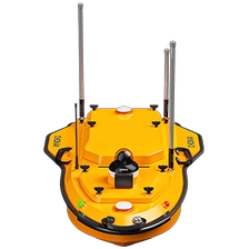
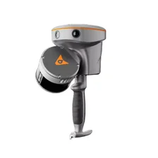
Hydrographic and Bathymetric Surveys USV CHCNAV APACHE 4
The APACHE 4 is a multi-platform unmanned surface vessel (USV) designed to support the CHCNAV HQ-400 multibeam echo sounder (MBES) and various acoustic doppler current profilers (ADCPs). It provides a fully autonomous hydrographic survey solution featuring shallow draft, high navigational accuracy, and stable hovering for measuring water flow velocity and discharge.More

-
-
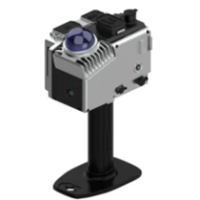
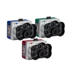
HIGH-PERFORMANCE FIVE-LENS TILT PHOTOGRAPHY CAMERA PY505
With a total resolution of 3.05 million pixels, the camera integrates five 61-megapixel full-frame ExmorRCMOS back-illuminated image sensors. Equipped with a high-performance AI motherboard, it excels in heat dissipation, data communication, system integration, and data transmission. It is compatible with mainstream Multirotor and Fixed-wing UAV on the market.
More
-
-
5-Band Multispectral High-Res RGB Drone Camera Rededge-P for Precision Agriculture
The Micasense Altum-PT is an advanced multispectral and thermal imaging sensor designed for precision agriculture and remote sensing applications. The combination of high-resolution multispectral and thermal images provides detailed insight into crop health, vegetation index, and biophysical parameters. Ideal for drone integration, Altum-PT enables efficient data collection and analysis for informed decision-making in agriculture and environmental surveillance. You can capture both thermal and multispectral data at the same time. This sensor is a powerful tool to improve agricultural productivity and sustainability.
More