


- Browse Categories
- DJI Drone
- YQFH Drone
- Other Drone
- Drone Payloads
- Robot
- Spectrometer
- Mechanical measurement device
- PJK Brand Monitoring System
- Optical Survey Instruments
- RTK GNSS Systems
- Pipeline Detector/ Locator & GPR
- Unmanned Aerial Vehicle Payload
- Thermal Camera
- 3D Laser Scanner
- Wet Blast Machine
- Measuring instrument Plainmeter
- Weather Station Series
- SDI Soil Tester
- Other
- Pengjin Smart Flying Drone Patrol and Inspection System
- Supercomputing
- USV
- Module
- Viscometer
- Electric Hygro-thermograph
- Echo Sounder
- Processing Software
- Keson Measuring Tools

|
|
|
|
|
|
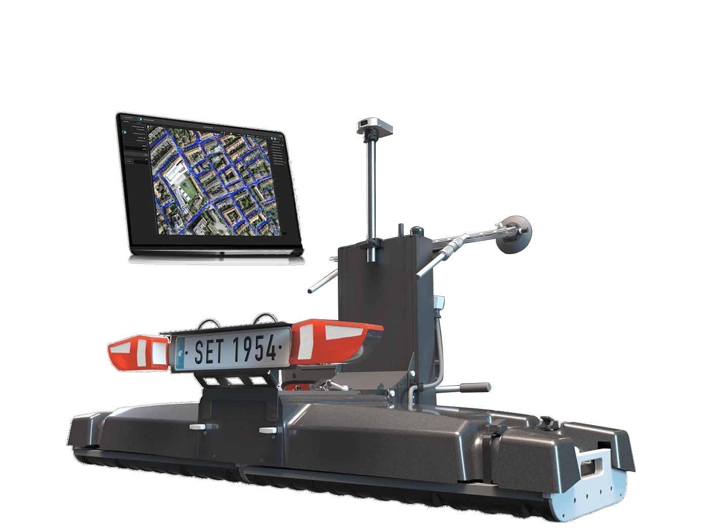
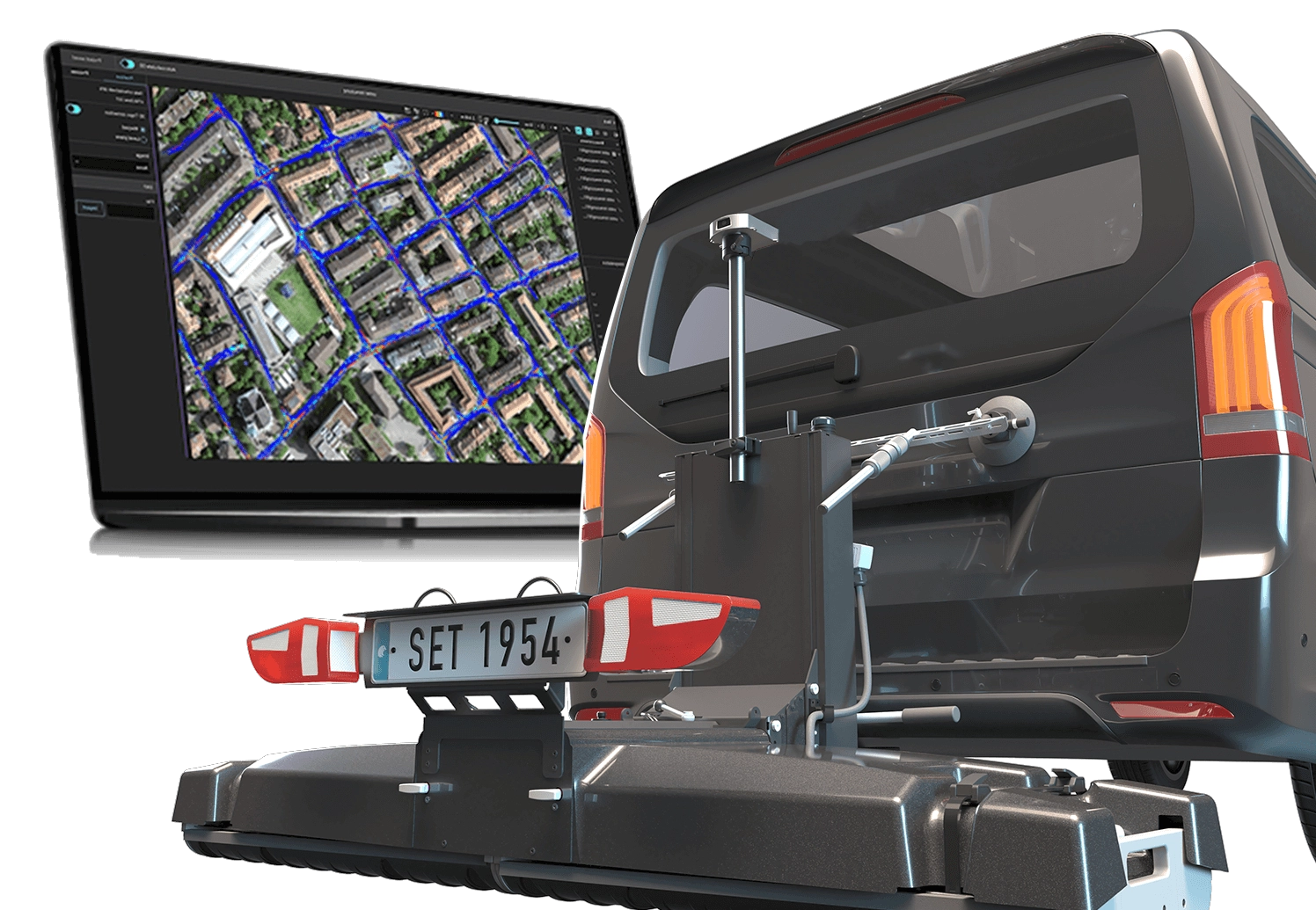
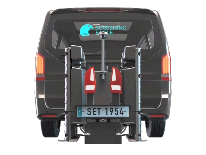
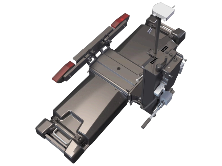
| Modular multichannel GPR mobile mapping system for the subsurface |
 |
 |
 |
||
| Versatility | Accuracy | Efficiency | ||
| Interchangeable GPR arrays for near surface and deep detection to scale your solution easily and approach new applications. | The highest density of information in all three dimensions, accurately mapped even in challenging conditions. | Easy to set up, operate, and get insights from. Data collection at high speed and direct path into the office. |
Technical Parameters
| Radar technology | Stepped-frequency GPR |
| Modulated frequency range | 500 – 3000 MHz ² | 30 – 750 MHz ³ |
| Number of channels | 71 (VV) + 31 (HH) ² | 23 (VV) ³ |
| Channel spacing | 2.5 cm (VV), 5.5 cm (HH) ² | 7.5 cm ³ |
| Scan width | 1.75 m ² | 1.67 m ³ |
| Scan rate | 27500 scans/s ² | 22000 scans/s ³ |
| Time window | 45 ns ² | 130 ns ³ |
| Acquisition speed | Up to 80 Km/h ² ⁴ | Up to 180 Km/h ³ ⁵ |
| Spatial interval | Up to 100 scans/m |
| Dimensions | Total length: 923 mm | Total width: 1882 mm |
| Weight | 87 - 93 Kg ¹⁰ |
| Odometry | Doppler radar or wheel speed sensor |
| Ingress protection (IP) / sealing | IP65 |
| Towing system | Rear hitch, 50 mm ball |
| Shock absorption system | Hydraulic, optional anti-bump wheels |
| Power supply | Power-over-Ethernet / External 12V |
| Operating temperature | -10° to 50°C | 14° to 122° F |
| Operating humidity | <95% RH, non-condensing |
| Connectivity | USB-C, USB-A, 2x Ethernet + Power, 2x Lemo ⁶, 2x ODU Antenna connector, Universal I/O (UART, CAN-Bus) |
| GNSS satellites | Multiband GPS + Glonass + Galileo + Beidou |
| GNSS real-time corrections | NTRIP RTK compatible ⁷ |
| RTK accuracy | Typ. 1 - 5 cm | 0.5 - 2 in ⁸ |
| RTK outage accuracy | <0.1% drift/distance ⁹ |
| Sensor fusion | GNSS + IMU + Camera imaging + Wheel speed |
| Feature tracking | Yes |
1. Running an up-to-date iOS version; recommended models: MacBook Pro® 2022 model or superio
2. In combination with 2x GX1 array modules
3. In combination with 2x GX2 array modules
4. At 100mm spacing
5. At 50mm spacing
6. For terrestrial positioning systems, an intermediate serial adapter to DB9 might be needed to output Pseudo NMEA GGA position
7. Needs an active Internet connection on the iPad; NTRIP corrections in RTCM3 format
8. The achieved accuracy is subject to atmospheric conditions, satellite geometry, observation time, etc
9. By bundle adjustment between
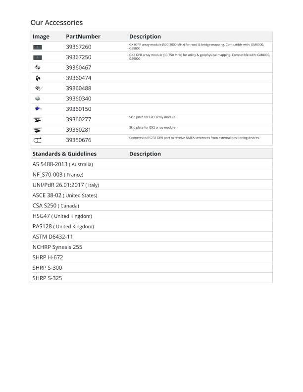
Our Accessories
Shenzhen Peng Jin Technology Co., Ltd.

Tel:+8613828792860
Wechat:PJK13828792860
Contact Person:Janet luo
- Other Products


