


- Browse Categories
- YQFH Drone
- DJI Drone
- Other Drone
- Drone Payloads
- Robot
- Pipeline Detection Instrument
- 3D Laser Scanner
- Industrial Measurement Devices
- Weather Station Series
- Optical Survey Instruments
- GNSS RTK & CORS System
- BDS System Products
- Visual Displacement Monitoring System
- UWB Indoor Positioning System
- Hydrology Products
- Others
- Spectrometer
- Wet Blast Machine
- SDI Soil Tester
- Pengjin Smart Flying Drone Patrol and Inspection System
- Supercomputing
- Module
- Viscometer
- Electric Hygro-thermograph
- Echo Sounder
- Processing Software
- Keson Measuring Tools
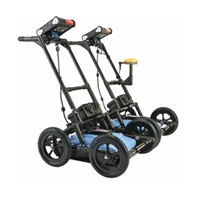
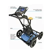
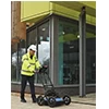
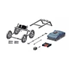
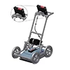
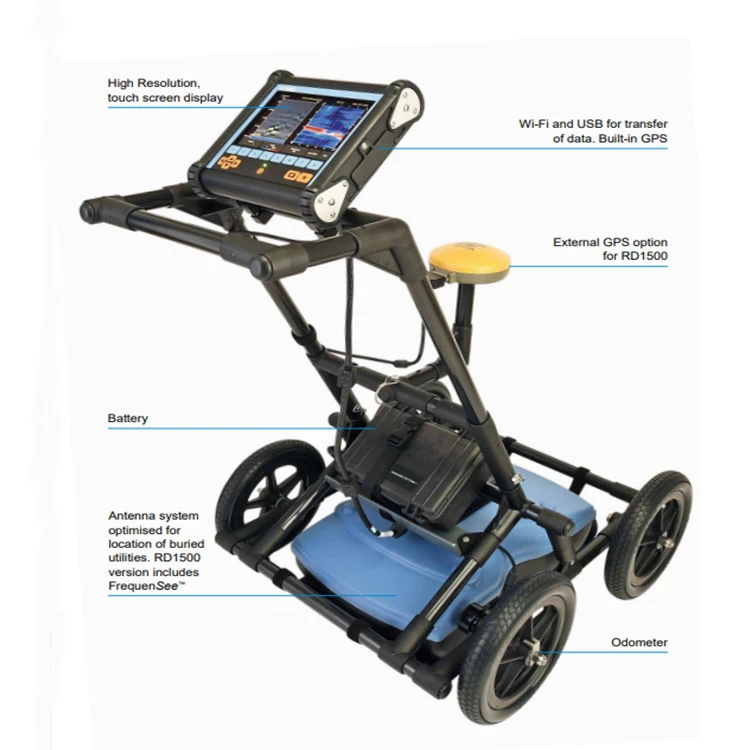
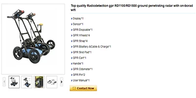
Top Quality Wireless Detection RD1100/RD1500 Underground Radar with On-Board Wi-Fi
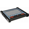
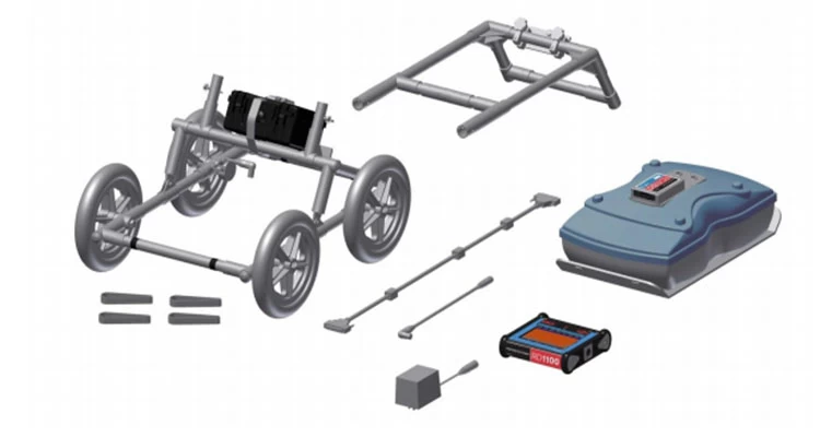
- Display*1
- Sensor*1
- GPR Despicable*1
- GPR wheels*4
- GPR strap*4
- GPR Battery & Cable & Charging*1
- GPR skid pad*1
- GPR Cart*1
- Handle*1
- GPR Odometer*1
- GPR pin*2
- User Manual*1
Product Description
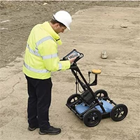
RD1100 It provides location experts, surveyors and other users with the tools they need to track and mark any type of location. Cables and pipes,
Plastic and ceramics. Ability to take standard built-in screenshots and save them internally Memory that allows you to send emails immediately
Export to Wi-Fi or later to a USB memory stick. GPS positioning is obtained for integration into Google Earth™. Underground radar utility location
RD1500 It takes utility localization to the next level, providing depth slices and traditional line views that are easy for users to interpret. use Unique
Frequency View™ technology highlights small/shallow, medium, or large/deeply buried utilities. Enhance the RD1500 Software to export GPR data and
Perform detailed analysis and use external GPS to improve positional accuracy
Product Specifications
Specifications
|
RD1100 & RD1500
|
Options and comments
|
|
|
Sensor frequency
|
250MHz Ultra Wide Band
|
RD1500:
Frequently includedSee
|
|
Signal Enhancement
|
DynaQ (Cart-based data quality optimization)
speed). Spatial filtering.
|
|
|
Data analysis
|
In field analysis
|
RD1500: post-
Processing analysis
EKKO_Project and
Utility Suite (optional)
|
|
Touch screen display
|
Size: 21cm diagonal (8 inch)
|
Strengthened: Upgraded
Display package
|
|
force
|
Power consumption: 1.25A at 12V
Battery: 12V, 9Ah Lead Acid Battery
|
Normal battery life
4-6 hours
|
|
Space spacing
|
5cm (2 inches)
|
|
|
Depth Range
|
Up to 8m (27 inches)
|
Ground situation dependence
|
|
Display depth scale
|
1m to 8m (3 inches to 30 inches)
|
|
|
Supported Languages
|
Non-verbal icons, English, Spanish,
French, German
|
|
|
Dimensions (H x W x D)
|
100 x 70 x 115 cm (39.4 x 27.6 x 45.3 inches)
|
|
|
Weight
|
22kg (48 lbs)
|
|
|
Operating temperature
range
|
Display: -10° to 50°C (14°F to 122°F)
Sensor: -40°C to 50°C (-40°F to 122°F)
|
|
|
Protecting the environment
|
IP65
|
|
|
compliance
|
CE, FCC, ETSI, Industry Canada
|
|
|
Standard warranty
|
1 year
|
Main features
Geographic reference data View the location of your survey in Google Earth™ and other georeference programs.
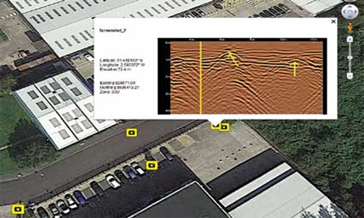
Screen capture Add markers via the touch screen display to highlight features of interest.


Our Services
 |
 |
Pre-Sales Services*Support for inquiries and consultations.. * Visit our website. |
After-sales service*Training on how to install machines and training on how to use machines. *We also have engineers who can handle machine repairs overseas. |

