


- Browse Categories
- YQFH Drone
- DJI Drone
- Other Drone
- Drone Payloads
- Robot
- Pipeline Detection Instrument
- 3D Laser Scanner
- Industrial Measurement Devices
- Weather Station Series
- Optical Survey Instruments
- GNSS RTK & CORS System
- BDS System Products
- Visual Displacement Monitoring System
- UWB Indoor Positioning System
- Hydrology Products
- Others
- Spectrometer
- Wet Blast Machine
- SDI Soil Tester
- Pengjin Smart Flying Drone Patrol and Inspection System
- Supercomputing
- Module
- Viscometer
- Electric Hygro-thermograph
- Echo Sounder
- Processing Software
- Keson Measuring Tools
ICEMAP™ Ice Bridge Thickness Detection Radar
- Brand name: Sensors and software
- Model name:ICEMAP™
- Origin: Canada
- Warranty period: 1 year
- Support Express: Shipping, Airmail
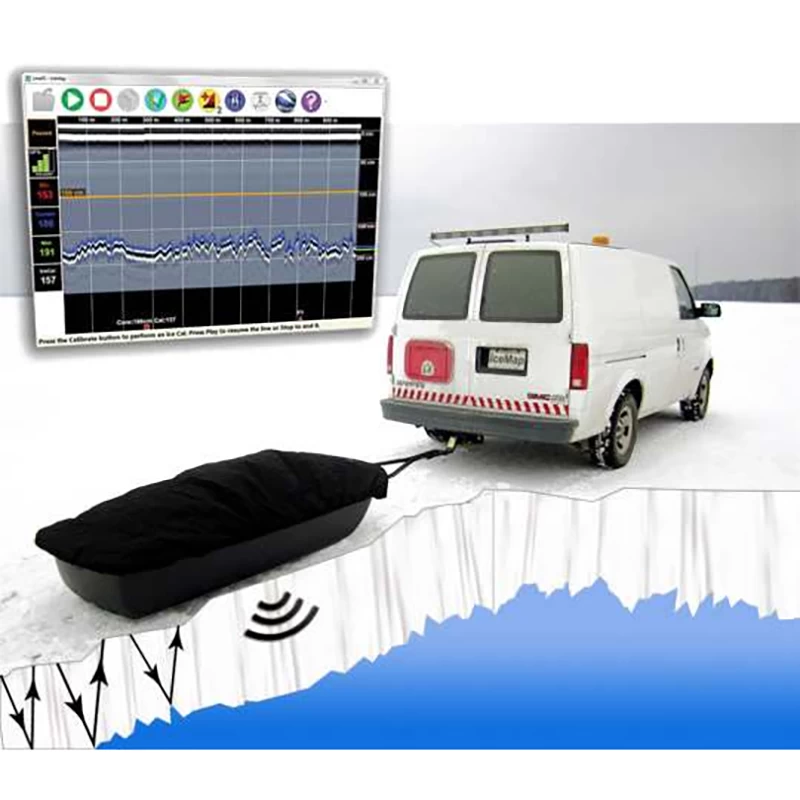
Ice map ™ ice B Sea RiDge T Hikness D detection R Adar
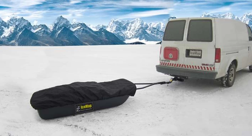
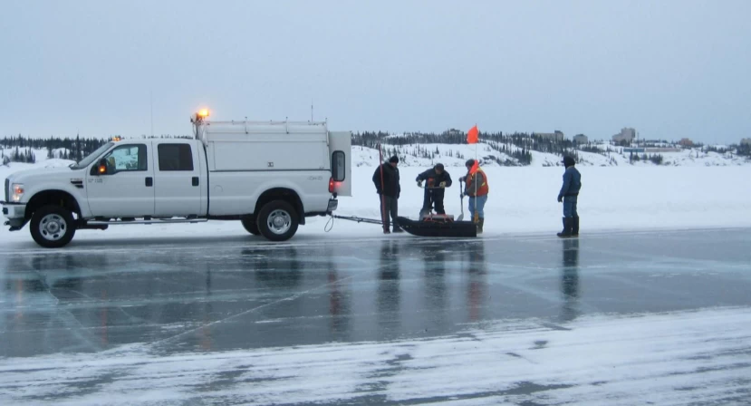
Continuous, real-time ice thickness measurements to ensure safety on winter ice roads.
Technical Features:
◇Can detect ice thickness less than 10m
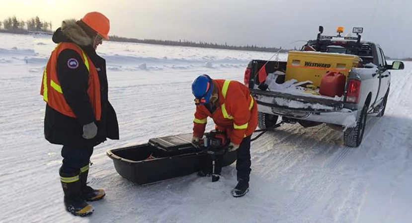
◇ Radio control of laptop antenna unit: Transfer collected data to laptop computer in real time
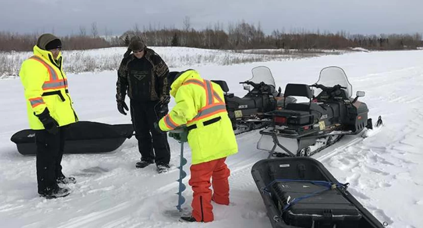
◇The antenna can be dragged by mechanical vehicles by moving at high speeds: up to 80km/h
◇Monitoring and recording of small and large thicknesses
◇Ice hazardous area warning function: Can be achieved by setting a valve with the thickness of the ice.
◇Continuously recorded GPS information allows you to accurately determine offline frozen hazardous areas maps on Google Earth
◇ Data playback display function, easy access to check
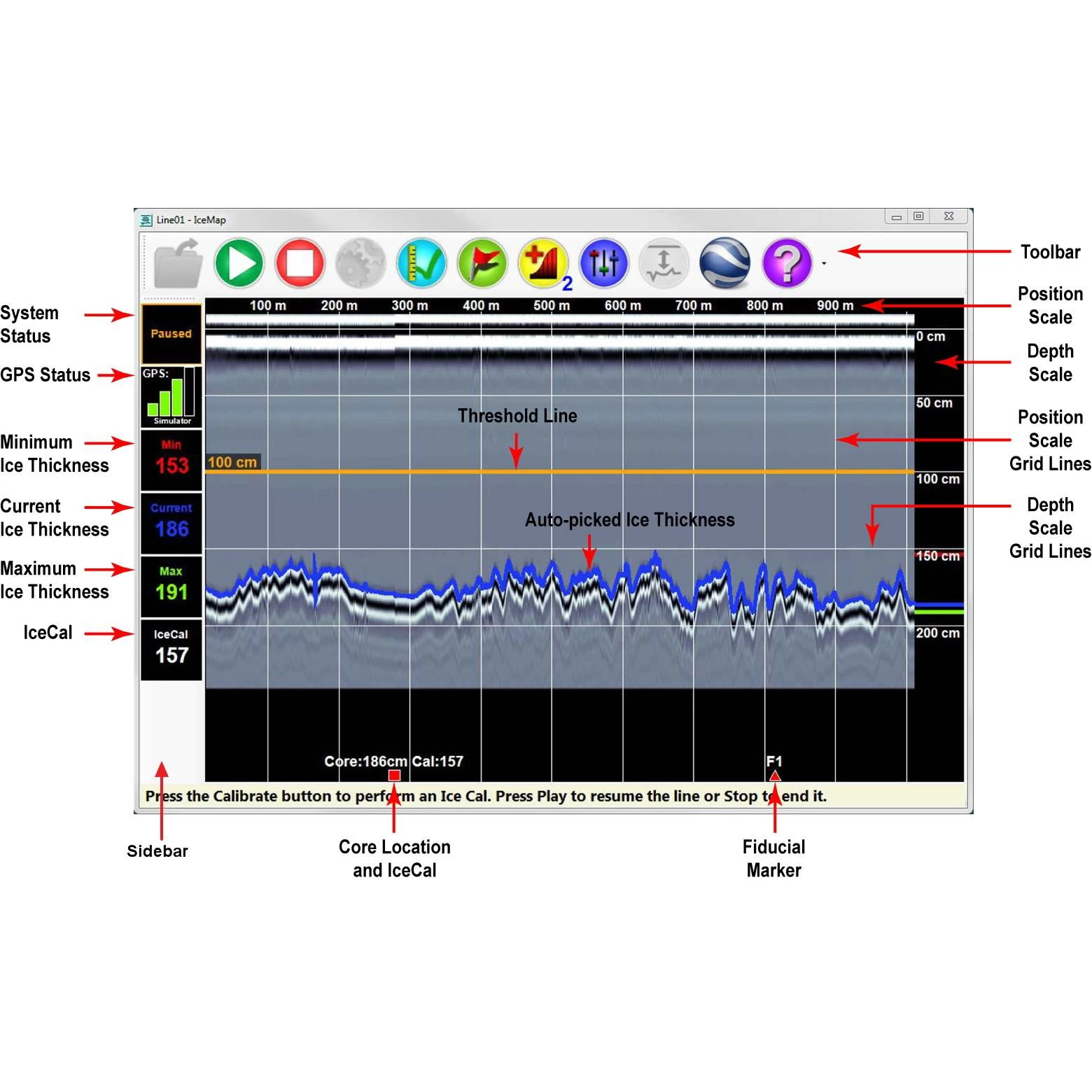
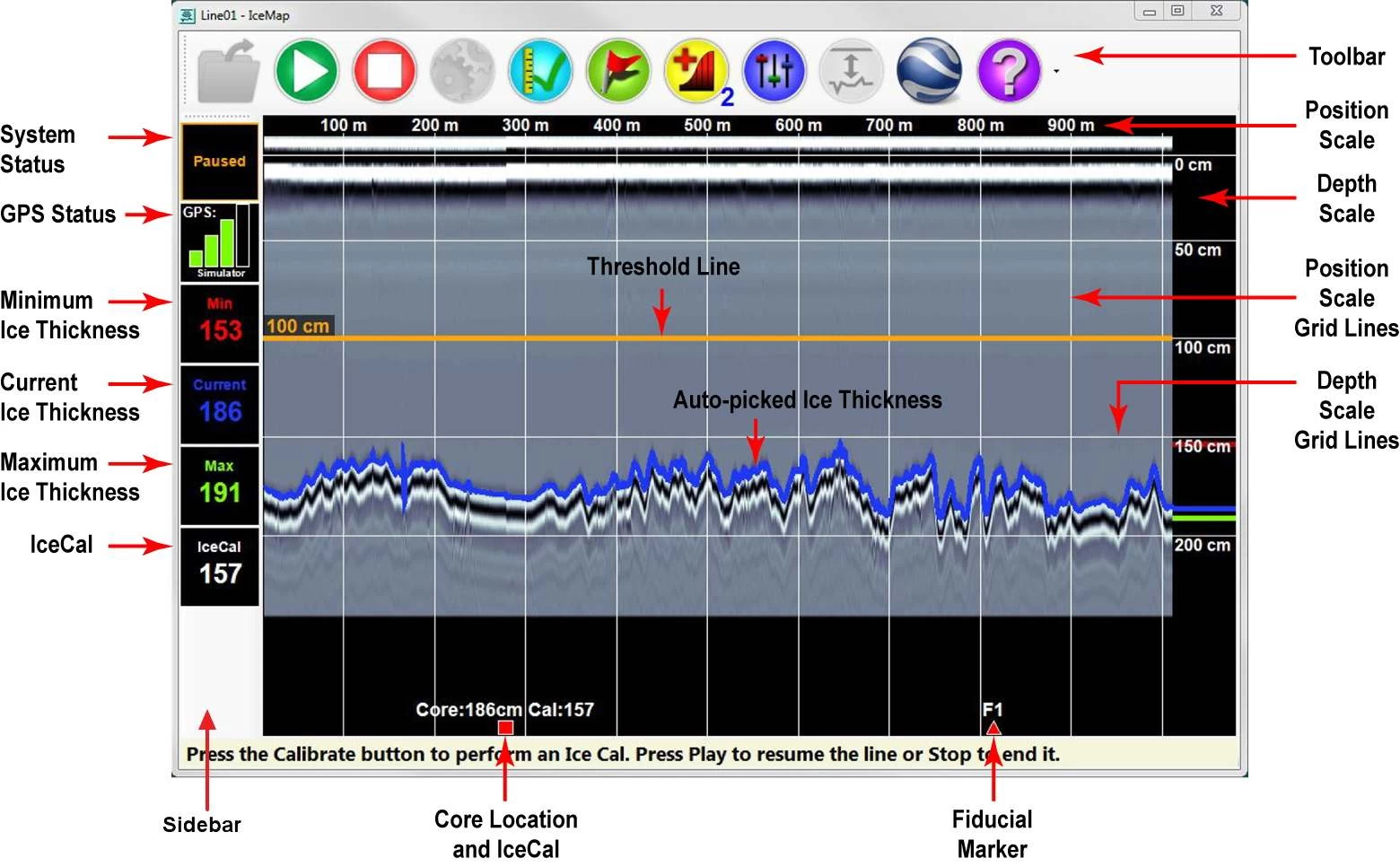
Real-time ice thickness measurement
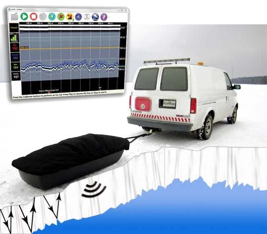
of Underground radar The IceMap™ Real-Time Display displays the automatically detected bottom of ice (blue lines) in real time. Users can set a minimum thickness warning threshold (gold wire).
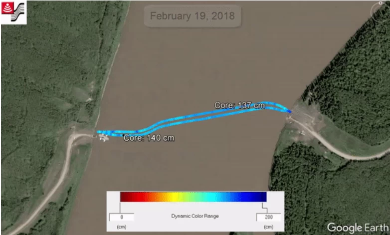
IceMap™ From thickness data for ice bridges in Alberta, Canada.
IceMap™ Data Collection Software
To collect IceMap™ data, users simply set the desired vehicle speed (km/h or mph), scan depth, and step size (measurement interval). All other parameters are automatically optimized for the highest quality data.
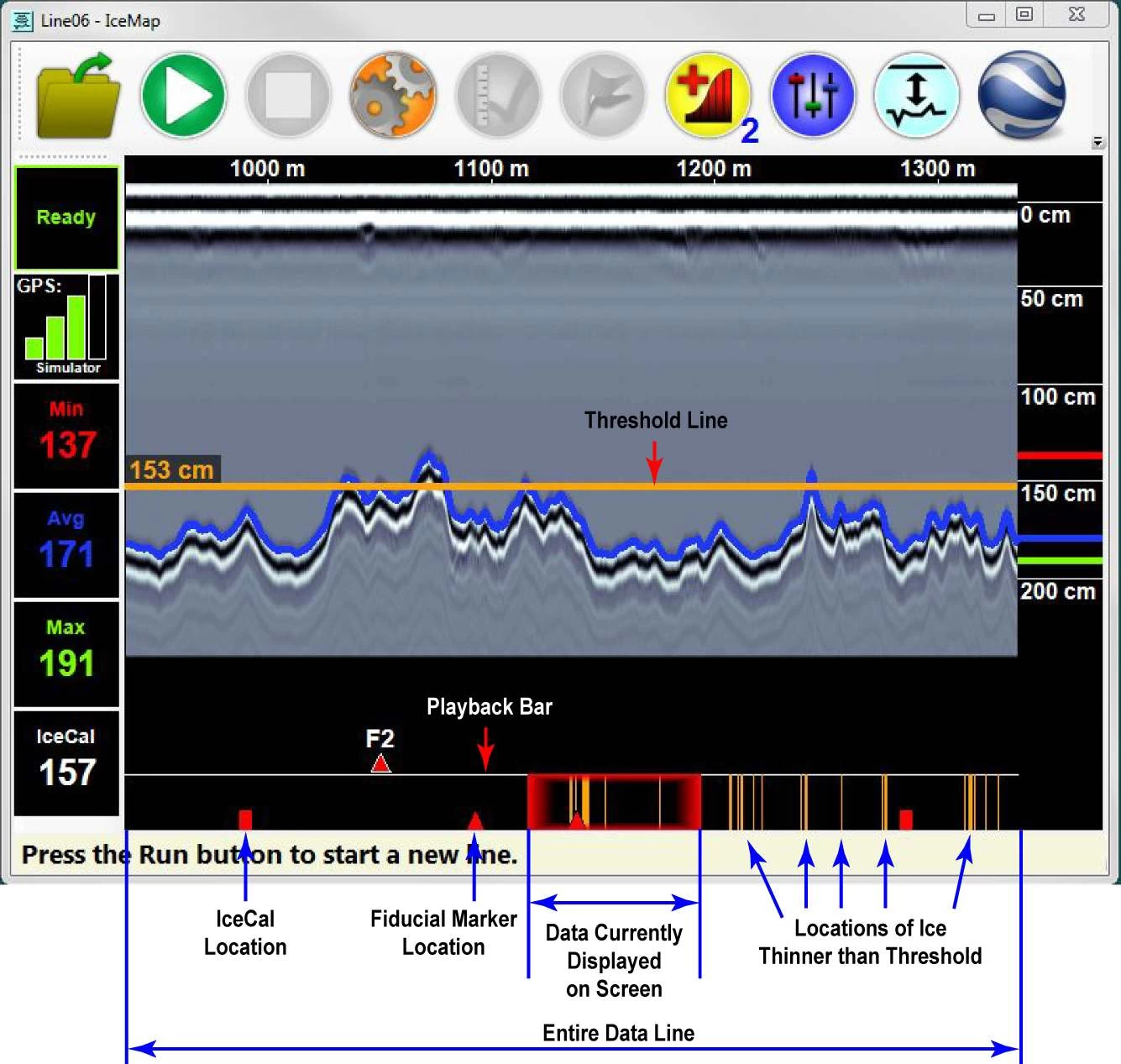
Data Review
After collecting IceMap™ data, the playback bar plots an area where ice is thinner than the threshold (orange line). Quickly identify where the problematic area is.
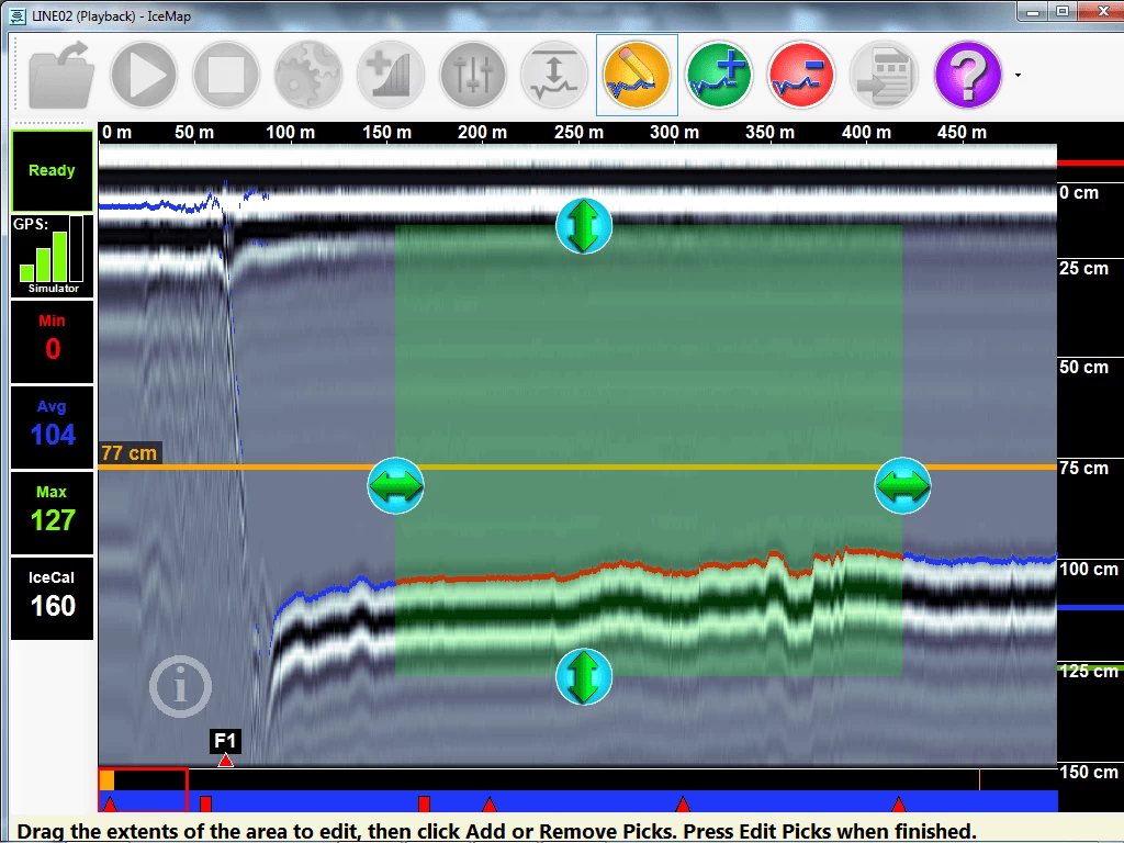
Data Edit
After collecting IceMap™ data, operators can edit it by clicking the button on the toolbar.
- The user drags the edge of the box on the touchscreen to define the area to delete or repick a pick.
Ice thickness report
Reports in PDF format are generated quickly from IceMap™ data.
- Users can define survey names, starting and ending locations, and additional comments.
- The Ice Calibration overview lists the IceCals that were run. Their location and measured ice thickness
- The thinnest ice section table, including the full length and longest continuous portion of thin ice.
- The exception table plots the area where the picks were manually deleted. These areas may indicate that the ice has been broken
- Map view view of IceMap™ lines
- Schematic cross-section of IceMap™ Line Ice Thickness
- Detailed cross-sections for every 1000 meters of IceMap™ line
specification :
|
specification |
values |
|
electronics |
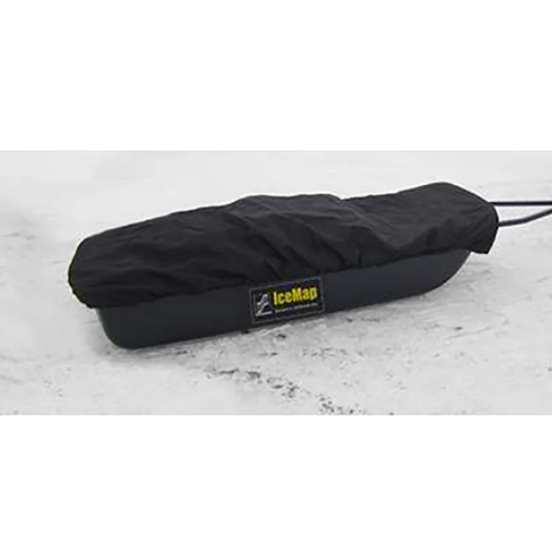
Size: 78 x 53 x 38cm (31 x 21 x 15 inches) Weight: 30 kg (65 lbs) |
|
toboggan |
Size: 191 x 79 x 30cm (75 x 31 x 12 inches) Weight without tow hitch: 16kg (36 lbs) Weight including tow hitch: 20kg (45 lbs) |
|
Center frequency |
500MHz |
|
-3dB Bandwidth |
250-750MHz |
|
Maximum depth setting |
10 meters (33 feet) |
|
Data output |
Digital (raw) 16-bit 2's complement |
|
Acquisition rate |
Up to 100,000 samples per second |
|
Maximum towing speed |
80 km/h (50 mph) |
|
Operation mode |
Free run and odometer at constant speed |
|
force |
8 watts, 0.7 amps @ 12 volts |
|
Performance Factor |
160dB10log 10 N Example: 193 dB for 2048 stack |
|
Dynacue |
yes |
|
battery |
Lifespan: 4-6 hours Capacity: 9Ah Charger input: 110-240V |
|
Acquisition rate |
Up to 100,000 samples per second |
|
Operating temperature |
-50 to 40℃ |
|
environment |
IP66 |
|
Integrated GPS |
Continuous NMEA String Logging |
If you are interested in this product, please feel free to contact us.

- Other Products


