







- Browse Categories
- YQFH Drone
- DJI Drone
- Other Drone
- Drone Payloads
- Robot
- Pipeline Detection Instrument
- 3D Laser Scanner
- Industrial Measurement Devices
- Weather Station Series
- Optical Survey Instruments
- GNSS RTK & CORS System
- BDS System Products
- Visual Displacement Monitoring System
- UWB Indoor Positioning System
- Hydrology Products
- Others
- Spectrometer
- Wet Blast Machine
- SDI Soil Tester
- Pengjin Smart Flying Drone Patrol and Inspection System
- Supercomputing
- Module
- Viscometer
- Electric Hygro-thermograph
- Echo Sounder
- Processing Software
- Keson Measuring Tools
Drone Payloads
Drone Payloads
-
-
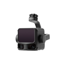
DJI Zenmuse L3 LiDAR
The DJI Zenmuse L3 is not just a simple performance upgrade. It improves range and accuracy, uses a dual 100-megapixel camera system to simultaneously acquire visible light data, and combines an intelligent gimbal, high-precision positioning, and end-to-end processing software to provide a complete solution from data acquisition and processing to application. It is an industry-application-level product that truly integrates hardware performance, software ecosystem, and user experience in the professional surveying and mapping field.
More
-
-
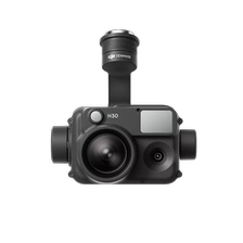
DJI Zenmuse H30
On May 16, 2024, DJI released the Zenmuse H30 series, a flagship all-weather multi-light payload. It includes two models: the H30 and H30T. The H30 integrates four modules: a wide-angle camera, a zoom camera, a laser rangefinder, and a near-infrared illuminator. The H30T adds an infrared thermal imaging module, comprehensively enhancing perception and imaging capabilities and overcoming the limitations of day and night vision. The H30 series, mounted on a flight platform, can be easily applied to various industries such as public safety, emergency rescue, and energy and power, making it DJI's most integrated and highest-performing multi-light flagship payload to date.
The all-new Zenmuse H30 series, a flagship multi-beam payload, is a highly integrated product that integrates sensors required by security, fire protection, and inspection users, offering a comprehensive upgrade in performance and user experience. It also boasts numerous independently developed technologies across modules such as optics, hardware structure, algorithms, and manufacturing processes, ensuring maximum performance within its compact and precise design. DJI will continue to address the pain points of industry users, drive product efficiency innovation, and provide industry customers with convenient, efficient, safe, reliable, and cost-effective technologies and services, enabling drone technology to play a greater role in various fields.
More
-
-
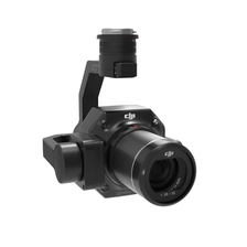
DJI Zenmuse P1
Zenmuse P1
A New Benchmark for Full-Frame Aerial Surveying.
The DJI P1 integrates a full-frame image sensor with a 3-axis gimbal and supports multiple prime lenses, creating a high-performance, versatile aerial surveying payload. When paired with the Matrice 300 RTK and DJI Terra software, it delivers a high-precision, high-efficiency, and integrated aerial surveying solution, setting a new benchmark in the field.
More
-

-
Original high-resolution panchromatic band multispectral Micasense camera Rededge-P
RedEdge-P: Capture data more quickly during the seasonSingle Camera Solution for Adjusted High-Resolution Synchronous Capture Efficient multispectral and RGB images with optimized FOV and capture rates. flight.More
-
-
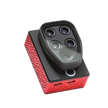
Parrot SEQUOIA+ Unmanned Aircraft Systems multispectral sensor for agricultural drone camera
The Parrot Sequoia+ multispectral sensor is revolutionising the sector, offering a comprehensive, adaptable solution that is compatible with all types of drones. With its two sensors, multispectral and sunshine, Parrot Sequoia+ analyses plants' vitality by capturing the amount of light they absorb and reflect. Collecting this data means that farmers can do what's best for their fields.
More
-
-
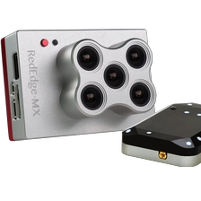
MicaSense Sensor RedEdge-MX Multispectral Camera For UAV Mapping Drone
The RedEdge-MX is a rugged, professionalmultispectral sensor designed for field-scaleprecision agriculture and environmentalmonitoring.
The modular payload captures ffve spectral bands in a single ffight, delivering reliable data for analysis and actionable insights.
A rugged, built-to-last, professional multispectral sensor for agriculturaldrone mapping. Captures five spectral bands, and is one of the mostflexible solutions on the market.More
-
-
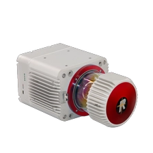
PJ-2000R Powered by RIEGL, Premium Performance
PJ-2000R is a long-range and high-precision airborne LiDAR scanning systemindependently developed by Geosun Navigation. It highly integrates a mechanical laserscanner, a GNSS satellite positioning system, and an INS inertial navigation system. Thisallows it to rapidly acquire high-precision LiDAR point cloud data and can be widelyapplied in industries such as surveying and mapping, land and resources, transportation,power, and digital cities.
More
-
-
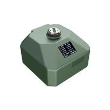
HIGH-PERFORMANCE FIVE-LENS TILT PHOTOGRAPHY CAMERA PY505
With a total resolution of 3.05 million pixels, the camera integrates five 61-megapixel full-frame ExmorRCMOS back-illuminated image sensors. Equipped with a high-performance AI motherboard, it excels in heat dissipation, data communication, system integration, and data transmission. It is compatible with mainstream Multirotor and Fixed-wing UAV on the market.
More
-
-
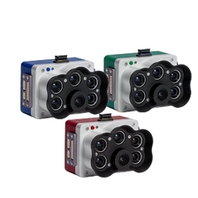
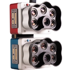
5-Band Multispectral High-Res RGB Drone Camera Rededge-P for Precision Agriculture
The Micasense Altum-PT is an advanced multispectral and thermal imaging sensor designed for precision agriculture and remote sensing applications. The combination of high-resolution multispectral and thermal images provides detailed insight into crop health, vegetation index, and biophysical parameters. Ideal for drone integration, Altum-PT enables efficient data collection and analysis for informed decision-making in agriculture and environmental surveillance. You can capture both thermal and multispectral data at the same time. This sensor is a powerful tool to improve agricultural productivity and sustainability.
More
-
-
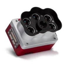
Multispectral Micasense Camera Rededge-P
The RedEdge-P, part of the MicaSense Series, sets a new standard for multispectral imaging with its focus on data quality, repeatability, and high resolution. It combines purpose-built optics, industrial-grade image sensors, and scientific narrowband filters, complemented by a rigorous factory calibration process to ensure reliable pan-sharpened outputs.
More
-
-
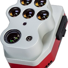
Micasense Multispectral Camera Altum-PT
The Altum-PT is an advanced imaging sensor that integrates synchronized high-resolution RGB, thermal, and multispectral capabilities, designed to deliver accurate, leaf-level remote sensing data. Equipped with a CF express storage card supporting a capture rate of 2 images per second. The sensor excels in applications such as irrigation scheduling, plant disease detection, plant phenotyping, fruit yield estimation, and irrigation system inspection, providing actionable insights through high-detail imagery that discerns issues even at early growth stages.
More
