


- Browse Categories
- YQFH Drone
- DJI Drone
- Other Drone
- Drone Payloads
- Robot
- Pipeline Detection Instrument
- 3D Laser Scanner
- Industrial Measurement Devices
- Weather Station Series
- Optical Survey Instruments
- GNSS RTK & CORS System
- BDS System Products
- Visual Displacement Monitoring System
- UWB Indoor Positioning System
- Hydrology Products
- Others
- Spectrometer
- Wet Blast Machine
- SDI Soil Tester
- Pengjin Smart Flying Drone Patrol and Inspection System
- Supercomputing
- Module
- Viscometer
- Electric Hygro-thermograph
- Echo Sounder
- Processing Software
- Keson Measuring Tools
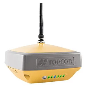
| Hyper VR |
A variety of performances
Better things in smaller packages!
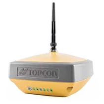
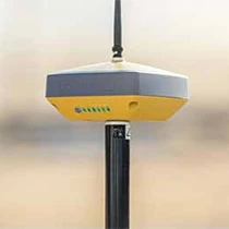
Made in Japan Topcon GNSS RTK GPS Hyper VR: HyperVR* is compact and lightweight, and incorporates cutting-edge GNSS technology designed to withstand the harshest field environments. Using Topcon's advanced GNSS chipset and universal tracking channel technology, HyperVR automatically tracks all satellite signals above, both now and in the future.
All signals, every satellite, every constellations are realized in a compact, robust design with integrated IMU and eCompass.
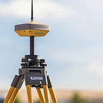
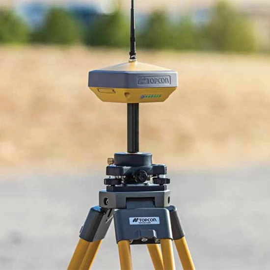
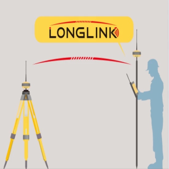
HiPer VR is a complete solution and is versatile in many ways. It can be used for static or kinematic GNSS post-processing investigations as a network RTK rover with an internal 4G/LTE mobile phone on the FC-5000. Can be used as a modem, UHF/FH/Longlink Worksite RTK Rover, and also in Topcon's patented hybrid positioning workflows.
|
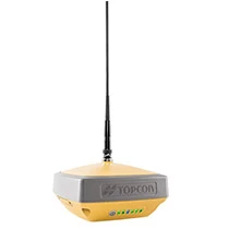
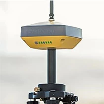
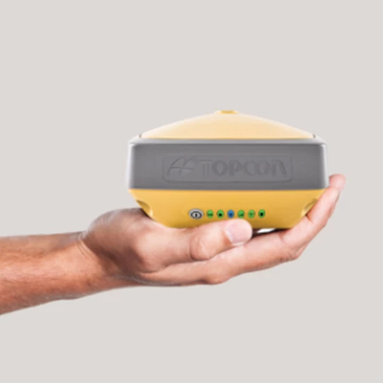
Better things in smaller packages The HiPer VR is smaller and lighter, but don't be fooled by how small it is. It's not just packed with most features. Advanced GNSS technology. It is also made to withstand the harshest on-site environments. Sturdy build Housing - not weak plastic - can be subject to harsh treatment on-site. Using Topcon's advanced GNSS chipset Universal Tracking Channels technology allows the receiver to automatically track all satellite signals. Top - To the present and the future. All signals, all satellites, all constellations - all in a compact and robust design, Integrated IMU and eCompass |
 |
 |
Complete and cutting edge performance ● "M" universal tracking channel for all satellites, signals and constellations Field-tested, field-compatible IP67 design ●Compact form factor ideal for millimeter-wave GPS and hybrid positioning ●Innovative 9-axis IMU and ultra-compact 3-axis eCompass |
|
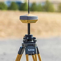
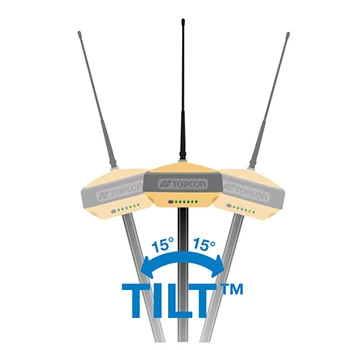
TILT" - Topcon Integrated Leveling Technology The HiPer VR incorporates an innovative nine-axis moment of inertia. Unit of measurement (IMLU) and ultra-compact 3-axis e-compass. This advanced technology Compensate for Miss- Field measurements are equally out of vertical As 15 Shots are difficult to take on steep slopes or areas where shooting is difficult. arrival TILT makes spots easier to find. |
 |
| specification |
| GNSS Tracking | |
| Number of channels | The 226 comes with Topcon's patented Universal Tracking Channels™ technology. |
| signal | |
| GPS signal | L1 C/A, L1C*, L2C, L2P(Y), L5, (*L1C if signal is available) |
| Gronus | L1 C/A, L1P, L2C/A, L2P, L3C* (L3C if signal is available) |
| Galileo | E1/E5a/E5b/Alt-BOC |
| Hokuto/BDS | B1, B2 |
| IRNSS | L5 |
| SBAS | WAAS, EGNOS, MSAS, GAGAN (L1/L5§) (L5 if signal is available) |
| L band | TopNET Global D&C Correction Service |
| Quasi-Zenith Satellite | L1 C/A, L1C, L1-SAIF, L2C, L5 |
| Positioning performance | |
| Fast Static (L1L2) | Height: 3mm0.4ppm V: 5mm 0.5ppm |
| RTK (L1L2) | Height: 5mm0.5ppm V: 10mm 0.8ppm |
| Compensator tilt sensor* | H: 1.3 mm/° tilt; tilt ≤ 10° H: 1.8 mm/°Tilt;Tilt > 10° |
| DGPS | 0.25mHRMS |
| Power and electricity | |
| Uptime | RX Mode - 10 hours TX mode 1W to 6 hours |
| General | |
| wireless | 405-470 MHz UHF Radio Maximum Transmission Power: 1W range: Usually 5-7km. 15km |
| memory | Internal non-removable 8 GB SDHC |
| Physical and environmental | |
| Intrusion protection | IP67 |
| Operating temperature | -40℃ to 65℃ |
| Humidity | 100%, condensed |
| Drop test | It fell from a height of 1.0m to concrete. Falls from a 2.0m pole onto concrete. |
| size | 150 x 100 x 150 mm (Width x Height x Depth) |
| Weight | Less than 1.15kg |
| Why choose Hyper VR? |
|
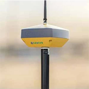
• Engineering GNSS receiver Sturdy and affordable |
• Multifunctional, small and lightweight Weight less than 1150g |
• Various communication modes Built-in radio, Cors, LongLINK |
||
 |
 |
 |
| Product Scenario Applications |
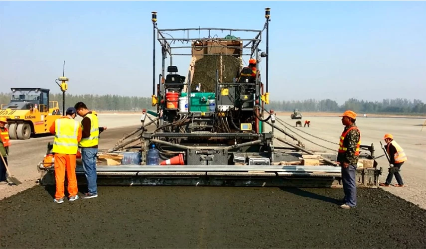
1. Civil Engineering Uses

2. Street tests and stling
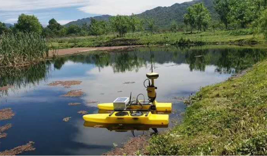
3. Water measurement
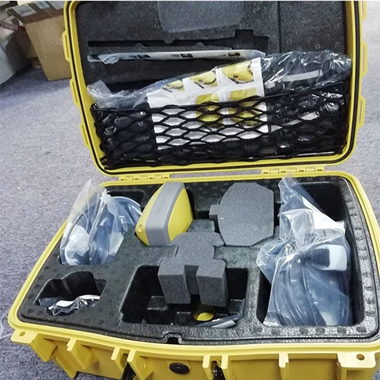
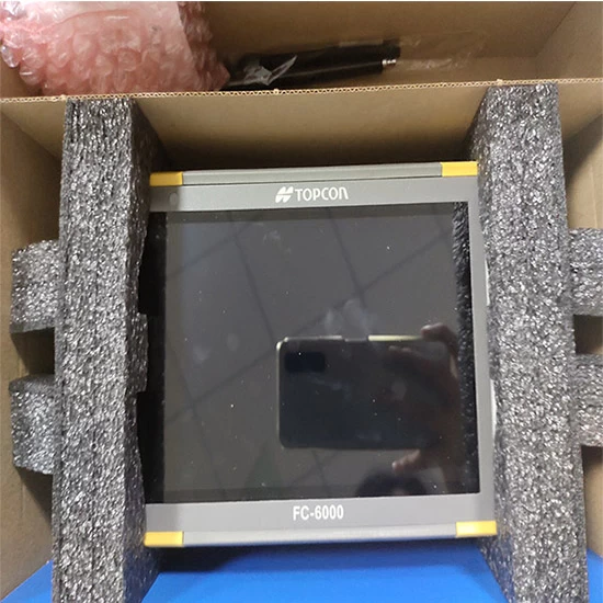
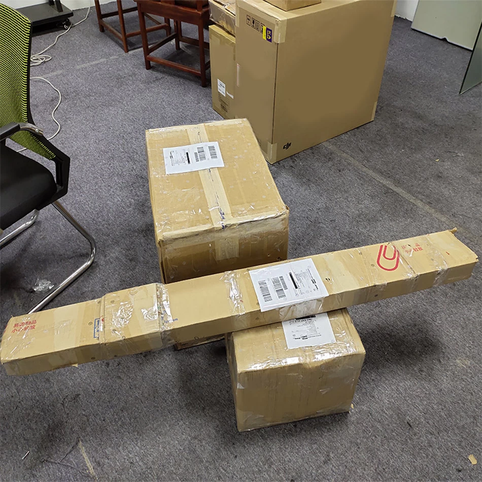
| Packaging and shipping |
 |
 |

- Other Products


