


- Browse Categories
- YQFH Drone
- DJI Drone
- Other Drone
- Drone Payloads
- Robot
- Pipeline Detection Instrument
- 3D Laser Scanner
- Industrial Measurement Devices
- Weather Station Series
- Optical Survey Instruments
- GNSS RTK & CORS System
- BDS System Products
- Visual Displacement Monitoring System
- UWB Indoor Positioning System
- Hydrology Products
- Others
- Spectrometer
- Wet Blast Machine
- SDI Soil Tester
- Pengjin Smart Flying Drone Patrol and Inspection System
- Supercomputing
- Module
- Viscometer
- Electric Hygro-thermograph
- Echo Sounder
- Processing Software
- Keson Measuring Tools
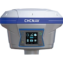
Low-cost surveying machine CHC I90 PROGNSS GPS RTK
- Brand name: CHC
- Model name: I90 Pro
- Origin: China
- Warranty period: 1 year
- Support Express: Shipping, Airmail
High Performance IMU RTK GNSS Receiver CHC i90 Pro RTK GNSS
 |
The i90 Pro GNSS receiver combines the latest CHCNAV IMU-RTK technology with compatibility with L-BAND correction services to extend RTK positioning anywhere.
Unlike standard MEMS-based GNSS receivers, the i90 Pro GNSS IMU-RTK combines a state-of-the-art GNSS RTK engine, high-end calibration-free IMU sensors, and advanced GNSS tracking capabilities to provide RTK availability and reliability. It greatly improves sexuality.
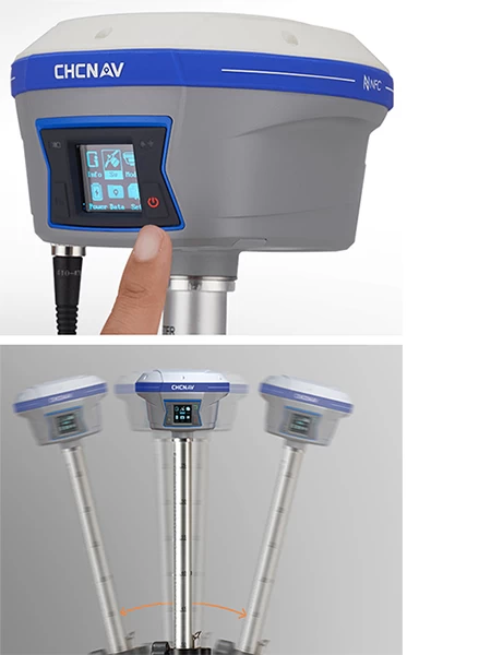
i90 automatic pole tilt correction increases surveying and piling speeds by up to 20%. Construction and land surveying projects are realized with high productivity and reliability that pushes the limits of traditional GNSS RTK surveying.
Details of CHC i90 Pro
|
|
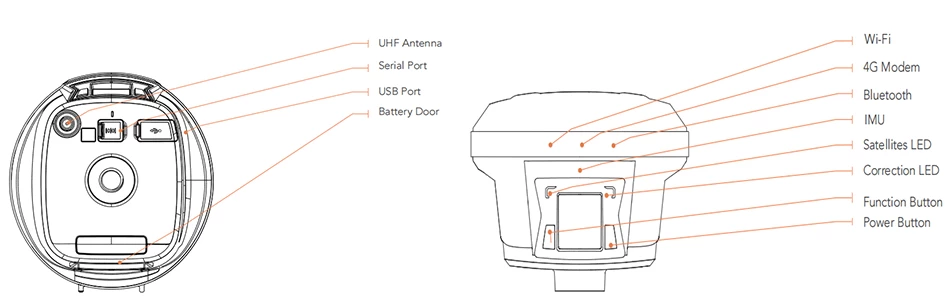
Tracking multiple constellations Combine GPS, Gronus, Galileo, and Hokuto Powered by a 336-channel GNSS core engine, the i90 Pro offers robust and reliable RTK positioning for any surveying project or positioning application. L-band PPP modification Supports L-band and RTX™ correction signals Connected to a third-party L-band correction service, the i90 Pro GNSS offers accurate positioning below decimeter in almost any region where RTK networks, GSM coverage, or traditional GNSS base stations are not available. Extended connectivity Instant NFC Pairing for Controllers The i90 Pro GNSS combines high-end connectivity modules such as Bluetooth, Wifi, NFC, 4G, and UHF wireless modems. 4G modems provide ease of use when working within an RTK network. Built-in UHF radio modem allows long-range surveys from bases up to 5km to spacecraft High accuracy. Anywhere Increases investigation and piling speed by up to 30% The i90 GNSS integrated IMU guarantees real-time automatic polar tilt compensation without interference. Accuracy of 3 cm is achieved over a pole tilt range of up to 30 degrees. |
 |
CHC i90 Pro Specification
|
| GNSS Performance | |
| channel | 336 ossuary |
| GPS | L1C, L1CIA, L2E, L2C, L5 |
| GLONASS | L1C/A, L2 CIA, L3 CDMA |
| Galileo | E1, E5a,E5b, E5AltBOC, E6 |
| BeiDou | B1, B2, B3 |
| SBAS | L1C/A, L5 |
| Quasi-Zenith Satellite | L1 CIA, L1 SAIF, L2C, L5, LEX |
| lRNSS | L5 |
| L-BAND | RTX |
|
GNSS Accuracy
|
|
| Real-Time Kinematics (RTK) | Horizontal: 8 mm 1 ppm RMS Vertical: 15 mm 1 ppm RMS Initialization time: < 10 seconds Initialization reliability: > 99.9% |
| Post-processing kinematics (PPK) | Horizontal: 2.5 mm1 ppm RMS Vertical: 5mm 1 ppm RMS |
| Post-processing static | Horizontal: 2.5 mm0.5 ppm RMS Vertical: 5mm0.5 ppm RMS |
| Code Difference | Horizontal: 0.25m RMS |
| Autonomous | Horizontal: 1 m RM Vertical: 1.5 m RMS |
| Positioning speed Time until first correction 3) RTK Tilt Compensation |
Up to 50Hz Cold Start: <45 seconds Hot Start: < 10 seconds Signal reacquisition: < 1 second |
| Hardware | |
| Size (Length x Width x Height) | 159mm x 150mm x 110mm (6.3" x 5.9" x 4.3") |
| Weight | 1.26kg (2.77lbs) |
| environment | Operating: -40°C to 65°C (-40°F to 149°F) Storage: -40 °C to 85 °C (-40 °F to 185 °F) |
| Humidity | 1 |
| Intrusion protection | IP67 waterproof and dustproof, protection From temporary submersion to 1m deep |
| shock | Survive from falling from a 2-meter pole |
| Lilt Sensor | Ultra-slope compensation with no calibration required lMU. Resistance to magnetic disturbances. E-Bubble Leveling |
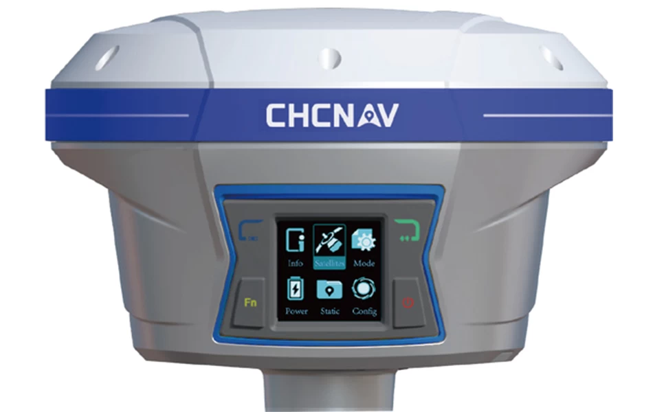
| Front panel | 4 Status LED 1.46 inch OLED display |
| certification | |
| FCC Part 15 (Class B Devices), FCC Part 22, 24, 90, CE Mark, NGS antenna calibration; |
|
| communication | |
| Network Modem | Integrated 4G modem LTE(FDD): B1, B2, B3, B4, B5, B7, B8, B20DC-HSPA/HSPA/HSPA/UMTS: B1, B2, B5, B8EDGE/GPRS/GSM 850/900/1800/1900 MHz |
| Wi-Fi | 802.11 b/g/n, access point mode |
| BluetoothR | v4.1 |
| port | 1x 7-pin LEMO port (external power supply, RS-232) 1x USB Type-C port (data download, firmware update) 1x UHF antenna port (TNC female) |
| UHF Radio | Standard internal Rx/Tx: 410 MHz to 470 MHz Transmit power: 0.5 W to 2 W Protocol: CHC, Transparent, TT450 Link rate: 9600 bps to 19200 bps Range: 5 km under optimal conditions |
| Data format | RTCM 2.x, RTCM 3.x, CMR, CMR, SCMRX I/O HCN, HRC, RINEX2.11, 3.02 NMEA 0183 Output NTRIP client, NTRIP caster |
| Data Storage | 32GB internal memory |
| electricity | |
| Power consumption | 5 W (depending on user settings) |
| Lithium-ion battery capacity | 2x3400mAh, 7.4V |

