


- Browse Categories
- Self-Developed Drone
- UAV from Represented Brands
- Robot
- Spectrometer
- Mechanical measurement device
- PJK Brand Monitoring System
- Optical Survey Instruments
- RTK GNSS Systems
- Pipeline Detector/ Locator & GPR
- Unmanned Aerial Vehicle Payload
- Thermal Camera
- 3D Laser Scanner
- Wet Blast Machine
- Measuring instrument Plainmeter
- Weather Station Series
- SDI Soil Tester
- Pengjin Smart Flying Drone Patrol and Inspection System
- Supercomputing
- USV
- Module
- Viscometer
- Electric Hygro-thermograph
- Echo Sounder
- Processing Software
- Keson Measuring Tools

AI Intelligent Recognition of Ground Features Makes Surveying Easier
The AI intelligent recognition function of ground features integrates field surveying, ground feature recognition, electronic sketching, and indoor mapping in mapping work.
Field measurement
Image measurement, survey while walking.
No waiting, higher efficiency.
More pleasant field surveying.
Ground Feature Recognition
Automatically match standard ground feature codes.
Automatically obtain ground feature coordinates.
No need to memorize ground feature codes, saving time and effort.
All-weather AR visual staking out, no waiting for measurement.
Professional imaging algorithm, no fear of strong light or dim light.
The professional AR image processing algorithm can clearly display images whether in strong light during the day or dim light at night, avoiding the situation where images are too bright or too dark to be seen clearly. It enables all-weather operations and ensures the progress of urgent projects.
AR real - scene navigation, guiding stakeout.
Through the arrows displayed in AR images, the direction of the stakeout point is guided, making point finding convenient and fast.
Image stakeout, one - rod in place.
By directly marking the stakeout point on the ground through images, there is no need to move back and forth for confirmation, and the stakeout can be completed with one rod.
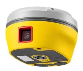
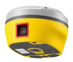
Seamless Self - Calibrating Inertial Navigation, Measure Upon Arrival
Measure Upon Arrival, No Need for Leveling
There's no need to specially calibrate the bubble. You can measure as soon as you arrive at the point, which is efficient and fast.
IMU Module, Stable and Reliable
High - precision IMU module, stable and not easy to exit, with reliable precision.
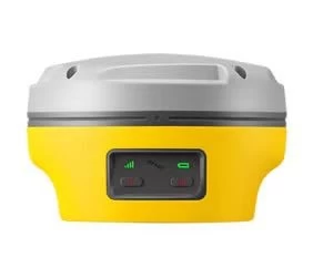
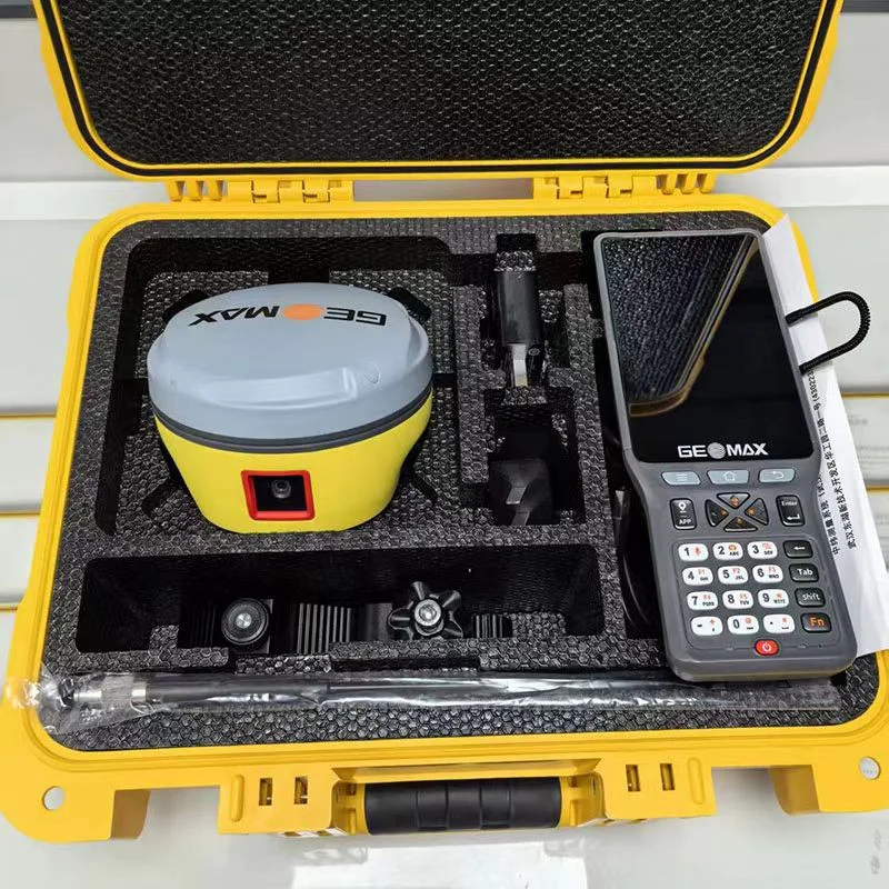
Product Specification
| Item | ZG30 AI |
| static accuracy | Horizontal: ±2.5mm+0.5ppm; Elevation: ±5mm+0.5ppm |
| RTK Accuracy | Horizontal: ±1.8mm+1ppm; Elevation: ±15mm+1ppm |
| Inertial Navigation System (IMU) Update Rate | 400Hz |
| Tilt Angle | 0 - 60° |
| Tilt Measurement Accuracy | 8mm+0.3mm/° tilt |
| Measurement Accuracy | 2 - 3cm |
| Measurement Distance | 2 - 15m |
| Shooting Frame Rate | 25Hz |
| AI Ground Recognition | Supported |
| AI Cloud Point Generation | Automatically generate cloud points, AI automatically identifies cloud point features, encoding and coordinates |
| Single Measurement Time | Not less than 5min |
| Operating Temperature | -40℃ - +65℃ |
| Storage Temperature | -40℃ - +80℃ |
| Size | Φ129mm×185mm |
| Weight | 0.88kg |
| Battery Capacity | 6800mAh non - removable lithium battery |
| Working Hours | 15h |
Tel:+8613828792860
Wechat:PJK13828792860
Contact Person:Janet luo

- Other Products


