


- Browse Categories
- YQFH Drone
- DJI Drone
- Other Drone
- Drone Payloads
- Robot
- Pipeline Detection Instrument
- 3D Laser Scanner
- Industrial Measurement Devices
- Weather Station Series
- Optical Survey Instruments
- GNSS RTK & CORS System
- BDS System Products
- Visual Displacement Monitoring System
- UWB Indoor Positioning System
- Hydrology Products
- Others
- Spectrometer
- Wet Blast Machine
- SDI Soil Tester
- Pengjin Smart Flying Drone Patrol and Inspection System
- Supercomputing
- Module
- Viscometer
- Electric Hygro-thermograph
- Echo Sounder
- Processing Software
- Keson Measuring Tools
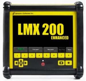
LMX200™ Utility Location Device
- Brand name: Radio Detection
- Model name: LMX200™
- Origin: UK
- Warranty period: 1 year
- Support Express: Shipping, Airmail
Underground radar LMX200 Utility Location Device
Make radar positioning more convenient
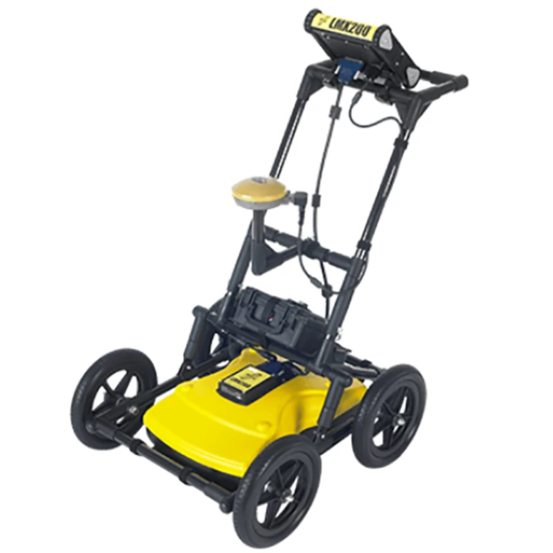
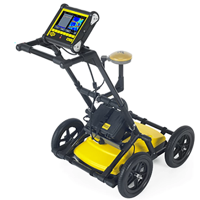

The LMX200™ is the leading underground radar (GPR) utility location device currently on the market.
The LMX200™ provides unprecedented insights and target reliability to detect underground features such as previously undiscovered:
► Non-metallic pipes containing PVC and asbestos cement
► Underground wire
► Concrete stormwater pipes and sewer systems
► Utility that failed tracer wiring installed
► Underground storage tanks and drainage tiles
► Septic tank system components
► Non-purpose structures such as safes, foundation walls, concrete pads and other
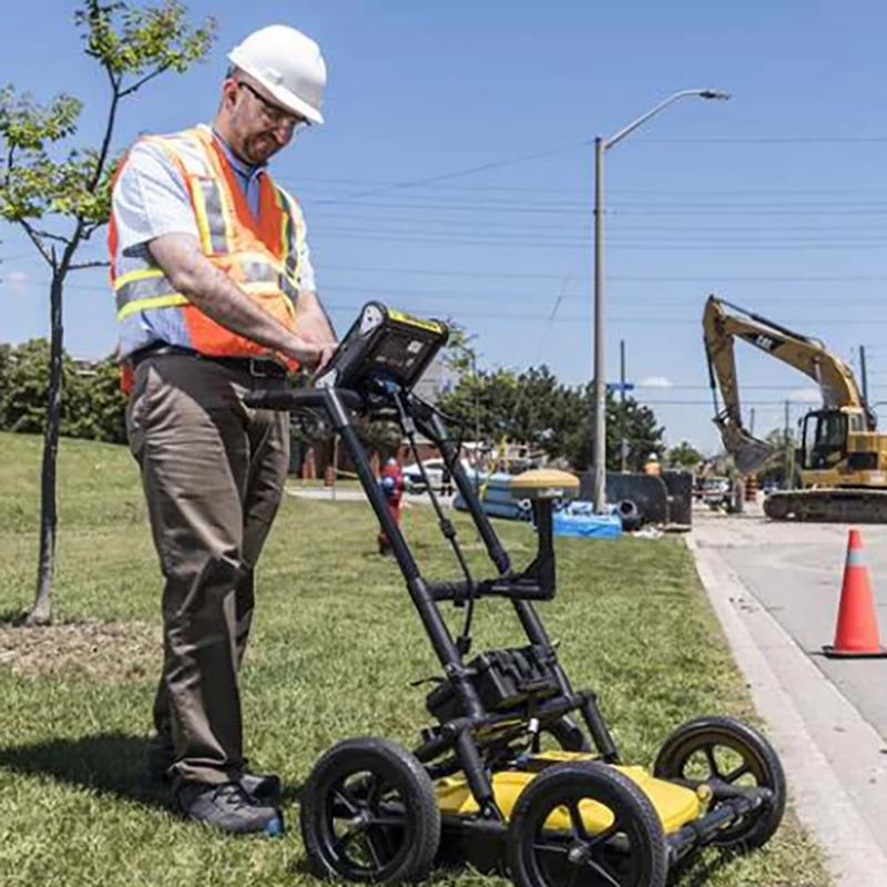
Public Works systems and local governments need to locate and mark underground systems. This will help you plan your project and avoid risks and dangers. The LMX200™ ise LMX100™ offers more features to help you search and map these utilities. It adds powerful grid scan mode and the ability to make the most of Split View and MapView using an external GPS. The LMX200™ also allows data export for post-processing, archive, reference, and further mapping features in EKKO_Project™
LMX200™ Features
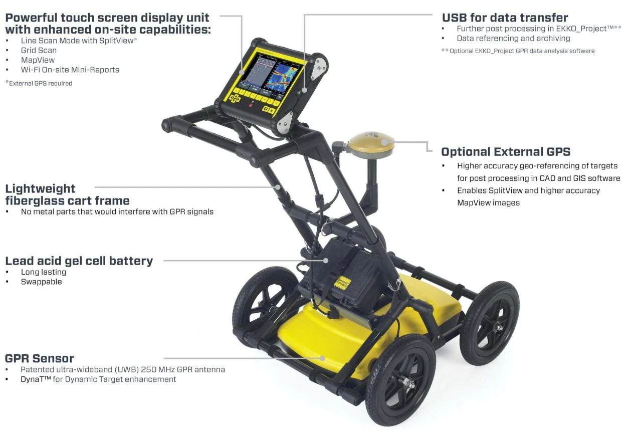
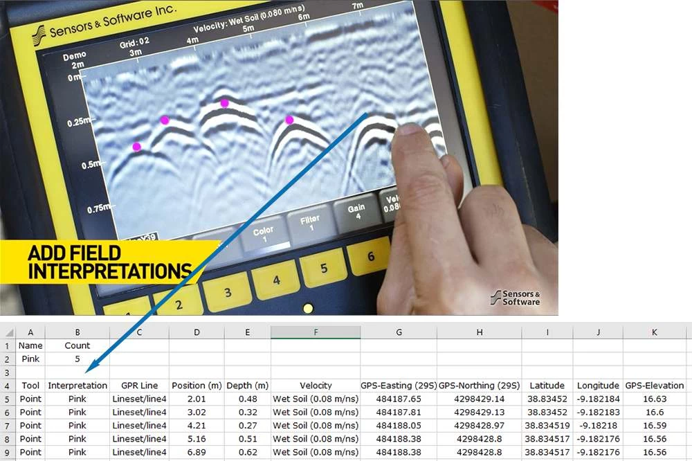
Field visualization function
interpretation
Classify targets in real time by field interpretation. Simply touch the screen and select from a variety of color-coded options.
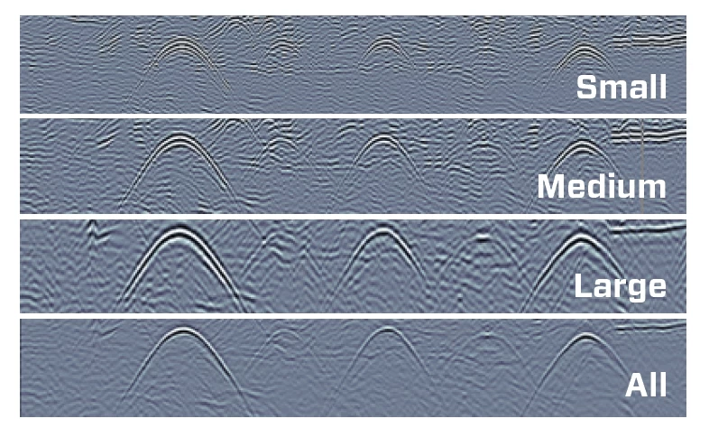
Dynamic Target Enhancement (DynaT™)
Dyna T™
DynaT™ is our patented dynamic target extension that optimizes display of small, medium and large targets. Toggling these views will display additional underground features, providing unprecedented insights and target reliability in the field.
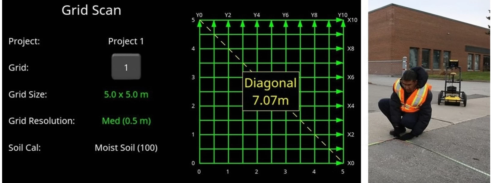
Grid Scan Mode
Simple grid settings and guided grid collection on the display
Choose from four standard grid sizes. The system guides you through the setup and collection of the grid.
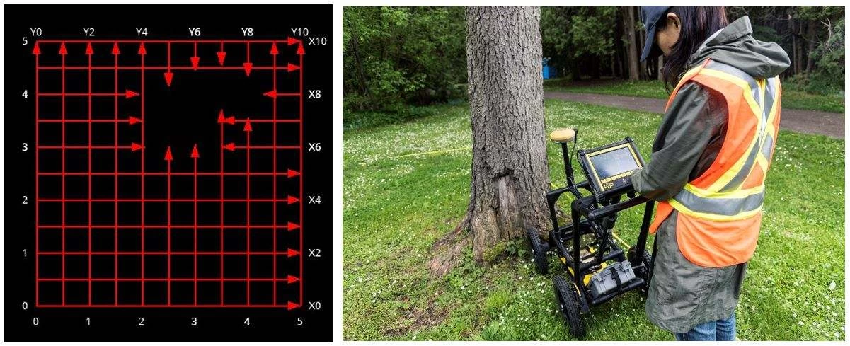
Flexible grid line collection with added obstacle avoidance
The system guides you to collect grids around obstacles. You can also collect strangely shaped grids by simply finishing a line shorter or skipping a line completely.
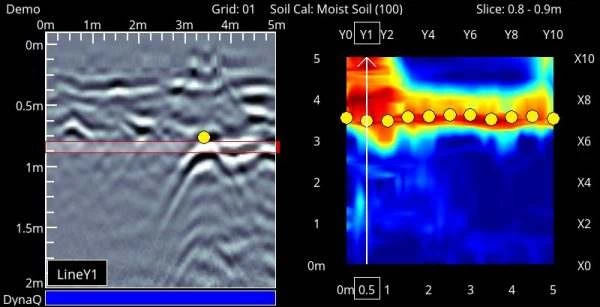
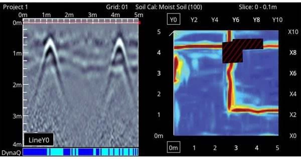
Slice View
A simple touch of a button will generate depth slices from both the complete and incomplete grids in the field.

View, save and share collected grids in fields
Displays the interpretations of grid lines, flags, or fields collected along with the depth slice image on the right. You can then associate the interpretation with the depth slice image at a glance.
Additional features with external GPS
SplitView
It combines the benefits of LineView and MapView into one screen. The MapView side of the screen displays all the collected GPR data and where the LMX200™ is currently located within the survey area. Meanwhile, the LineView side displays cross-section data, allowing you to quickly check the spatial relationships between targets and determine whether the series is correct. The hyperbola is a straight line.
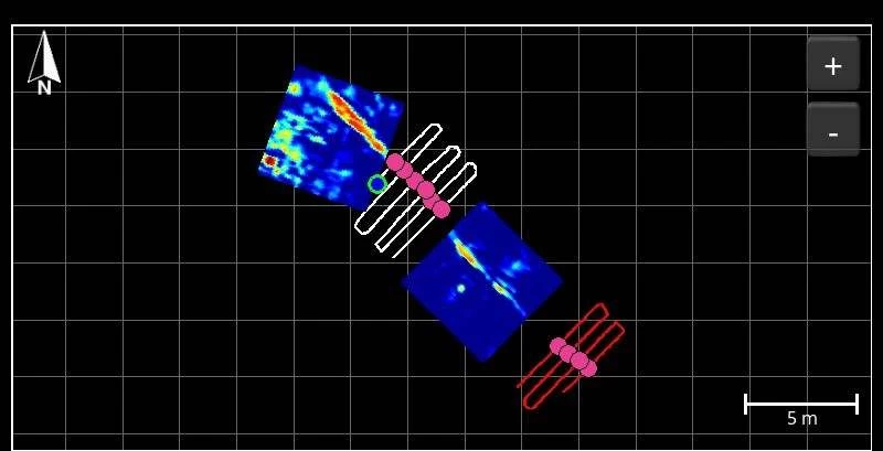
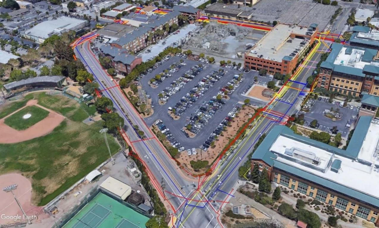
Map view display
View a powerful and meaningful bird's-eye view of your site map, including survey paths, depth slices, field interpretations, flags, and collected lines.
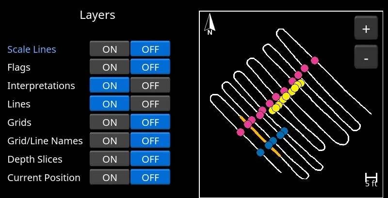
Map View Layer
Turn multiple layers on and off to optimize views, generate more complete images of the entire site, and capture screenshots to enhance reports directly from the display unit.
Various data export possibilities
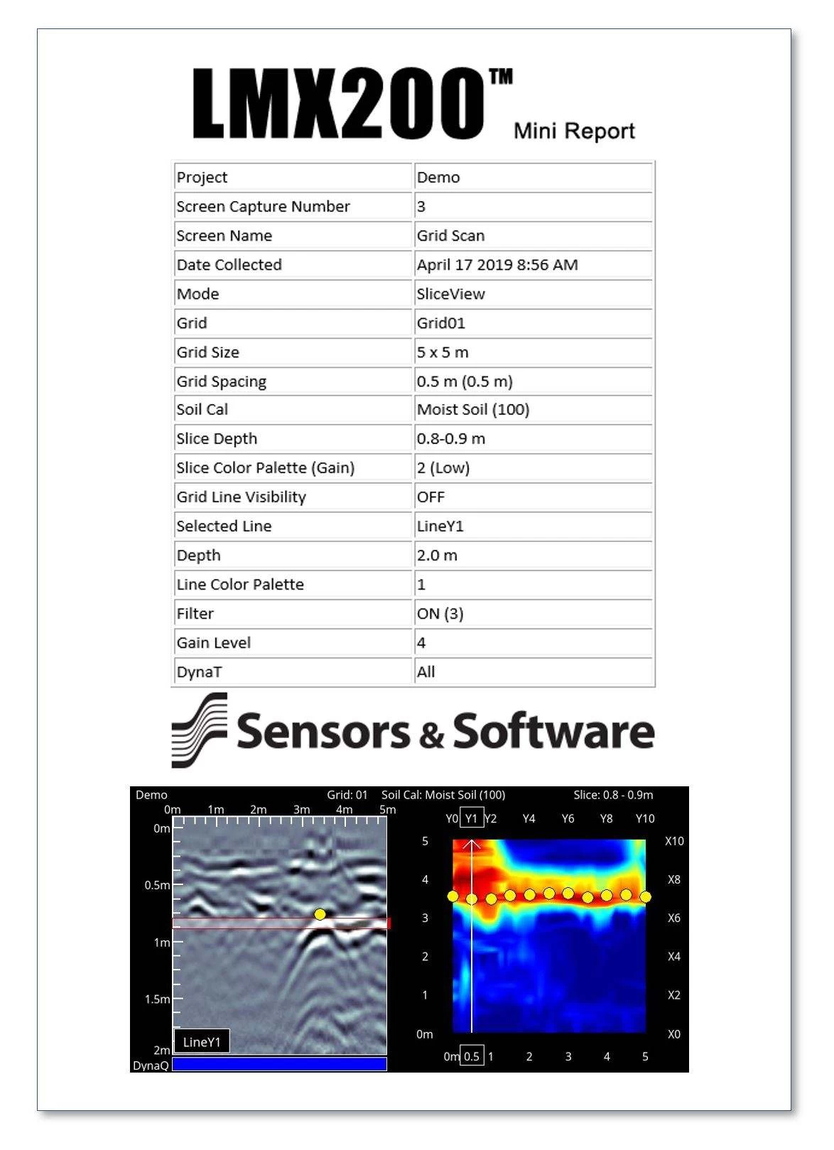
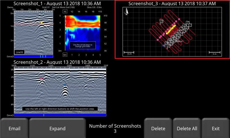
Easily view and share screenshots captured with Wi-Fi Mini Report
The Screenshot Gallery displays a tile view of the saved screen by pressing the camera button. Select a screenshot and send it via email as a mini report.
Quickly share survey results directly from the field
Creates instant reports from the display unit that contain screen captures of lines, grids, and MapView information.
Field Interpretation File (.CSV)
Interpretation information added in the field is automatically saved in a CSV file that contains depth, location, and GPS coordinates.
Google Earth™ Files (.KMZ)
Survey paths and field interpretations are automatically exported to a.KMZ file for viewing in Google Earth™. Generate an attractive public facility map by plotting interpretations on GIS or aerial images and connecting them to view the public facility routes.


