


- Browse Categories
- YQFH Drone
- DJI Drone
- Other Drone
- Drone Payloads
- Robot
- Pipeline Detection Instrument
- 3D Laser Scanner
- Industrial Measurement Devices
- Weather Station Series
- Optical Survey Instruments
- GNSS RTK & CORS System
- BDS System Products
- Visual Displacement Monitoring System
- UWB Indoor Positioning System
- Hydrology Products
- Others
- Spectrometer
- Wet Blast Machine
- SDI Soil Tester
- Pengjin Smart Flying Drone Patrol and Inspection System
- Supercomputing
- Module
- Viscometer
- Electric Hygro-thermograph
- Echo Sounder
- Processing Software
- Keson Measuring Tools
CCH-M8 PRO efficient aerial survey is a good assistant
- Brand name: YFMFLY
- Model name: CCH-M8 Pro
- Place of origin: China
- Warranty period: 1 year
- Support express: sea mail, air mail
CCH-M8 Pro EfficienT aerial survey is a good assistant
Long battery life of over 190 minutes! CCH-M8 PRO Drone Earns 100 Billion Mapping Profits
Prologue:
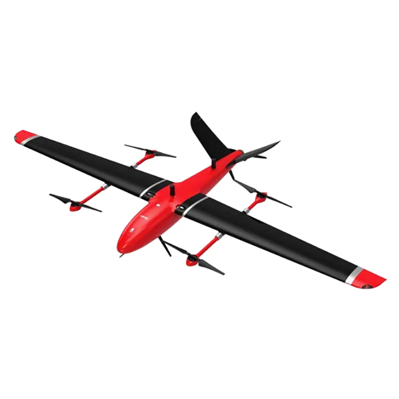
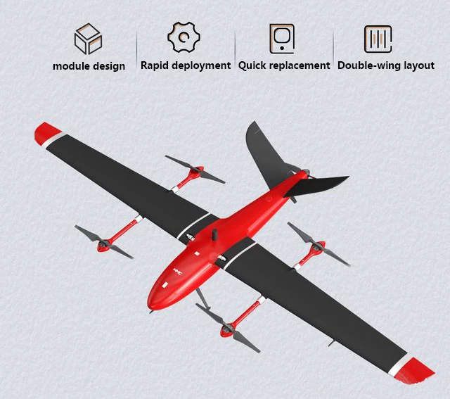
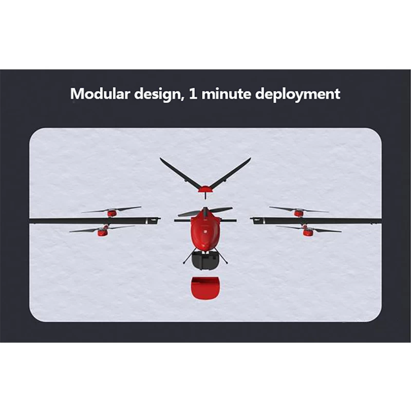
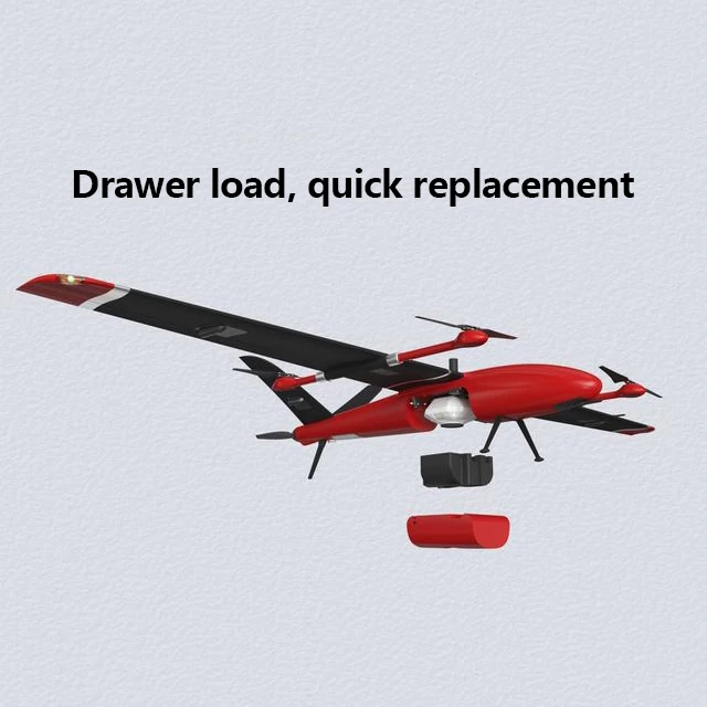
CCH-M8 Pro is the second generation model of M8, a new mapping product launched for the high-precision aerial survey market, with higher durability, more reliable flight performance, and higher flight accuracy.With a maximum take-off weight of 7.5 kg, the main body components are modular in design and can be quickly deployed within a minute, providing a better product experience than the first generation M8. Independent drawer-type loading bin design, quick replacement, users can flexibly choose front-facing or tilting camera according to operating requirements.
application:
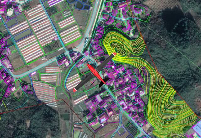
Surveying and mapping are widely used in economic and national defense construction. Urban and rural construction planning work requires carrying out land and resource utilization, environmental protection, address surveying and mineral development, land surveying and the production of various maps for use in planning and management. In recent years, the surveying and mapping service industry has further developed. According to data, the market size of China's mapping geographic information industry will increase from 83.7 billion yuan in 2015 to 184.5 billion yuan in 2021, and the market size of surveying and mapping geographic information industry will exceed 200 billion yuan in 2022. is expected to reach.
With the continuous maturation of core technology, the technology, equipment and performance of surveying and mapping UAV will gradually improve, the application in the field of surveying and mapping will become deeper and deeper, and the market size will experience rapid growth. It maintains and also shows diverse trends and benefits in applications. It can be widely used in the construction of national major projects, disaster first aid and treatment, land supervision, resource development, new rural and small town construction, etc., especially basic surveying and mapping, land resource survey and monitoring, land There are wide prospects for dynamic monitoring of usage, acquisition of surveying and mapping data for digital city construction and emergency disaster relief.
Product features :
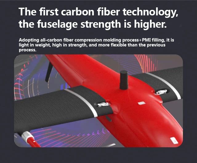
• The fuselage is made of carbon fiber composite material, ensuring the strength of the fuselage structure while minimizing the weight of the fuselage.
• In multirotor mode, fully autonomous one-key vertical takeoff and landing is not restricted to takeoff and landing locations, and independently switches fixed-wing flight after takeoff.
• Can be combined with high-reliability shooting, tilt cameras, zoom lenses and other solutions to meet the needs of different scenarios.
• Vertical takeoff and landing and horizontal flight use two sets of independent power supplies, and the maximum range is 200km, avoiding the risk of fixed wing endurance shortfall and reduced landing force, and ensuring operational durability.
• Support for RTK precision takeoff and landing and PPK mode. .
T Technical parameters :
|
wing type |
Composite wing(41) |
|
Takeoff and landing mode |
VTOL |
|
Body size |
2500mm/1486mm |
|
empty weight |
4.5kg (excluding battery mount) |
|
packing measurement |
1200*420*300mm |
|
maximum takeoff weight |
7.5kg |
|
maximum load |
1kg |
|
cruising speed |
75km/s(21m/s) |
|
ultimate run |
170-210km (Load: Sony A7RII camera - -170km) |
|
Maximum control radius |
15km |
|
cell |
25,000 mAh 6s 1 piece |
|
Maximum battery life without load |
190 minutes |
|
full range time |
150 minutes (using Sony A7r2 camera) |
|
sea level rise rate |
5m/sec |
|
altitude limit |
4500m (±500m) |
|
wind resistance |
level 6 |
|
working temperature |
-10~60℃ |
|
Dustproof/waterproof level |
IP54 protection against light rain |
|
material quality |
composite carbon fiber |
|
standard orthogonal camera |
Sony α7r240mm |
If you are interested in this product, please feel free to contact us.

- Other Products


