







- Browse Categories
- YQFH Drone
- DJI Drone
- Other Drone
- Drone Payloads
- Robot
- Pipeline Detection Instrument
- 3D Laser Scanner
- Industrial Measurement Devices
- Weather Station Series
- Optical Survey Instruments
- GNSS RTK & CORS System
- BDS System Products
- Visual Displacement Monitoring System
- UWB Indoor Positioning System
- Hydrology Products
- Others
- Spectrometer
- Wet Blast Machine
- SDI Soil Tester
- Pengjin Smart Flying Drone Patrol and Inspection System
- Supercomputing
- Module
- Viscometer
- Electric Hygro-thermograph
- Echo Sounder
- Processing Software
- Keson Measuring Tools
3D laser scanner
3D Laser Scanner
-
-
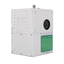
PJ-100C+ Your First UAV LiDAR Scanning System
PJ-100C+ is an entry-level, short-range detection Aerial LiDAR solutionindependently developed by Geosun Navigation. With advantages of cost-effective,strong practicability, rich point cloud data and image information, PJ-100C+ is widelyused in general mapping, especially for corridor mapping and other industries.
More
-
-
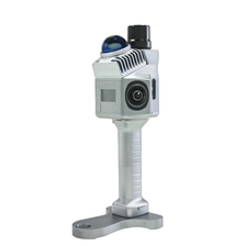
PJ-200G The Most Affordable Lightweight LiDAR System
The PJ-200G is a lightweight, high-performance handheld LiDAR system by Geosun Navigation. Featuring theLivox Mid-360 sensor and advanced SLAM algorithms, it captures precise 3D point clouds in GNSS or GNSS-denied environments. Its compact design ensures easy mobility for indoor and outdoor mapping, includingurban surveys, infrastructure inspection, and digital twin modeling. Combining LiDAR, GNSS, and INS, the PJ-200G delivers reliable, seamless data processing across diverse applications.
More
-
-
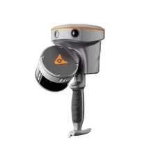
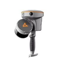
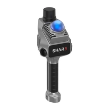
3D Lidar scanner Share slam S20
One-Stop Aerial Survey Solution Professional Aerial Survey Camera Realistic 3D Modeling, Clear and Accurate 2D Modeling.
More
-
-
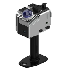
3D Laser Scan Mobile Measurement System GOSLAM M40
The Goslam M40 combines the lightweight design with the flexibility of a handheld headset. It uses advanced fixed LIDAR technology and offers a convenient scan experience with a compact, streamlined design. The Goslam M40 has a stylish look, exquisite details, focusing on wearing comfort and simple operation, helping users to complete fine 3D scans efficiently.
More
-
-
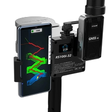
Goslam 3D laser scanner RS100i-32
The GoSLAM RS100i-32 mobile scanner supports a variety of scanning modes and is suitable for a variety of application scenarios. GNSS module can be switched quickly, supporting scanning to obtain WGS84 and CGCS2000 coordinate system point cloud, using the second generation of mapping program, absolute accuracy of about 2cm.
More
-
-
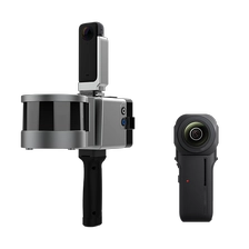
Goslam 3D laser scanner RS100i
The GoSLAM RS100i mobile scanner supports a variety of scanning modes and is suitable for a variety of application scenarios. GNSS module can be switched quickly, supporting scanning to obtain WGS84 and CGCS2000 coordinate system point cloud, using the second generation of mapping program, absolute accuracy of about 2cm.
More
