


- Browse Categories
- YQFH Drone
- DJI Drone
- Other Drone
- Drone Payloads
- Robot
- Pipeline Detection Instrument
- 3D Laser Scanner
- Industrial Measurement Devices
- Weather Station Series
- Optical Survey Instruments
- GNSS RTK & CORS System
- BDS System Products
- Visual Displacement Monitoring System
- UWB Indoor Positioning System
- Hydrology Products
- Others
- Spectrometer
- Wet Blast Machine
- SDI Soil Tester
- Pengjin Smart Flying Drone Patrol and Inspection System
- Supercomputing
- Module
- Viscometer
- Electric Hygro-thermograph
- Echo Sounder
- Processing Software
- Keson Measuring Tools
-
-
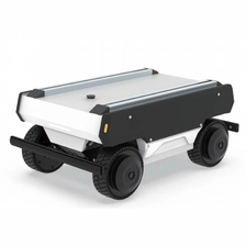
YQ-FW-minipro Omnidirectional Mobile Robot Platform
-Modular Light-weight Design
More
-Industry application development platform for small, portable omnidirectional robots
-
-
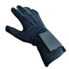
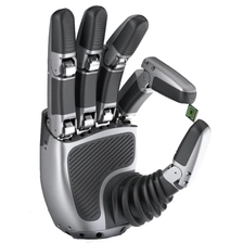
CASIAHAND GLOVE
- High Precision
- Low Latency
- Anti-Interference
- Lightweight
-
-
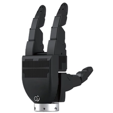
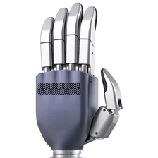
YQ7G Industry-Grade Dexterous Hand
- Ultra-High Payload
- Ultimate All-Round Performance
- Industrial-Grade Standard
-
-
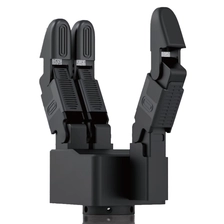
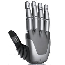
YQ4G Industry-Grade Dexterous Hand
- Cost-effective
- Mind-Controlled Free Operation
- Active Cooling System
-

-
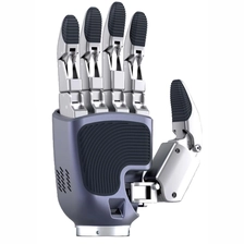
YQ21X Industry-Grade Dexterous Hand
- Human-Like Dexterity
- Full Direct Drive
- Industrial Grade Standard
-
-
YQ12X Industry-Grade Dexterous Hand
- Fast, Precise & Stable
- Full Direct Drive
- Industrial Grade Standard
-
-
YQ7X Industry-Grade Dexterous Hand
- Humanoid Design
- Rigid-Soft Hybrid Control
- Active Cooling System
-
-
YQ11M Industry-Grade Dexterous Hand
- Humanoid Design
- Rigid-Soft Hybrid Control
- Active Cooling System
-
-
YQ6M Industry-Grade Dexterous Hand
- Ultra-compact & UItralight
- Humanoid Design
- Multimodal Perception
- Active Cooling System
-
-
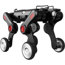
YQ-D30WS Medium Wheel-Leg Quadruped Robot
Expert for Ultra-Narrow Space Operations, Redefining the Operation Boundaries of Mobile RobotsThe YQ-D30WS integrates the dual strengths of wheeled high-speed movement and legged flexibility.Equipped with deformable leg structures, it can switch forward and backward without turning. Custom-builtfor ultra-narrow spaces and complex scenarios, it redefines the operational limits of mobile robots.
More
-
-
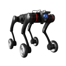
YQ-D30W Medium-sized Wheel-legged Quadruped Robot
The YQ-D30W is specially designed for lightweight all-terrain applications. Its wheel-legged composite structure delivers outstanding all-terrain traversability, ideal for lightweight industrial and emergency missions including rubble reconnaissance, emergency search & rescue, and toxic environment detection,striking a perfect balance between efficiency and terrain adaptability.
More
-
-
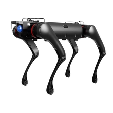
YQ-D30 Medium Quadruped Robot
Model YQ-D30 is engineered for lightweight industrial, emergency response, security, scientific research andother industrial scenarios. It boasts outstanding mobility and operational stability in unstructuredenvironments including factory inspection zones, wild exploration sites, rubble piles, staircases and slippery ground.
More
