





English
français
Deutsche
Italian
русский
Español

PJM Technology Industry Co., Limited

Shenzhen Peng Jin Technology Co., LTD.

Home > Search >
Browse Categories
YQFH Drone
DJI Drone
Other Drone
Drone Payloads
Robot
Pipeline Detection Instrument
3D Laser Scanner
Industrial Measurement Devices
Weather Station Series
Optical Survey Instruments
GNSS RTK & CORS System
BDS System Products
Visual Displacement Monitoring System
UWB Indoor Positioning System
Hydrology Products
Others
Spectrometer
Wet Blast Machine
SDI Soil Tester
Pengjin Smart Flying Drone Patrol and Inspection System
Supercomputing
Module
Viscometer
Electric Hygro-thermograph
Echo Sounder
Processing Software
Keson Measuring Tools

China AIRBOT TOK4-01-100 manufacturer

AIRBOT TOK4-01-100

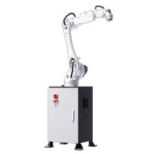
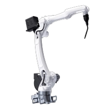
AIRBOT TOK4 is equipped with an ultra-lightweight 6-DOF intelligent robotic arm, teachpendant, multi-channel vision sensors, LiDAR, mobile chassis and other components,delivering an efficient solution for data collection and model training in embodiedintelligence.
It supports data acquisition for mobile manipulation, deployment of automatedapplications and execution of intelligent tasks, and enables rapid deployment ofopen-source algorithms such as Mobile ALOHA.

More
China AIRBOT Play-01-100 manufacturer

AIRBOT Play-01-100

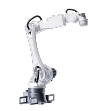
AIRBOT Play is a highly integrated, highly expandable 6-degree-of-freedom intelligentrobotic arm. Equipped with comprehensive secondary application development toolsand full Real2Sim2Real support, it is engineered for embodied intelligence research,educational training and industrial application exploration.Adopting a lightweight design with a high payload-to-self-weight ratio, it deliversoutstanding reliability and portability. The robotic arm can be flexibly mounted onvarious mainstream mobile robot platforms, including wheeled, wheel-legged andquadruped robots. Its end effector is compatible with multiple devices such astwo-finger grippers and dexterous hands, enabling it to easily fulfill mobile manipulationtasks across diverse scenarios.
It significantly expands the application scope of data collection and offers an efficientsolution for intelligent manipulation in a wide range of fields.

More
China PJ- S300S Collision-ResistantIndoor Inspection Drone manufacturer

PJ- S300S Collision-ResistantIndoor Inspection Drone

PJ- 300S is under 380mm in size and equipped with a 360° physical protective cage to ensure safe light. With advanced distance-lockingtechnology and high-precision LiDAR, the system can accurately perceive its suroundings. The 1080P HD video transmission paired witha 4K camera captures detailed imagery with clarity, while up to 10,000 lumens of illumination ensures superior imaging quality. Equippedwith dual system sensing, PJ-300S enables real-time modeling without the need for GPS, fully meeting inspection requirements in complexindoor environments.

More
China PJ-S300 Multi-Payload Commercial Drone manufacturer

PJ-S300 Multi-Payload Commercial Drone

The PJ-S300 is a versatile all-electric composite wing drone with a sleek and simpledesign that enables it to cruise at speeds of up to 90km/h, with an effective enduranceof 2.5 hours. It can easily carry efficient equipment such as LiDAR, professional aerialsurvey cameras, and high-brightness sensors for efficient operations.

More
China PJ-S200 Multi-Payload Commercial Drone manufacturer

PJ-S200 Multi-Payload Commercial Drone

The PJ-S200 is a versatile all-electric composite wing drone with a sleek and simpledesign that enables it to cruise at speeds of up to 90km/h, with an effective enduranceof 6 hours. It can easily carry efficient equipment such as LiDAR, professional aerialsurvey cameras, and high-brightness sensors for efficient operations.

More
China PJ-L400 Multi-Payload Commercial Drone manufacturer

PJ-L400 Multi-Payload Commercial Drone

PJ-L400 is a new lightweight industrial-grade drone that integrates the cutting-edgetechnology of the UAV system. It has made major breakthroughs in terms of stability,autonomy and intelligence. It has industry-leading drone cross-line-of-sight networkingtechnology, easily realizing intelligent interconnection of multiple drones and controlequipment, doubling operating efficiency. The frame is made of magnesium alloy. Thebody is foldable, safe, stable and easy to carry. It is equipped with a millimeter-waveradar fusion binocular sensing system, which can achieve omnidirectional obstacleavoidance and calculate the building through the airborne edge to ensure refinedautomation of various inspection operations.

More
China PJ-2000R Powered by RIEGL, Premium Performance manufacturer

PJ-2000R Powered by RIEGL, Premium Performance

PJ-2000R is a long-range and high-precision airborne LiDAR scanning systemindependently developed by Geosun Navigation. It highly integrates a mechanical laserscanner, a GNSS satellite positioning system, and an INS inertial navigation system. Thisallows it to rapidly acquire high-precision LiDAR point cloud data and can be widelyapplied in industries such as surveying and mapping, land and resources, transportation,power, and digital cities.

More
China PJ-2000N Born for Aerial Surveying manufacturer

PJ-2000N Born for Aerial Surveying

PJ-200ON LiDAR Solution is a long range detection & higher precision 3D data acquisitionsystem specially designed by Geosun Navigation for large-scale aerial survey projects. It isintegrated long-range laser sensor, GNSS satellite positioning systems, INS inertialnavigation systems, full frame cameras and storage control units. It can be loaded onmultiple platforms such as multi-rotor, fixed-wing, and helicopter, supports non-basestation operation mode, and can provide customers in many fields with a completeintegrated solution, including terrain surveying, road measurement, power inspection,etc...

More
China PJ-1800N Wider Vision, Richer Capture manufacturer

PJ-1800N Wider Vision, Richer Capture

PJ-1800N is a long-range and high-precision airborne LiDAR scanning systemindependently developed by Geosun Navigation. It is an advanced scanning systemindependently developed by Geosun Navigation. It captures high-precision point clouddata quickly and efficiently. With its user-friendly design, high integration, compact size,and low power consumption, the PJ-180ON is ideal for applications in surveying, landmanagement, transportation, power, and digital city projects.

More
China PJ-1500N Airborne Precision, Long-Range Mastery manufacturer

PJ-1500N Airborne Precision, Long-Range Mastery

PJ-1500N LiDAR Solution is a long range detection & large-scale 3D data acquisitionsystem independently developed by Geosun Navigation. Its shell is made of advancedaluminium alloy materials and integrates long range laser scanners, GNSS satellitepositioning systems, INS inertial navigation systems and other functional modules. It canquickly obtain high-precision point cloud data and has the characteristics of easyapplication, high integration, small volume, and low power consumption. It can be widelyused in mapping & surveying, forestry, power line patrol, agriculture, land and resources,water conservancy, smart city construction.

More
China PJ-960 Precision Redefined and Range Extended manufacturer

PJ-960 Precision Redefined and Range Extended

The PJ -960X is the flagship airborne LiDAR system of GEOSUN, built for demandinggeospatial missions.Combining a high-performance LiDAR sensor, proprietary precisionPOS, and modular imaging, it delivers exceptional range, accuracy, and data density.Engineered for complex terrain, large-scale topographic mapping, and 3D reconstruction,the PJ-960X ensures reliable results where performance matters most.

More
China PJ-920 Better Penetration and Precision manufacturer

PJ-920 Better Penetration and Precision

PJ-920X is a next-generation airborne LiDAR scanning system newly developed byGeosun Navigation. Equipped with mapping-grade LiDAR, a self-developed high-performance POS system, and a modular mapping camera, the system features longmeasurement range, lightweight design, strong penetration capability, and high efficiency.It is suitable for large-area topographic surveys with significant elevation differences,emergency surveying, 3D real-scene modeling development, as well as exploration anddesign applications.

More