


- Browse Categories
- YQFH Drone
- DJI Drone
- Other Drone
- Drone Payloads
- Robot
- Pipeline Detection Instrument
- 3D Laser Scanner
- Industrial Measurement Devices
- Weather Station Series
- Optical Survey Instruments
- GNSS RTK & CORS System
- BDS System Products
- Visual Displacement Monitoring System
- UWB Indoor Positioning System
- Hydrology Products
- Others
- Spectrometer
- Wet Blast Machine
- SDI Soil Tester
- Pengjin Smart Flying Drone Patrol and Inspection System
- Supercomputing
- Module
- Viscometer
- Electric Hygro-thermograph
- Echo Sounder
- Processing Software
- Keson Measuring Tools
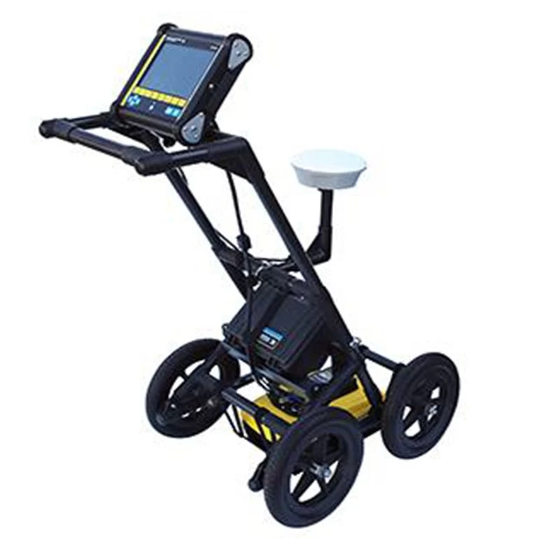
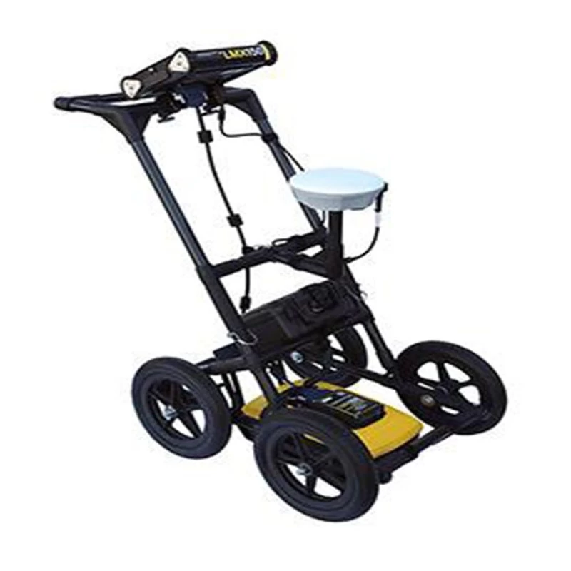
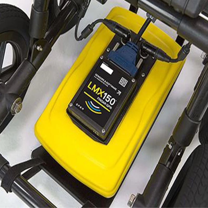
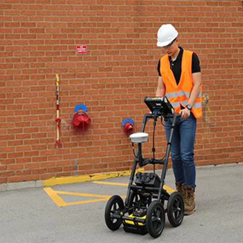
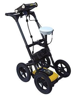
LMX150 Viewfinder GPR
- Size: 115 x 55 x 90 cm (45 x 21 x 35 inches)
- Weight: 19 kg (41 lbs) (including battery)
- Display unit size: 21 cm diagonal (8 inches)
- Power supply: 12V sealed lead acid gel cell
- Battery capacity: 9.0Ah
- Battery weight: 3.6 kg (7.9 lbs)
- Battery life: 4-6 hours
- Charger: 110-240V
LMX150 Viewfinder GPRUnderground Radar (GPR) |
 |
LMX150 Viewfinder GPR :GPR makes it easy to find the location of the utility. Do you want to avoid a dangerous and costly blow to important utility projects? Want to find more non-metal utilities in your field? Are you experiencing problems finding small, small public facilities? If that's the case, the LMX150TM FINDAR® GPR is the best option. Our sensors and software LMX150™ FINDAR® is a compact, high-resolution utility location system that meets your localization and mapping needs. LMX150™ FINDAR® GPR complements traditional pipe and cable locators, allowing you to locate subsurface targets such as: ► Metal utilities such as pipes and cables ► Non-metallic pipes containing PVC and asbestos cement ►Concrete stormwater pipes and sewer systems ► Utility that failed to install tracer wiring ► Underground storage tanks and drainage tiles ► Components of the septic tank system ► Fiber Optic Cable ► Non-purpose structures such as safes, foundation walls, concrete pads |
| Product Information |
|
Lead Acid Gel Cell Battery High resolution GPR sensor Integrated GPS Site Report Immediate production on site |
Highly visible touchscreen display unit Lifetime Free System Software Updates Wifi Compact and lightweight fiberglass cart frame USB USB |
| Features |
Increase productivity
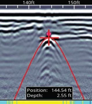
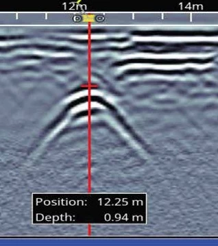
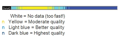
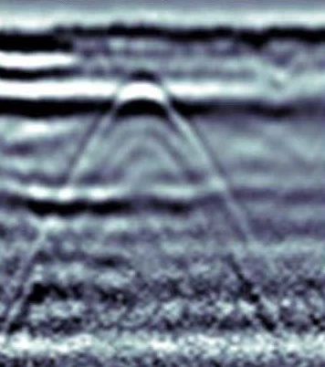
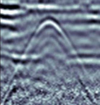
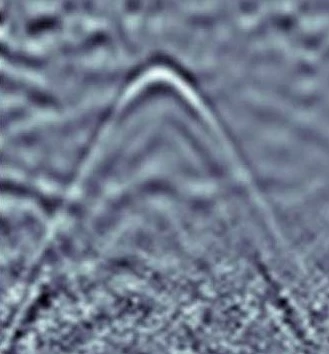
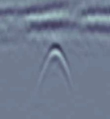
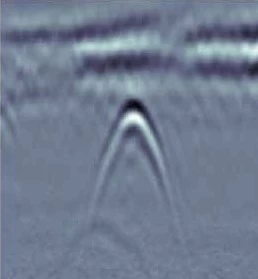
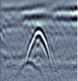
| Easy depth calibration | Identify the depth and position accurately | Dynamic Stacking (DynaQ") | ||
 |
 |
 |
||
| No complicated settings required - just press Start and then click Cart Use hyperbolic fitting to ensure accurate depth Measurements and backups to be displayed Its position and depth. |
Improve data quality with DynaQ - Automatic adjustments by allies |
|||
————————————— —————
Optimize target visibility in the field
| Preset filter | ||||
 |
 |
 |
||
| Adjustable gain | ||||
 |
 |
 |
| Interpretation of color-coded fields |
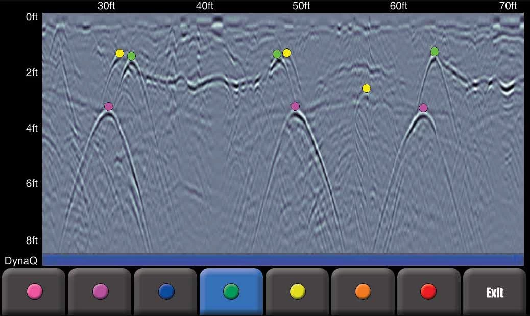 |
| Classify targets in real time by selecting color options and touching the screen. |
————————————— —————
Get your deliverables faster
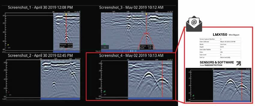
| Screenshots in the field Gallery and Wi-Fi Mini Report | Geographically tagged information for reports and archives | |
 |
 |
|
| Manage and review screenshots and send them via Wi-Fi via email Mini reports from the site. |
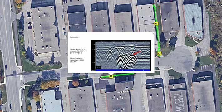
All screenshots will be geographically tagged and exported to KMZ This file can be easily viewed in Google Earth. ” |
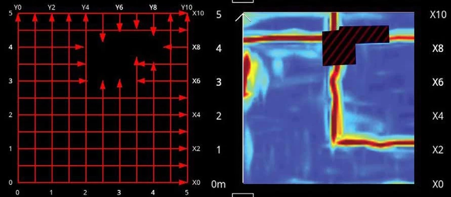
| Complete coverage of complex areas |
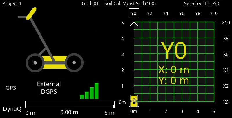
Flexible, guided grid collection
The LMX150" FINDAR" GPR guides the setup using a pre-selected grid size. Stop the line early or skip it.
In-field depth slice
Process grid data into depth slices, move the data down to visualize targets at different depths.
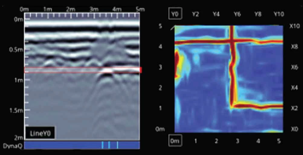
In-field depth slice
Process grid data into depth slices, move the data down to visualize targets at different depths.

- Other Products


