


- Browse Categories
- YQFH Drone
- DJI Drone
- Other Drone
- Drone Payloads
- Robot
- Pipeline Detection Instrument
- 3D Laser Scanner
- Industrial Measurement Devices
- Weather Station Series
- Optical Survey Instruments
- GNSS RTK & CORS System
- BDS System Products
- Visual Displacement Monitoring System
- UWB Indoor Positioning System
- Hydrology Products
- Others
- Spectrometer
- Wet Blast Machine
- SDI Soil Tester
- Pengjin Smart Flying Drone Patrol and Inspection System
- Supercomputing
- Module
- Viscometer
- Electric Hygro-thermograph
- Echo Sounder
- Processing Software
- Keson Measuring Tools
CIST/884-2.25kg Impact Soil Tester
- Brand Name:SDI
- Model Name:CIST/884-2.25kg
- Place of Origin:UK
- Warranty:1 year
- Support Express:Sea freight, air freight
CIST/884-2.25kg Impact Soil Tester
Product profile
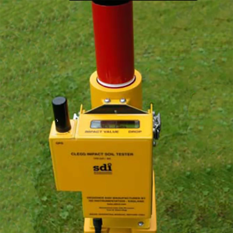
The CIST / 884 Impact Soil Tester with GPS, designed and produced by SDI, provides a simple and direct measure for testing the robustness of the sports field.During use, the GPS 884 reader is clamped to the catheter and the readings can be observed from the top.Single-button operation, simple to use.
Data recording performance
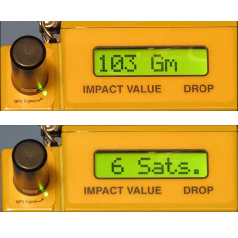
The instrument has wireless data transmission components and has airborne data recording and data storage functions.The latitude and longitude coordinates of the test position are received by the built-in GPS, providing the user with an accurate location reference for subsequent viewing, such as in Google earth.Bluetooth connection provides data download to PC (provides PC software).
Use
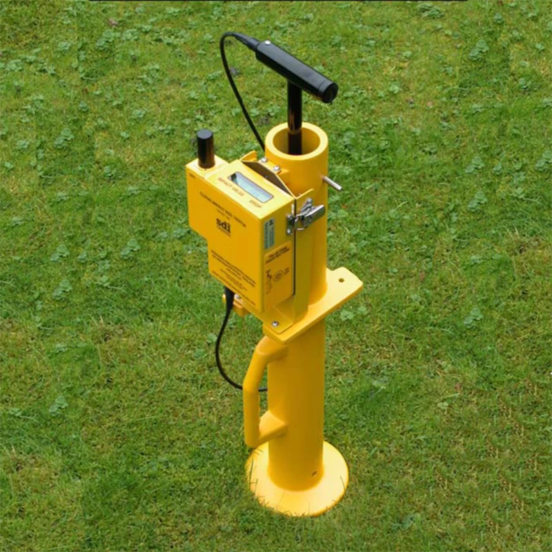
The instrument was used to confirm the uniform surface hardness of football, rugby, cricket and equestrian surfaces.It can rapidly identify changes in surface hardness in a wide range of regions.Like the yellow map pin, Google Earth also provides visibility of the test position.
Design
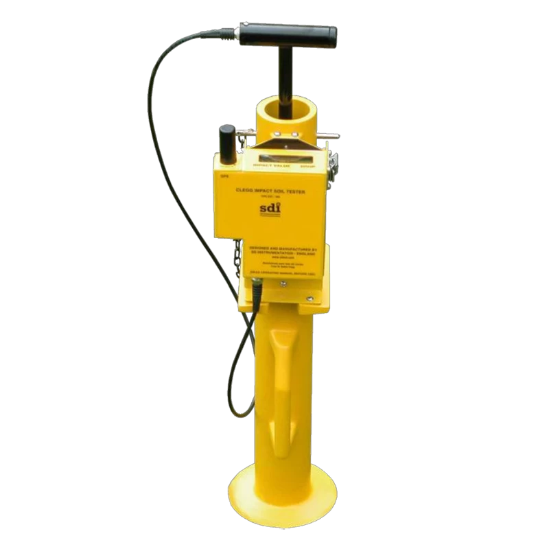
The instrument is equipped with a 2.25 kg hammer that can fall from a fixed height to the measured surface.Motion surface hardness values are immediately displayed on the reader.The instrument typically runs 2 'C' batteries, usually for 12 months.The CIST / 884 Impact Soil Tester is a compact and reliable instrument.Includes an aluminum alloy transport and storage tank.
GPS map points count
When the data are downloaded to the PC, the time and date of the test and the surface hardness (Gm) are displayed in the Google Earth with a yellow pin.
Specifications of the products
Dimensions: 83 x 31 x 28 cm
Weight: The instrument weighs 6.9Kg, and includes the package weight is 12.2Kg.
Hammer weight: 2.25Kg
Value display (character number form): backlight vertical display, vertical clip on the catheter is easy to watch
Read range: up to 800 Gm
Power: 3V Low power: 2 "C" battery packs, usually for 12 months.
Battery rating: it is displayed on the switch button.
Open and control: a single button, automatically close.
Data storage in the reader: Storage can store 10,000 readings.Each copy includes hardness readings, time and date of each test, longitude and latitude, and satellite numbers.
Data transmission mode: Bluetooth wireless data transmission, no need for cable, freely connected to Microsoft XP or tablet.
Data type at transfer: CSV file type, used for operation in third-party software, such as the readable KML in Microsoft Excel, Google earth.Calculate and store the north and east distances of the Ordnance Survey GB.
GPS longitude / Output: usually less than 5m.Google map, Google earth and Ordnance Survey GB up to 1m res north and east.(Such as "ST 80269 55704" and "E380269 N155704".
GPS operation: you can switch on / off through the side button.
System software: SDI company provides computer software for convenient data transmission, real-time test and viewing, time and date setting, and configuration and installation.
Transport storage box: Model CIST / ATS / 15. Aluminum alloy boxes can provide additional protection in transport.
Range Of Application
The instrument was used to confirm the uniform surface hardness of soccer, rugby, cricket and equestrian surfaces
Please feel free to contact us if you are interested in this product.

