


The 2023 Surveying and Mapping Discipline Development Forum
The 2023 Surveying and Mapping Discipline Development Forum and the Annual Meeting of the "Surveying and Mapping Geographic Information" Council were grandly held, and Pengjin Technology brought new products

From August 21st to 22nd, 2023, on the occasion of celebrating the 130th anniversary of Wuhan University and the 40th anniversary of Shenzhen Research Institute Co., Ltd., the Surveying and Mapping Discipline Development Forum and the 2023 "Surveying, Mapping and Geographic Information" Council Annual Meeting will be held in Shenzhen Successfully held.
The conference is guided by the Science and Technology Development Research Institute of Wuhan University, hosted by the editorial department of Wuhan University "Surveying, Mapping and Geographic Information", and undertaken by Shenzhen Research Institute Co., Ltd. Professor Li Qingquan, Secretary of the Party Committee of Shenzhen University, Wang Aichao, Chairman of Shenzhen Society of Surveying, Mapping and Geographic Information, Wang Zhan, Deputy Director of Surveying and Mapping Management Office of Shenzhen Municipal Planning and Natural Resources Bureau, Chen Xueye, Director of Shenzhen Planning and Natural Resources Data Management Center, Science and Technology of Wuhan University Ren Xiaozhou, deputy director of the Technology Development Research Institute, Wang Hongchen, executive deputy editor of "Surveying and Mapping Geographic Information", Mi Yilin, chairman of Shenzhen Survey Research Institute Co., Ltd., Zhou Yunlin, deputy general manager, Yu Chenghua, chief engineer, and more than 100 government departments and colleges and universities , representatives of enterprises and institutions and technical experts from the surveying and mapping industry from all over the country participated in this event.

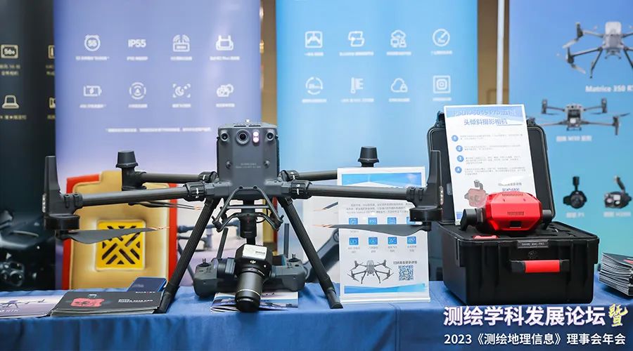
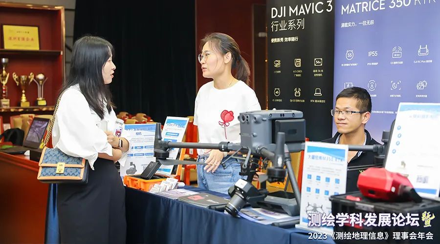
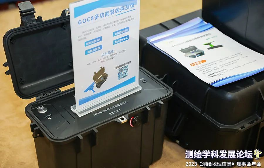
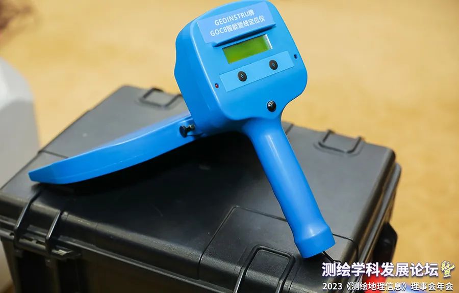
As one of the supporting units, Sun Mingming, DJI Industry Application Development Manager of Shenzhen Dajiang Innovation Technology Co., Ltd., made a report on "DJI Industrial UAVs Accelerate Real-Scene 3D Construction in China"; Shenzhen Pengjin Technology Co., Ltd. (hereinafter referred to as "" Peng Jin Technology ") exhibited the latest surveying and mapping products and solutions, including DJI UAV M350 RTK, DJI Airport + Matrice M30 series, Mavic 3 industry series, Zenmuse P1, UAV load multi-spectrum MicaSense Altum-PT, Xaar 304S five-lens tilt camera, GOC8 intelligent pipeline locator, visual displacement measurement system, etc.。
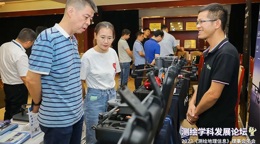
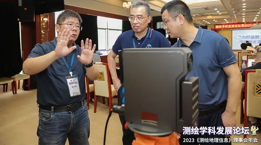
With the development of modern technology, UAV surveying and mapping is gradually becoming an important tool in the field of geographic information systems and surveying and mapping, which not only improves the speed and accuracy of surveying and mapping, but also reduces costs and manpower requirements. The products and solutions exhibited by Pengjin Technology at the conference attracted the attention of many guests.
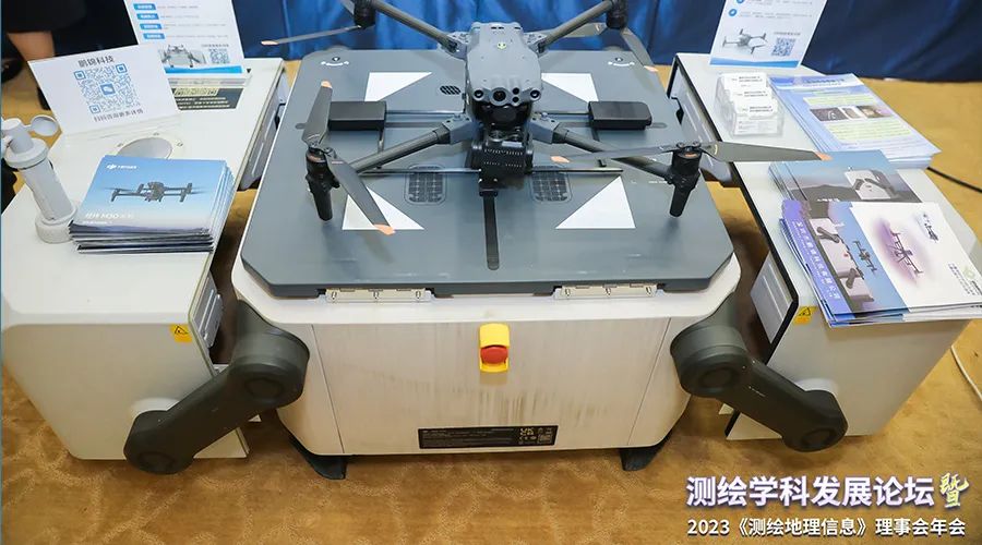
The newly released DJI industry drone platform Matrice 350 RTK (hereinafter referred to as M350 RTK) is a comprehensive upgrade since the release of the same model of Matrice 300 RTK three years ago. It has a new image transmission system and control experience, and is more efficient. The advanced battery system, combined with rich loads, is DJI's industry flagship flight platform with super performance and heavy loads, and it is also a master that can solve complex aerial operation needs for industry users.
DJI Airport Unattended Solution is a revolutionary application matrix product in the surveying and mapping industry.
The solution includes the medium-sized flagship UAV Matrice M30 series, the one-stop UAV mission management cloud platform DJI Sakong 2, DJI DOCK which supports 7x24 unmanned operations at DJI Airport, and the light-level night vision camera load Zenmuse H20N, and drone AI recognition software that can be customized according to the needs of various industries.
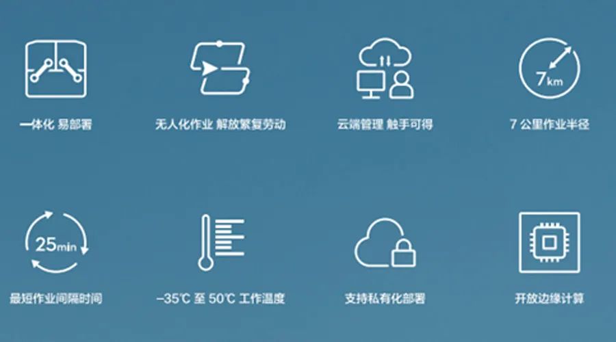
UAV + payload + Sikong platform + DJI airport + AI software, this combined product breaks the previous technical boundaries and combines into a new intelligent, automated, and unmanned application solution to achieve efficient air-ground collaboration and unmanned On-duty operations can be widely used in surveying and mapping, inspection, emergency and other fields.
The visual displacement measurement system is also a hot topic in recent years, and Pengjin Technology also exhibited related products and solutions.
The GOC8 intelligent pipeline locator can quickly and accurately locate the position, buried depth, direction and diameter of pipelines of various materials such as gas (metal or non-metal), tap water, optical cables, and cables without excavating the ground.
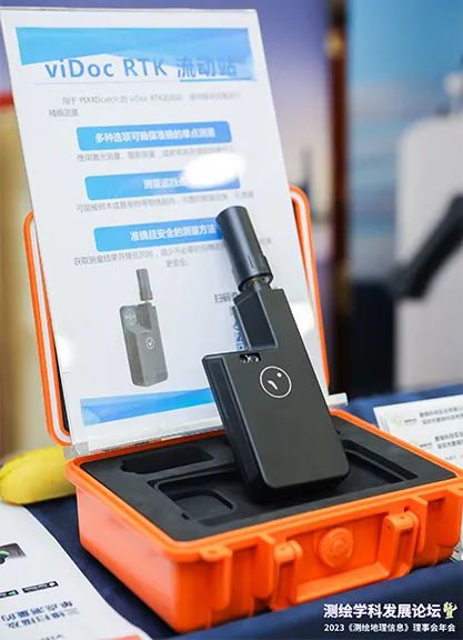
viDoc RTK 3D scanner + Pix4Dcatch can perform 3D scanning of small-scale scenes, and the scanned data can be solved by Pix4Dmatic to obtain point cloud models and solid models.
As an S-level agent in the surveying and mapping industry of DJI, Pengjin Technology focuses on the research and development, production and sales of surveying and mapping UAVs and related loads and software, and surveying and mapping instruments, and is committed to geographic surveying and mapping, unmanned inspections, emergency relief and other industries. Provide all-round integrated comprehensive solutions from scheme design, product sales, technical consultation, data processing, etc., and has project departments for aerial survey, earthquake monitoring, and pipeline detection to assist customers in carrying out surveying and mapping business.
