2024 Survey and Cartography Public Relations Day and National Map Awareness Week Events
2024 Survey and Cartography Public Relations Day and National Map Awareness Week Events
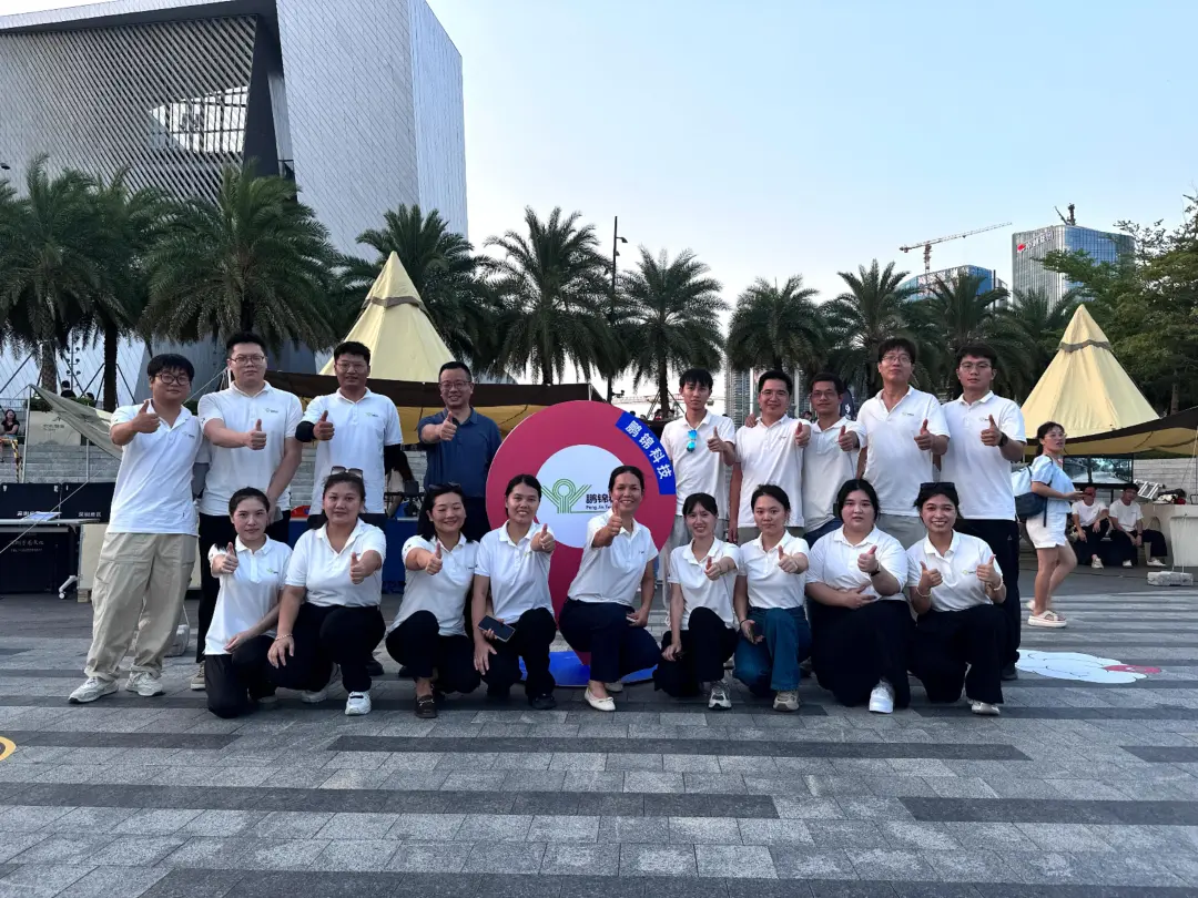
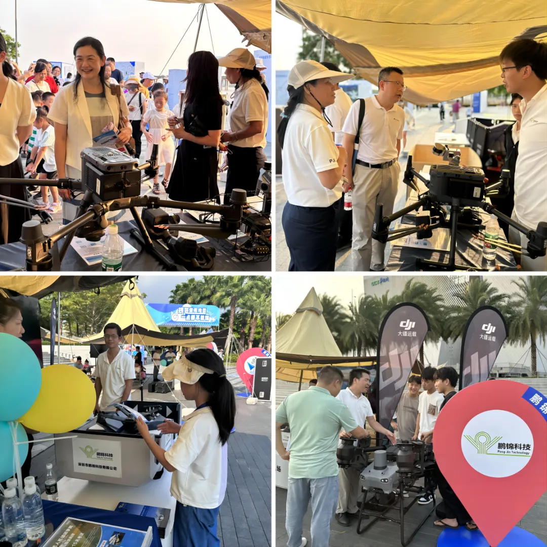
From August 26th to August 30th, National Survey and Cartography Public Relations Day and National Map Awareness Week events were actively held across the city. As a key enterprise in the field of surveying and geographic information in Shenzhen, Shenzhen Pengjin Science and Technology Co., Ltd. enthusiastically responded to this call and participated in the "2024 Shenzhen Surveying and Mapping Educational Event" sponsored by Shenzhen Planning and Nature. The Resources Bureau was held on August 26th at the sculpture plaza of Baowan Demonstration Section of the West Coast Vitality Belt in Bao'an District. During the event, Pengjin Technology was the center of attention for its innovative technology and state-of-the-art equipment.
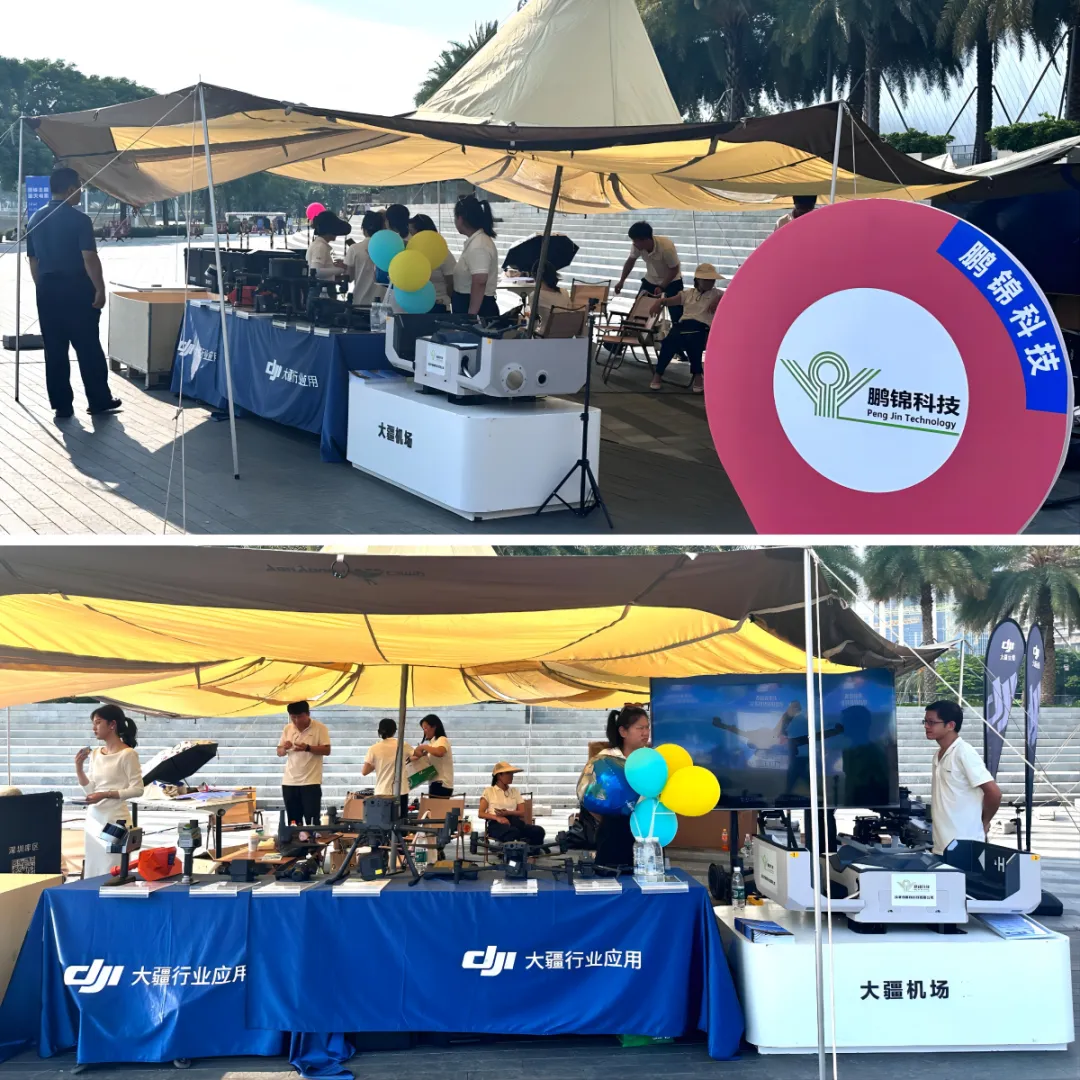
The company showcased its advanced technologies and products for surveying emergency support, including DJI Airport 2 Platform AI software, DJI FlyCart 30 carrier drone, M3E drone, M350RTK drone, M30T drone, P1 camera, L2 LiDAR, and Zenmuse H30T. , which incorporates the PJC8/PJC18 integrated intelligent pipeline detector, GS8000 ground penetrating radar, 3D laser scanner T100RTK, and 3D laser scanner S10, will demonstrate the importance of survey cartography through live and interactive demonstrations. and enlightened the public on the proper use of maps. experience.
Event Highlights: Shenzhen Surveying and Geographic Information Technology and Equipment Show
At the main event, "Shenzhen Surveying and Geographic Information Technology and Equipment Show", Pengjin Technology presented a wonderful technology feast. The company not only showcased its rich experience in the field of surveying and geographic information, but also let the audience experience the charm and endless possibilities of surveying technology through live demonstrations of a series of high-tech products and solutions.
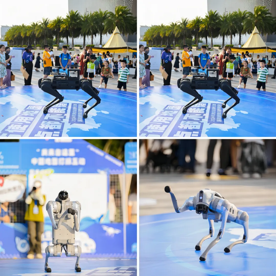
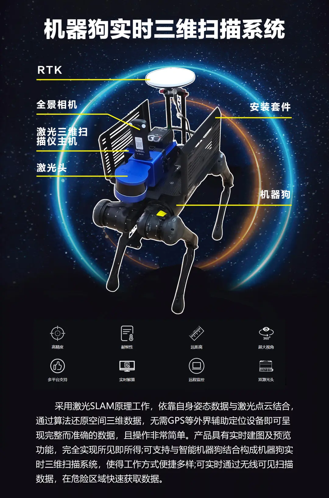
1. Robot dog performance that opens up the future of surveying
The most eye-catching performance was the robot dog performance by Pengjin Technology. This robotic dog integrates advanced autonomous navigation, environmental awareness, and intelligent decision-making technology, allowing it to flexibly navigate in complex environments and perform surveying tasks. Accurate positioning, stable walking performance, and powerful data processing capabilities drew applause from the audience, demonstrating the infinite possibilities of future surveying technology.
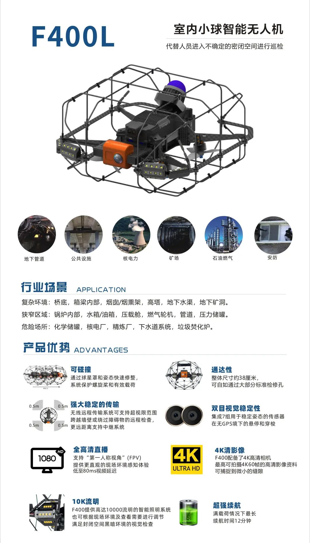
2.F400L Indoor Smart Ball Drone Demonstration: Accurate Surveying at Your Fingertips
Additionally, Pengjin Technology exhibited his F400L indoor smart ball his drone. This drone is specially designed for indoor surveying and features high-precision positioning, obstacle avoidance, and autonomous flight capabilities. During his live demonstration, the F400L effortlessly completed rapid scanning and modeling tasks in complex indoor environments, leaving a strong impression with its efficient and accurate performance.
In addition to the above highlights, Pengjin Technology also presented a comprehensive display of products and solutions across various surveying and detection fields. These include the DJI Airport 2 Platform with AI Software, DJI FlyCart 30 Carrier Drone, M3E Drone, M350RTK Drone, M30T Drone, P1 Camera, L2 LiDAR, Zenmuse H30T, PJC8/PJC18 Integrated Intelligent Pipeline Detector, GS8000 Ground Medium radar, 3D laser scanner T100RTK, 3D laser scanner S10. These products cover a wide range of surveying needs, from drone mapping and intelligent transportation to smart detection, fully demonstrating Pengjin Technology's comprehensive strength and innovative capabilities in the field of surveying and geographic information.
Through this surveying cartography education event, Pengjin Technology not only introduced the latest achievements and technological capabilities in the field of surveying and geographic information, but also strengthened public awareness and support for surveying work.
In the future, Pengjin Technology will continue to adhere to the corporate spirit of "customer first, based on integrity, efficient execution, and professional excellence". Our company aims to further contribute to the sustainable and healthy development of the surveying and geographic information industry, with the aim of "providing high-quality surveying products, precise surveying solutions, and comprehensive surveying services."