


- Browse Categories
- YQFH Drone
- DJI Drone
- Other Drone
- Drone Payloads
- Robot
- Pipeline Detection Instrument
- 3D Laser Scanner
- Industrial Measurement Devices
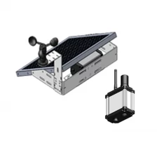
- Weather Station Series
- Optical Survey Instruments
- GNSS RTK & CORS System
- BDS System Products
- Visual Displacement Monitoring System
- UWB Indoor Positioning System
- Hydrology Products
- Others
- Spectrometer
- Wet Blast Machine
- SDI Soil Tester
- Pengjin Smart Flying Drone Patrol and Inspection System
- Supercomputing
- Module
- Viscometer
- Electric Hygro-thermograph
- Echo Sounder
- Processing Software
- Keson Measuring Tools
Category
-
-
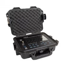
1205CXB Cable Analyzer TDR Time Domain Reflector
Radiodetection has developed the 1205CXB Metallic Cable Analyzer TDR, which makes cable failures quick and easy to detect.
The combination of a very clean, low-noise signal and a large color display makes all TDR controls on the screen with your fingertips, making it one of the industry's easiest to use.
More
-
-
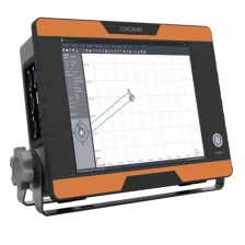
Portable professional hydrographic system CHCNAV single beam echo sounder
Turnkey hydrographic solution
Simplified survey operationStandard DGNSS and sensors interfaces
Ultra-fast startupwithout lag time
More
-
-
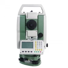
Hot Sale Total Station Survey Equipment FOIF RTS102
- ♥ Measurement distance: 600m
- ♥ RTS102 EDM can be upgraded to RTS EDM (factory option)
- ♥ Bluetooth cableless connection (factory option)
- ♥ 120,000 points and 40 jobs can be saved
- ♥ Operate with Data Collector, FOIF FieldGenius or other third-party software
- ♥ IP66 Environmental Protection
- ♥ Alphanumeric Keyboard
-
-
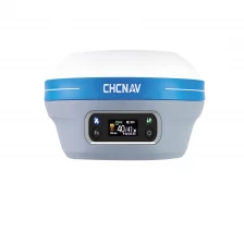
Compact GNSS Base Station and Rover CHCNAV i73 RTK GNSS for maximum flexibility
The i73 GNSS is a very compact, powerful and versatile GNSS receiver with an integrated UHF Tx/Rx modem that can be used as a base station or spacecraft. Equipped with CHCNAV iStar technology, which tracks satellite signals from all constellations, the i73 GNSS offers fixed survey grade RTK centimeter positioning within 30 seconds of power-on. Additionally, automatic pole tilt correction increases the efficiency of point measurements by up to 20% and piling investigations by up to 30%. Easy to carry with one hand, the i73 GNSS is an effective, lightweight GNSS solution that can be adapted to a variety of site configurations, making intensive site surveys more convenient and reducing operator fatigue.
More
-
-
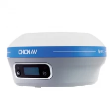
Portable Surveyor Base Rover CHC i80 GNSS GPS RTK Receiver
The i83 GNSS receiver is more than a universal 1408-channel multiband IMU-RTK GNSS receiver, and is the perfect GNSS RTK surveying tool that surveying, construction and mapping experts expect. Built-in connection modules such as Wi-Fi, Bluetooth, NFC, UHF, 4G modems are reliable, efficient and convenient to use in a variety of application scenarios for any field configuration.
More
-
-
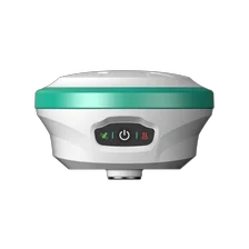
WR1010 High-Precision RTK Layout System – Intelligent Visual, Cost-Effective Choice
WR1010 is a portable,multifunctional GNSS receiver that supports Tilt working and AR stakeout.Its built-in 5W data transmission radio supports a long working distance of up to 15 km in open areas.The durable IP68 design makes it possible to work in extreme environments.More
-
-
Absorption tester S500
Absorption tester S500
More
-
-
Real-time dynamic monitoring system for large-scale industrial structures
This was jointly developed by China Tower Co., Ltd. Hubei Branch, Wuhan Branch, and Wuhan Beidu Industrial Union Co., Ltd. The system includes a comprehensive management platform, a Hokudo positioning monitoring terminal and a mobile application. The company aims to provide accurate operational management solutions, including transformation monitoring, environmental monitoring, operation management, and alarm management, which targets high-rise industrial structures such as communication towers, power transmission towers, and tower cranes.
More
-
-
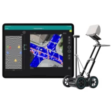
Underground mapping GPR Underground radar GS8000
The most efficient real-time workflow and technology for scanning and digitizing underground
- Get clear images of the underground in 2D and 3D as you walk.
- Site survey results are digitized on a map and sent to CAD/GIS
- Access data anytime, anywhere
-
-
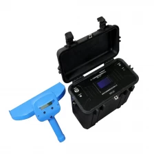
China Pipe Survey Intelligent Pipeline Detector GOC8 Manufacturer
Intelligent pipeline detectors can quickly and accurately locate pipelines and cables buried with a variety of buried steel pipes, polyethylene pipes, PVC and other materials without excavating soil in the ground.
Please click " moreFor more information, see below.
More
-
-
PJK Branded Subway Subway Tunnel Surveillance Visual Displacement Monitoring System V21
By introducing the Hokuto Space-Time Benchmark, Real-time dynamic alarm system for subway tunnels We have entered an era of efficient and sophisticated management, solving the lack of real-time data and the high-cost problems of traditional monitoring methods.
The system employs technologies such as BDS, proximity photogrammetry, 5G, and IOT cloud services, and provides early warning for subway tunnels, with the advantages of high efficiency, high accuracy and intelligent operation.
More
