






- Browse Categories
- YQFH Drone
- DJI Drone
- Other Drone
- Drone Payloads
- Robot
- Pipeline Detection Instrument
- 3D Laser Scanner
- Industrial Measurement Devices
- Weather Station Series
- Optical Survey Instruments
- GNSS RTK & CORS System
- BDS System Products
- Visual Displacement Monitoring System
- UWB Indoor Positioning System
- Hydrology Products
- Others
- Spectrometer
- Wet Blast Machine
- SDI Soil Tester
- Pengjin Smart Flying Drone Patrol and Inspection System
- Supercomputing
- Module
- Viscometer
- Electric Hygro-thermograph
- Echo Sounder
- Processing Software
- Keson Measuring Tools
-
-
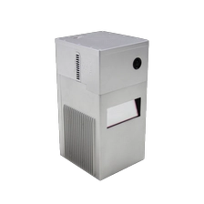
PJ-2000N Born for Aerial Surveying
PJ-200ON LiDAR Solution is a long range detection & higher precision 3D data acquisitionsystem specially designed by Geosun Navigation for large-scale aerial survey projects. It isintegrated long-range laser sensor, GNSS satellite positioning systems, INS inertialnavigation systems, full frame cameras and storage control units. It can be loaded onmultiple platforms such as multi-rotor, fixed-wing, and helicopter, supports non-basestation operation mode, and can provide customers in many fields with a completeintegrated solution, including terrain surveying, road measurement, power inspection,etc...
More
-
-
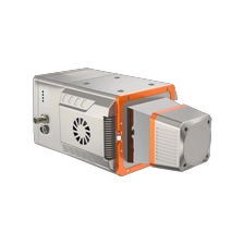
PJ-1800N Wider Vision, Richer Capture
PJ-1800N is a long-range and high-precision airborne LiDAR scanning systemindependently developed by Geosun Navigation. It is an advanced scanning systemindependently developed by Geosun Navigation. It captures high-precision point clouddata quickly and efficiently. With its user-friendly design, high integration, compact size,and low power consumption, the PJ-180ON is ideal for applications in surveying, landmanagement, transportation, power, and digital city projects.
More
-
-
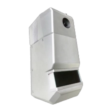
PJ-1500N Airborne Precision, Long-Range Mastery
PJ-1500N LiDAR Solution is a long range detection & large-scale 3D data acquisitionsystem independently developed by Geosun Navigation. Its shell is made of advancedaluminium alloy materials and integrates long range laser scanners, GNSS satellitepositioning systems, INS inertial navigation systems and other functional modules. It canquickly obtain high-precision point cloud data and has the characteristics of easyapplication, high integration, small volume, and low power consumption. It can be widelyused in mapping & surveying, forestry, power line patrol, agriculture, land and resources,water conservancy, smart city construction.
More
-
-
PJ-960 Precision Redefined and Range Extended
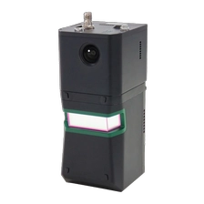
The PJ -960X is the flagship airborne LiDAR system of GEOSUN, built for demandinggeospatial missions.Combining a high-performance LiDAR sensor, proprietary precisionPOS, and modular imaging, it delivers exceptional range, accuracy, and data density.Engineered for complex terrain, large-scale topographic mapping, and 3D reconstruction,the PJ-960X ensures reliable results where performance matters most.
More
-
-
PJ-920 Better Penetration and Precision
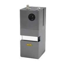
PJ-920X is a next-generation airborne LiDAR scanning system newly developed byGeosun Navigation. Equipped with mapping-grade LiDAR, a self-developed high-performance POS system, and a modular mapping camera, the system features longmeasurement range, lightweight design, strong penetration capability, and high efficiency.It is suitable for large-area topographic surveys with significant elevation differences,emergency surveying, 3D real-scene modeling development, as well as exploration anddesign applications.
More
-
-
PJ-260X Much Longer, Much Better
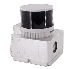
PJ-260X is a medium detection, higher precision & surveying grade LiDAR solutionindependently developed by Geosun Navigation, with a maximum range of 300m lasersensor. The weight is only 1.1kg, which maximizes the operation time. With high densitypoint cloud and strong penetration capability, it is deeply integrated with a camera forsimultaneous acquisition of point cloud and imagery. PJ-260X is widely used in industriessuch as mapping & surveying, forestry, power line patrol, agriculture, land and resources,water conservancy, smart city construction, making large-scale data acquisition easier.
More
-
-
PJ-260H Starting with Versatile Solutions
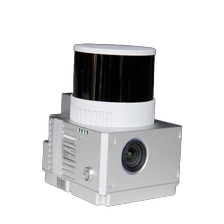
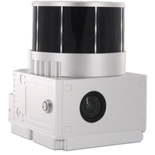
PJ-260H is a high-precision, surveying grade LiDAR solution independently developed byGeosun Navigation. The P J -260H features a 300-meter range, weighs 1.1 kg,and provides 1,920,000 points per second with three returns. It includes a camerafor synchronized point cloud and image capture, making it ideal for efficient datacollection in mapping, inspections, forestry, and urban planning.
More
-
-
PJ-130X Enhanced Precision, Deeper Penetration
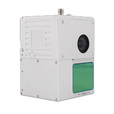
PJ-130X is a high-precision, surveying grade LiDAR solution independently developed byGeosun Navigation, which is integrated with laser sensor, mapping camera, and high-precision POS system. It can be mounted on most brands' drones in the market and canalso be used for vehicle-mounted operations. With simple and convenient operation, itcan generate true-color point cloud models and widely used in many fields, such asmapping & surveying, forestry, power Line patrol, agriculture, land and resources, waterconservancy, smart city construction etc...
More
-
-
PJ-100C+ Your First UAV LiDAR Scanning System
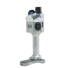
PJ-100C+ is an entry-level, short-range detection Aerial LiDAR solutionindependently developed by Geosun Navigation. With advantages of cost-effective,strong practicability, rich point cloud data and image information, PJ-100C+ is widelyused in general mapping, especially for corridor mapping and other industries.
More
-
-
PJ-200G The Most Affordable Lightweight LiDAR System
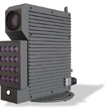
The PJ-200G is a lightweight, high-performance handheld LiDAR system by Geosun Navigation. Featuring theLivox Mid-360 sensor and advanced SLAM algorithms, it captures precise 3D point clouds in GNSS or GNSS-denied environments. Its compact design ensures easy mobility for indoor and outdoor mapping, includingurban surveys, infrastructure inspection, and digital twin modeling. Combining LiDAR, GNSS, and INS, the PJ-200G delivers reliable, seamless data processing across diverse applications.
More
-
-
Visual Displacement Measurement System VDMS 210S
- Sub-millimeter measurement accuracy
- Alidentifies measuring points
- 24 hours online monitoring
- Real-time reaction displacementand deformation
- It can be used for big data analysis